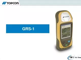
GRS-1
GRS-1. GRS-1. RTK Dual constellation tracking L1+L2. Integrated Barcode Reader. Advanced digital imaging. Internal Magnetic Compass. Internal GSM Modem 1GB internal memory. RH-1 Radio Pack. 806 MHz XScale Processor Windows Mobile. Mobile Web Server Solution – GRS-1.

GRS-1
E N D
Presentation Transcript
GRS-1 RTK Dual constellation tracking L1+L2 Integrated Barcode Reader Advanced digital imaging Internal Magnetic Compass Internal GSM Modem 1GB internal memory RH-1 Radio Pack 806 MHz XScale Processor Windows Mobile
Mobile Web Server Solution – GRS-1 • Windows Mobile + integrated SIM opens complete new fields for Web Service Applications!!! • use ArcGIS Server to distribute and synchronize geographic information to GRS-1
Mobile Mapping Solutions – GRS-1 GRS-1w/external Beacon receiver GRS-1w/ NTRIP corrections GG GRS-1 w/ EGNOS GRS-1 + PG-A1w/ RH-1 Radio for GGD GRS-1 + PG-A1w/ NTRIP corrections for GGD CM SubMeter M DM
GRS-1 Summary • All in one Dual Frequency RTK receiver • Network DGPS or RTK by Internal Quad band GSM cell phone / ext. Beacon • Single frequency Internal antenna, Dual frequency with external antenna • Multi purpose - Upgradeable by OAF • Radio RTK by Optional clip on Radio pack
Rugged Antenna connector 2Mpix Camera Macro mode toggle Internal L1 Antenna Electrical contactPower, Communication(GPS port-D) Magnetic compass 3.7’ VGA LCD Stylus Internal Cell phone module Speaker ESC key ENT key Cell phone LED Li ION Battery BT LED Power LED Power key Internal cell phone antenna Microphone SD card slot USB, Serial, Power Product features
Radio / Battery Pack (optional) • Optional accessory to use Radio RTK • Additional Battery power supplied as part of cradle • Space for 2 Li-Ion Batteries • Will be available with Satel and Topcon UHF 410-470MHz
DGPS / External Applications • Standard GRS-1 • WASS/ external beacon • 0.7m-2m • Add SIM GPRS data card • DGPS correction from network • 0.3m • Use internal SIM for email and external applications • ftp sync
Network RTK • Standard GRS-1 with Data SIM • Plus • external PG-A1 L1/L2 Antenna • OAF upgrade to GD/GGD RTK • Pole and pole bracket • 1-2 cm
Radio RTK Configuration Rover GR-3/Hiper PG-A1 antenna GRS-1 with Radio holder Used as Base with External Antenna Rover works with existing RTK base systems
GPS/GLONASS L1/L2 / WASS receiver Windows Mobile 6 3.7” VGA Color TFT LCD with Touch screen 2.0 Mega pixel Digital Camera + Compass GSM Quad band cell phone modem Bluetooth and WiFi SD card slot Specification Summary
Barcode, ID scan via camera Bluetooth External RS232C serial ports Receiver 12 contact pins for Holder USB 1.1 Client for Windows mobile Communications
GPS/GLONASS L1/L2 C/A Code & Carrier, GPS L2C SBAS (WAAS/EGNOS/MSAS) Receiver Type G - GPS L1 (std) GD – GPS L1/L2 (Option OAF) GGD - GPS/GLONASS L1/L2Channel (Option OAF) 72 channels Cold Tracking< 30sec Warm Tracking< 10sec Reacquisition< 1sec Tracking Specification
Accuracy • Static • L1 (1Sigma) H: 3mm + 0.8ppm V: 4mm + 1.0ppm • L1+L2: H: 3mm + 0.5ppm V: 5mm + 0.5ppm • PP Kinematic • L1: (1Sigma) H: 10mm + 1ppm V: 15mm + 1ppm • DGPS Real time / Post Process • L1: (1Sigma) 0.3m • RTK • (1Sigma) H: 10mm + 1ppm V: 15mm + 1ppm
Operating Time • Internal Battery • No less than 3.7 hours with GPS and cell phone use. • No less than 5 hours with GPS use. • No less than 15 hours without GPS and cell phone. • Supply from Holder (without Radio modem operates) • No less than 10 hours with GPS and cell phone use. • Supply from Holder (with Radio modem operates for Base) • No less than 5 hours with GPS use. • Supply from Holder (with Radio modem operates for Rover) • No less than 7.5 hours with GPS use.
Physical Specification • Dimension • D: 213 x W: 93 x H: 46mm • Weight • 0.7 kg • Waterproof • IP66 (closed connector caps) • Drop • 1m drop 213mm 46mm 93mm
Software Applications • Survey/ Engineering • TopSURV • Construction • Pocket-3D • GIS • TopGIS • TopPAD • Field Tools for Arcpad • Special Applications • eTop Sync • Email • ftp
GIS Applications • Field Mapping • Boundary Mapping • Wetlands Delineation • Military Fieldwork and Mapping • Asset Inventory • Street Sign Inventory • Storm Water Inlet Inventory • Fire Perimeter Mapping • Asset Maintenance • Road Condition Survey • Power Pole Maintenance • Drainage System Management
Field to Finish Solution ● eTopPlus / TopSURV / User software ● eTopSync: Tool for easy data synchronisation ● eTopViewer: Desktop-Tool for visualization controller Transfer area PC / Network
Topcon Synchronisation tool • Identifies automatically the type of Hardware (GRS-1;GMS-2; FC-100; FC-200; ...) • Tool for automatically data transfer following a predefined workflow • Tool for automatically updating the software on the device (DLL’s, Applets) • Auto back-up function • Can automatically convert data into “customer used” data (needs extra consideration) Benefits • TopSync can handle a myriad of Applets and Extension and will show if a newer version of a DLL is installed or not • handling a huge amount of units at one time becomes easy • no headaches with wrong copied files, etc.
SAP Workflow to Desktop PC Office software GIS Mapping, Analysis, Visualization, Presentation • eTopSync: • Export Data • TopPAD, TopSURV • eTopSync: • Import Data • TopPAD,TopSURV Data collection in the field - ArcPad, TopSURV
GRS-1 Hand Held GNSS The Ultimate GNSS receiver for all applications