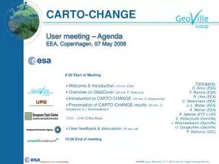
GLOBCOVER overview
Martin Herold ESA GOFC-GOLD Land Cover Office FSU Jena, Germany. GLOBCOVER overview. GLOBCOVER 2005. Global land cover using ENVISAT/MERIS (300 m resol.) ESA/JRC with FAO, IGBP, EEA, GOFC-GOLD … Builds upon experiences (GLC2000) and evolving standards (LCCS, validation protocols)

GLOBCOVER overview
E N D
Presentation Transcript
Martin Herold ESA GOFC-GOLD Land Cover Office FSU Jena, Germany GLOBCOVER overview
GLOBCOVER 2005 • Global land cover using ENVISAT/MERIS (300 m resol.) • ESA/JRC with FAO, IGBP, EEA, GOFC-GOLD … • Builds upon experiences (GLC2000) and evolving standards (LCCS, validation protocols) • Link to international initiatives and mapping programs • Partnership of ESA, EEA, and GOFC-GOLD to link GLOBCOVER products and European CORINE program • Data acquisition completed • First map products: • Europe (Nov ‘06) • Globe (Jan ‘06) Global MERIS mosaic