Download

1 / 15
150 likes | 174 Vues
DIS-ALP is a project funded by the European Regional Development Fund aimed at improving the documentation process of natural hazards in Alpine regions. It focuses on information sharing, standardization, and the development of new tools for disaster management.

E N D
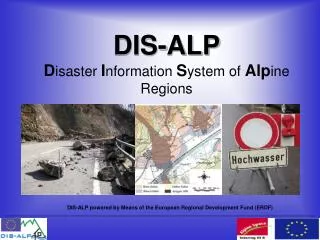
DIS-ALPDisasterInformationSystemof AlpineRegions DIS-ALP powered by Means of the European Regional Development Fund (ERDF)
DIS-ALPDisaster InformationSystem of Alpine Regions General Information • Interreg IIIB Project; Duration: 3 years (2003-2006) • International as well as interdisciplinary project partners:
DIS-ALPDisaster InformationSystem of Alpine Regions General Information • Concentration of DIS-ALP is on information gaps and communication problems between different institutions within the documentation of disaster events. Emphasis was thus laid on: • Unified methodology • Providing meta-information for databases • Considerations about new and existing tools • Instructions and tutorials • Implementation
DIS-ALPDisaster InformationSystem of Alpine Regions Objectives DIS-ALP helps to improve the documentation process of natural hazards by sharing bilateral knowledge in order to achieve interdisciplinary results in following domains: • Near-term: An intensive transnational information exchange by experts of different working fields was set-up (practitioners of spatial planning, risk prevention, civil protection, water – and torrent management, forestry and information technology). Results are specifications for record documents regarding to natural hazards. • Middle-term: A public information-platform about natural hazards has been developed as portal. In the future it will bridge information gaps between practical users, concerned people and official planning institutions. • Long-term: Standardisation and homogenisation of natural hazard documentations for the whole alpine space will result in better comparable information basis and provide means for improved disaster management.
DIS-ALPDisaster InformationSystem of Alpine Regions Method of Resolution
DIS-ALPDisaster InformationSystem of Alpine Regions WP Methodology Concentrated on the methodology of systematic documentation and storage of data, which is important to make resulting data comparable and usable over longer period of time. The cornerstones of a documentation structure were before not organised in an uniform way:
DIS-ALPDisaster InformationSystem of Alpine Regions WP Methodology The time between event and documentation is a substantial factor for the quality of the event data. Therefore the number of possible documenters has to be increased by the admission of new work areas, which improves "proximity" to the processes and thus the quality of the data however. Consideration of interdisciplinary needs in the working-fields like spatial planning, watershed management, avalanche and torrent control. Guideline of a multilingual uniform documentation system, including phenomena catalogue and providing common interfaces between local event databases.
DIS-ALPDisaster InformationSystem of Alpine Regions WP Methodology Open standards were defined, including definitions of hazardous processes and collecting phenomena, which can be identified immediately after disasters. To implement these data in a cartographic environment, a clear definition of features was determined as well as a generalized legend. Source: BUWAL 2000 Source: BUWAL 2000 One important task of this WP is to adapt the results of DOMODIS project to practical requirements.
DIS-ALPDisaster InformationSystem of Alpine Regions WP System Development Common information platform – based on GIS and the existing national and regional information sources as web-portal. WWW.DIS-ALP.ORG All results All papers Link to portal
DIS-ALPDisaster InformationSystem of Alpine Regions WP System Development Develop standards and terminology as ontology (which is queryable as a free knowledge servie and functioning as translation module). A meta database on existing information, allows to serve as a single entry point to a wide range of information sources. Information provision for different user groups, including the broad public for the improvement of risk awareness and risk estimation.
DIS-ALPDisaster InformationSystem of Alpine Regions WP System Development • DIS-ALP event information portal: • uses open standards • Integrates existing data services without duplicating data • Provides interface for knowledge base
DIS-ALPDisaster InformationSystem of Alpine Regions WP Tools New tools were tested to support the field documentation process and make it more efficient, thus increasing the possible number of recorded events as well as the quality of recording. The resulting tools for surveying are able to combine traditional techniques with up-to-date technologies (e.g. GPS, mobile GIS and GPRS). Laser-scanner surveys can be carried out in the cases of events of particular severity, in order to detect possible variations in the topography due to erosion and deposition phenomena. Source: Trento, Progress Report,2004
DIS-ALPDisaster InformationSystem of Alpine Regions WP Instructions • Persons involved in event documentation must carefully be instructed. A new field-guidebook for supporting event documentation praxis was developed: • Make the recording persons aware of the importance of theirdocumentation work. • Ensure that when documenting all relevant data are collected in astandardized way and data fulfill the requirements of the end-user. • Tutorials can be used in instruction courses as well as directly in the field • Instruction workshops were organised to check practicability of instruction materials
DIS-ALPDisaster InformationSystem of Alpine Regions WP Implementation In implementation work-package regional test beds for the defined methodology and the tools and systems developed were defined. It was used for evaluation of procedures and feed-back to other work-packages. Results include event databases and GIS data from historical events archives in Bavaria, South Tyrol, Salzburg and documentations of recent events in the Tyrol.
DIS-ALPDisaster InformationSystem of Alpine Regions Contact Points • DIS-ALP produced formalised knowledge base on disaster events, related phenomena and documentation (ontology) • DIS-ALP integrates experience of different institutions on best documentation practices. • DIS-ALP provides technical and organisational knowledge for definition and improvement of disaster documentation • DIS-ALP offers event database, integrated in GIS-based open web-portal • Resuming information: www.dis-alp.org Thank you for your attention!