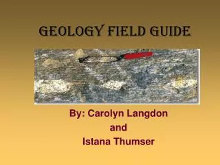
Geology Field Guide
Geology Field Guide. By: Carolyn Langdon and Istana Thumser. Our High Schools Mesozoic Basin. Battlefield Haymarket, VA Osbourn Park Manassas, VA. Produced by Frank Gregorio (OPHS). Produced by Frank Gregorio (OPHS). Produced by Frank Gregorio (OPHS).

Geology Field Guide
E N D
Presentation Transcript
Geology Field Guide By: Carolyn Langdon and Istana Thumser
Our High Schools Mesozoic Basin Battlefield Haymarket, VA Osbourn Park Manassas, VA
General Piedmont and Mesozoic Basin Description • The Piedmont region of Virginia was exposed after Gondwana collided with North America in the Paleozoic 310 million years ago creating the Alleghanian Orogeny.
Piedmont • During the opening of the Atlantic ocean (DCM) that started approximately 230 million years ago, sediments from the eroding mountains started collecting in the geographic region now known as the Piedmont.
Transgression and Deposition http://csmres.jmu.edu/geollab/Fichter/Wilson/StageC.html
Piedmont in Detail • Alleghanian Orogeny cooked rock • folded, twisted faulted • Igneous and sedimentary rock turned to metamorphic rock from immense pressure • Faults formed from broken rock • Landscape wore down to almost sea level • Deep red clayey soils present • Indicates chemical weathering; high in FeOx http://www.nps.gov/archive/mana/pphtml/subenvironmentalfactors13.html
Faults • Reverse and strike-slip faults can also be found in this area, running in the northeast southwest direction • Created by tension between N. America & Africa’s separation Piedmont Fault line C. M. Bailey, College of William & Mary
Mesozoic Basin • Low basins in the Piedmont where sediments collect in grabens between faults are Triassic and Jurassic in age. • The largest basin in Virginia is the Culpeper Basin.
Culpeper BasinNewark Supergroup • Borders eastern front of Appalachian Mountains from Culpeper, VA into MD • Low, gentle rolling to flat topography • Sediment filled grabens & half grabens • Stage “O” of Wilson Cycle • Formed by rifting; separation of Africa from N. Am • Aligned in NE-SW orientation • Sedimentary and igneous rocks (Jurassic & Triassic) • Basalt flows • Most common rock type= diabase as dikes & sills http://www.nps.gov/archive/mana/pphtml/subenvironmentalfactors13.html
Day 2 Haymarket, Manassas, Quarry Day 1 USGS; Great Falls WPWestern Piedmont Mz Mesozoic Basins Early Paleozoic meta- sedimentary and igneous rocks associated with the suture zone between Blue Ridge (Laurentian) rocks and terrains of the Piedmont. Triassic sedimentary rocks deposited in half grabens & grabens during rifting that produced the Atlantic Ocean.
Pre-Lesson Visit USGS
Rock Garden Scavenger Hunt • Examples of rock units in Piedmont • Show sedimentary, structural, mineralogical and weathering features http://www.usgs.gov/visitors/rocks.html
Great Falls: Western Piedmont Virginia and Maryland • Major attraction= Potomac River • Formed by uplift of Piedmont Plateau & Appalachian Highlands • Slope of land increased; streams deepened their valleys & coalesced into the Potomac • Great Falls formed during Ice Age • Occupies broad valley • Thick metamorphosed sandstone layers • River flows into Mather Gorge below falls • Excavated ~ 2 MYA (Pleistocene glaciation) www.cr.nps.gov/history/online_books/grfa/sec4.htm
Guided Inquiry: Incomplete Trail Log • Walking tour with notable geological features seen from park trails • Virginia and Maryland sides • Describe and discuss rock features • Use hand lens to identify minerals • Include geologic time chart
Rocks of Mather Gorge Formation(Late Proterozoic and Precambrian) Buried & metamorphosed by heat/pressure Precambrian rock!! • Mica Schist • Metagraywacke • Amphibolite: intruded ~550-600 mya (zircon) • Granite: intruded ~425 mya • Lamprophyre: mostly mica; ~360 mya • Pegmatite • Granodiorite (jd)~470 mya http://www.cr.nps.gov/history/online_books/grfa/sec5.htm
Geologic Time Chart http://www.cr.nps.gov/history/online_books/grfa/sec5.htm
Metamorphosed Sed/Ig Rocks • Deformed during collisions of continental plates • Resulted in Alleghanian Orogeny • Sedimentary and Igneous rocks metamorphosed to schist and gneiss (CZms) & migmatite (CZmm) • Tightly folded; layered w/ foliation planes of mica • Contain closely-spaced fractures http://geology.er.usgs.gov/eespteam/Greatfalls/INDEX.HTML
Mather Gorge Formation • Made of metamorphosed sedimentary rocks • ~600 mya (Precambrian) • Originally deposited as sand, mud, silt in Iapetus Ocean (before Atlantic) • Eroded from an ultramafic igneous rock • Biotite, muscovite, staurolite, kyanite & garnet crystals grew as rocks cooled http://geology.er.usgs.gov/eespteam/Greatfalls/INDEX.HTML
After Granite Intrusions • Crust rose & overlying rocks eroded • Rock temps declined; rocks fractured • Molten material formed lamprophyre dykes • Gorge cut along several faults (Triassic) • Contain siliceous white quartz veins; some native gold ** Have same orientation as Triassic age faults close by (~200mya) http://www.cr.nps.gov/history/online_books/grfa/sec5.htm
Current Landscape • Results from erosion of Potomac River • River follows cracks & faults in Mather Gorge • Terraces (level surfaces) cut into bedrock by river = remnants of flood plains • 6 recognized terrace levels • Down-cutting created islands, islets, oxbows, potholes and more • Exposures of Piedmont bedrock http://geology.er.usgs.gov/eespteam/Greatfalls/INDEX.HTML
Metagraywacke and Schist (folded beds ) http://geology.er.usgs.gov/eespteam/Greatfalls/INDEX.HTML
Amphibole (dark) & plagioclase (light) crystals in amphibolite Vein quartz intrudes all Mather Gorge Formation http://geology.er.usgs.gov/eespteam/Greatfalls/INDEX.HTML
Haymarket • Extrusive igneous rock layered with sedimentary rock layers • Vesicular basalt from Jurassic indicates tectonic activity • Aphanitic rock shows it cooled very quickly Randy Korntev, WUStL
Manassas Battlefield ParkPart of Culpeper Basin • Composed of sedimentary rock matrix (i.e., siltstone & sandstone) • Igneous diabase forms intrusive dikes & sills • Eastern park soil from parent siltstone • Western park soil from diabase • Progressed up through siltstone during upheaval of Alleghanian Orogeny http://www.nps.gov/archive/mana/pphtml/subenvironmentalfactors13.html
Soils • 79% from siltstone • Strongly acidic, well-drained silt loam • 19% from diabase • Loamy, clay minerals, fragipan layers limit permeability • 2% alluvial (carried/deposited by stream action) http://www.nps.gov/archive/mana/pphtml/subenvironmentalfactors13.html
Siltstone and Diabase Collision • Heat of emerging diabase melted siltstone • Created narrow metamorphic rock bands • Contained epidote, pyroxene, garnet, cordierite minerals http://www.nps.gov/archive/mana/pphtml/subenvironmentalfactors13.html
Gainesville Quarry • Intrusive igneous rock in dikes throughout the existing sedimentary rock • Medium grain size and dark color indicates diabase and shallow underground cooling www.nr.gov.nl.ca/mines&en/geosurvey/education/features/intrusive/
Post Lesson Inquiry Activity Discovering The Wilson Cycle By: Dr. Lynn Fichter http://csmres.jmu.edu/geollab/fichter/Wilson/platbnd2.html