Download
1 / 6
60 likes | 241 Vues
Parts of a Map & Physical Maps. Use pages A20-A21 and 15 in your World Geography textbook to complete the following. On a blank sheet of paper, sketch an outline of the United States Does not have to be precise Draw and label lines of latitude and longitude at 5° intervals

E N D
Use pages A20-A21 and 15 in your World Geography textbook to complete the following • On a blank sheet of paper, sketch an outline of the United States • Does not have to be precise • Draw and label lines of latitude and longitude at 5° intervals • Put a compass rose on your map • Put a scale on your map • Put a title on your map
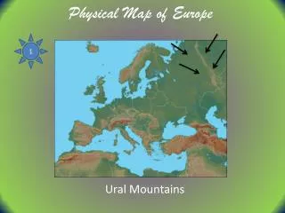
Use pages 20-21 in your World Geography Textbook to answer the following questions on the back of your paper • What is the purpose of a physical map? • What is “relief”? • How does a physical map represent relief? • What is the purpose of a political map? • What sorts of things do political maps show?
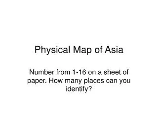
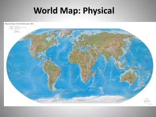
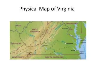
Use pages A18-A19 in your World Geography textbook to answer the following questions • What islands form a state in the US? • What is the largest mountain range in the US? • Are most around-sea-level areas inland or on the coast? • Through what states does the Mississippi river flow? • What region of the US is the lowest? • What states border Lake Michigan?
Use pages A18-A19 in your World Geography textbook to identify the elevation range of the following cities • San Francisco, CA • Boston, MA • Philadelphia, PA • Atlanta, GA • Miami, FL • New Orleans, LA • Chicago, IL • Minneapolis, MN • Denver, CO • Phoenix, AZ
Human-Environment Interaction: The US • Mountain Ranges • The Appalachian Mountains made it more difficult for Europeans to move inland from the East Coast • The Rocky Mountains made it more difficult for Europeans to move inland from the West Coast • Railroads built in the middle and end of the 1800’s allowed settlers to move more easily through the mountains • Rivers • It is far easier to move goods on a river barge than over land • The Mississippi River is one of the most important trade routes in the US • Where a river enters into an ocean, ports are needed to move goods from sea-going ships to river barges • Ex.: New Orleans