Download

1 / 26
280 likes | 769 Vues
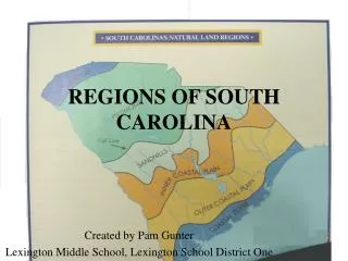
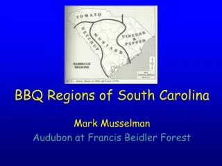
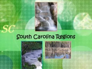
SC. South Carolina Regions. Earth. Where is South Carolina?. SC. North America. United States of America. Here we are! South Carolina borders the Atlantic Ocean. SC. South Carolina Landform Regions Map.

E N D
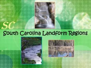
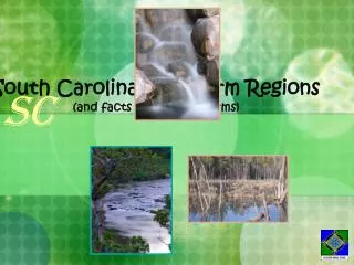
SC South Carolina Regions
Earth Where is South Carolina? SC North America United States of America Here we are! South Carolina borders the Atlantic Ocean.
SC South Carolina Landform Regions Map Our state is divided into regions, starting at the mountains and going down to the coast.
Blue Ridge Mountains Landform Regions SC The Blue Ridge Mountain Region is only 2% of the South Carolina land mass.
Facts About the Blue Ridge Mountains (pages: 44-45) 1. The Blue Ridge Mountains are part of theAppalachian Mountain Range. 2. Manystreams beginin the mountains. 3. These are theoldest mountainsin America. 4. The Blue Ridge Region takes up only2% of South Carolina’s land mass and is located in the northwestern corner of the state. 6. The highest mountain in SC is Sassafras Mountain. 7. Favorite activities include hiking and camping. 8. An important man-made lake is Lake Jocassee, it was built to provide hydroelectric power for the area
Greenville Spartanburg Union Greenwood Rock Hill Abbeville Piedmont Landform Regions SC If you could see the Piedmont Region from space and without the foliage, you would notice it is sort of a huge plateau.
Facts About the Piedmont Region . . . (pages : 46-47) 1.The Piedmont is the largest region of South Carolina. 2.The Piedmont is NOT flat, but has rollinghills. 3. A special feature is monadnock which is an isolated, or single, hill made of very hard rock. Table Rock is an example of a mondadnock. 4. The Piedmont containsmany of our largest citiesin South Carolina. 5. The nickname for this region is ”the foot of the mountains.” 6.The two important industries in the Piedmont region are peaches, and textiles (cloth).
Table Rock Web Cam http://www.southcarolinaparks.com/beautiful-places/webcams/table_rock_webcam.aspx
Columbia, Our State Capitol Sandhills Landform Regions SC Do you wonder why the Sandhills are so sandy? They used to be the coastline of North America millions of years ago.
Facts About the Sandhills Region . . . (pages : 52-53) 1. Long ago, the coastline reached all the way to the middle of the state. 2. You can find ocean remains of living things from long ago in the Sandhills region. This type of remain is called a fossil. 3. Our state capital, the large city of Columbia is located in this region. 4. The fall line is east of the Sandhills, it is an imaginary line where the land in the middle of the state begins to slope downward. 5. Human-made waterways that were built along the fall line are called canals. 6. The fall line became a good area for trade when cities were built along it. 7. Textile mills were built along the fall line to provide water power for the mills.
Fall Line on a South Carolina Map Saluda River at the Fall Line near Columbia The Columbia Canal is the surviving canal Another Canal Picture
Aiken Orangeburg Sumter Florence Coastal Plain Landform Regions SC There is an Inner and Outer Coastal Plain. Can you see the dividing line? This area was once in the ocean millions of years ago.
Facts About The Inner Coastal Plains(pages : 54-55) 1. This region is the center of SC’s cotton production. 2. SC’s best soil can be found here. wheat and soybeans are crops grown in this region. 3. The land in this region is described by rolling hills. 4. Congaree National Park is found in the Inner Coastal Plains region. 5. The Coastal Plains used to be under the ocean millions of years ago. 6. More than half of this region is covered by forest. 7. Evelyn Dabbs is a wildlife Advocate who helps protect the birds and wildlife in this region. You can find her studying and watching birds in the Inner Coastal Plains.
1/2 of this region is covered in forest Cotton in the Inner Costal Plain Evelyn Dabbs Congaree National Park
Aiken Orangeburg Sumter Florence Coastal Plain Landform Regions SC There is an Inner and Outer Coastal Plain. Can you see the dividing line? This area was once in the ocean millions of years ago.
Facts about The Outer Coastal Plains(pages : 60-61) 1. This region’s borders are the Inner Coastal Plains and the Coastal Zone. 2. The region is flat and broken up by many rivers and streams. 3. Swamps cover much of the land along the rivers. 4. Lumber companies have built railroads into the swamps to carry out lumber. 5. Canals were built to connect rivers so that ships could carry goods from place to place. 6. The Santee Canal was built to connect the Santee and the Cooper River. 7. Columbia and Charleston were the two cities that the Santee Canal allowed goods to be shipped. 8. Tributaries or smaller rivers and streams flow into larger rivers in this region.
Hilton Head Beaufort Charleston Georgetown Myrtle Beach Coastal Zone Landform Regions SC Take a look at the city map of South Carolina. Can you name the cities in the Coastal Zone?
Facts About the Coastal ZonePages: 62-63 1. It borders the Atlantic Ocean. 2. The main industry is tourism and fishing. 3. Two physical features in this area are beaches, sea islands, barrier islands, and marshes. 4. The Grand Strand stretches 60 miles and is made up of wide sandy beaches. 5. South of the beaches you can find salt marshes. Marshes contain food that feeds shrimp and other shell fish. 6. The Ashley-Combahee-Edisto River System also known as the ACE basin are called “blackwater rivers” because the hardwood trees in the swamps drop their leaves and darken the water. 7. The Edisto River is the longest blackwater river in the United States.
Click the link below to find out information on the Edisto Riverhttp://www.sciway.net/sc-photos/colleton-county/edisto-river.html Marshes ACE Basin Grand Strand
How did cities begin in South Carolina? Take a look at the South Carolina Cities Map to learn where the main cities are placed. Then look at the Rivers and Streams Map. Can you see learn anything by comparing the two maps? Hint: How were rivers used when the South Carolina colony was beginning to settle?
Remember . . . • There are 6 regions in South Carolina: • Blue Ridge Mountains • Piedmont • Sandhills • Inner Coastal Plain • Outer Coastal Plain • Coastal Zone