Download
1 / 12
120 likes | 312 Vues
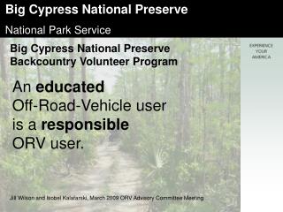
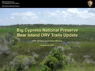
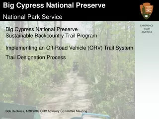
Big Cypress National Preserve Sustainable Backcountry Trail Program. Implementing an Off-Road Vehicle (ORV) Trail System Trail Designation Process. Bob DeGross, 1/20/2009 ORV Advisory Committee Meeting. Recreational ORV Plan Completed in 2000

E N D
Big Cypress National Preserve Sustainable Backcountry Trail Program Implementing an Off-Road Vehicle (ORV) Trail System Trail Designation Process Bob DeGross, 1/20/2009 ORV Advisory Committee Meeting
Recreational ORV Plan Completed in 2000 • Immediate focus was designation of trails in Zone 4 and stabilization of trails in other units. • Sequence of work was unclear. • This was a big job with lots to learn. • Lacked Implementation Plan.
Lessons Learned • Heavily stabilized trails were undesirable to visitors and very expensive. • Spot treatment approach is cheaper, provides more desirable ORV visitor experience, while protecting surrounding resources. • Major improvements needed in signage. • ORV Plan gave no thought to where 2nd trails should be. • Need to standardize implementation process and document steps. • Need to standardize signage.
Typical Planning Process • Broad Concept Plan (General Management Plan) • Program Specific Plan (ORV Plan)Narrows concept but does not create final “on-the-ground” product. Uses words like conceptual, approximately, should consider. • Implementation Plan (Current Step)Creates “final product” that is evaluated against parameters outlined in GMP and Program Plan.
In 2006 Preserve staff recognized the need to begin a standardized implementation process. • Internally created a systematic sequence to complete final designation of Recreational ORV Trail System. • Need to conduct process unit by unit. Preserve too large to do all at once. • Need to consider Primary and Secondary Trails • Preserve units that allow ORV use – Bear Island, Turner River, Corn Dance, Stairsteps Zones 2, 3, 4
First began process on Bear Island and Zone 4 in 2006/07 • Subsequent elements will be • Turner River Unit – 2008/09Corn Dance Unit, zones 2 and 3 – 2009/10 • Final outcome – Designated ORV Trail Network throughout Preserve with no dispersed use.
The Process – Accept Input-Internally review ORV Plan to identify allowable parameters in specific unit. • Coordinate Public Input • - Hold public meeting to ascertain adequacy of conceptual trail network identified in plan, need for secondary trails, identify desired destinations and areas to avoid. Not required by NEPA. • - ORV Adv. Comm. Considers public comment and provides further recommendations.
The Process – Evaluate Suggestion-NPS Internal ORV Committee reviews recommendations from public and ORVAC against ORV Plan parameters. Adjustments made accordingly. • NPS multi-disciplinary review of recommended trails Review aerials ArcheologicalEndangered Species Soil TypesLand Ownership Identify Stabilization NeedsSensitive Areas Maintenance ConcernsMonitoring Points Identified • This is all completed by review of maps, aerial photos and extensive ground-truthing of both primary and secondary trails • - Up-dates provided to ORVAC throughout process.
The Process – Identify Route-Through evaluation efforts internal team formulates alternatives that identify primary and secondary trail network for unit. • Finalize-Superintendent reviews and selects final designated trail system for unit. • Official map is created, names of trails identified, Marking of trail system begins in field, spot stabilization of areas identified during field work begins and is on-going • Final official map created and announced to the public. • Dispersed use discontinued within unit.
The Process – Designate -Designated trail use enforced through Superintendent’s compendium, no dispersed use allowed in unit. • Proceed to final rule making. • Note – the need for adjusting trails, closing trails or implementing seasonal closures may be necessary even after final rule is created and published. These adjustments will be stipulated in Superintendent’s Compendium. Public notices, and trail head information will always be used to inform the public.
The Process – On-Going The NPS recognizes the need for on-going education, evaluation and enforcement. Continual stabilization and monitoring Need to create VIP Trail Corps to assist. A file will be kept on each primary trail (and associated secondary trails) within a unit documenting all work and decision processes.
Implementation Plan - In a Nutshell • Accept Input (Unit By Unit) • Evaluate Suggestion • Identify Route • Finalize (Mark, Stabilize, Make Public) • Designate (Enforce, Codify) • On-going stabilization, monitoring and evaluation • A well thought out trail concept will greatly encourage appropriate trail use and allow us to go to a designated trail system.