Download
1 / 10
100 likes | 222 Vues
In her presentation at the ICT4Development Conference in Lusaka, Zambia, Kathryn Ramirez, a Geographic Information Systems Specialist, highlights the transformative role of GIS in project management and decision-making. She discusses the necessity of GIS training, the importance of standardized data across regions, and the contributions of tools such as ArcGIS and Google Earth. Kathryn elaborates on challenges like data accuracy and formats, while emphasizing the need for effective implementation and capacity building to leverage GIS effectively in diverse projects across communities.

E N D
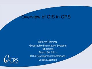
Overview of GIS in CRS Kathryn Ramirez Geographic Information Systems Specialist March 30, 2011 ICT4 Development Conference Lusaka, Zambia
Introduction • Kathryn Ramirez • Baltimore, Maryland (HQ) • Create/Perform GIS Trainings • Provide Guidance on GIS Implementation • Assist in the design/deployment of the GIS architecture • Create maps when approved
Project Background • Making Information Spatial to Improve Decision Making and Project Management • Located in Pockets • Need for Training and Expansion • Opportunity to Compare Standardized Data Across Regions
ICT Solution • ArcGIS 10.0, ArcGIS Explorer, Google Earth • ArcGIS- ESRI (Environmental Systems Research Institute) • Tech Support • -ESRI • -CRS • Staff Support • Training Time • IT Support Time • Software User Time
Key Challenges • Data Standards • Projections-GPS units, and spatial files • Accuracy • Data formats • .jpg,.shp, .mxd, .kml, .kmz, ascii., ect. • Metadata
Lessons Learned • GIS is a Great Tool That Has Benefited Many Projects • Donors are Asking for Spatial Data • Improves Project Management • Encourages Standardized Indicators
Sustainability • Computer Literacy • Software Costs • Hardware Costs • Training Time
Summary and Close • Localized Pockets • Standard Platform • Training and Capacity building • Improve • Project Management, Decision Making, and Showing where we operate • ICT4D solutions require carefully managed technological, personnel, and process changes
2 GIS Presentations Thank You!