The Imaging Node
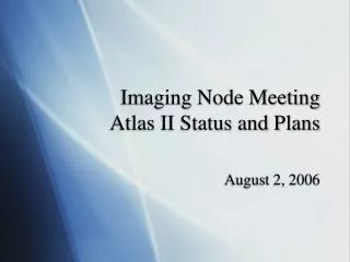
The Imaging Node. FY09 Mid-Year Status April 2, 2009 Lisa Gaddis (USGS) Sue LaVoie (JPL). Lisa Gaddis, PI USGS Node Sue LaVoie, Co-I JPL Sub-Node. USGS Technical Leads: Patty Garcia: Mission Interface Chris Isbell: Data Delivery Bob Sucharski: Collections. JPL Technical Manager:

The Imaging Node
E N D
Presentation Transcript
The Imaging Node FY09 Mid-Year Status April 2, 2009 Lisa Gaddis (USGS) Sue LaVoie (JPL)
Lisa Gaddis, PI USGS Node Sue LaVoie, Co-I JPL Sub-Node USGS Technical Leads: Patty Garcia: Mission Interface Chris Isbell: Data Delivery Bob Sucharski: Collections JPL Technical Manager: Alice Stanboli S. Akins M. Bailen J. Barrett K. Becker P. Geissler R. Raub • R. Alanis K. Boggs • J. Diehl A. Leung • J. Padams L. Plesea • E. Rye D. Yu THEMIS Data Node (ASU): Philip Christensen, PI Kimm Murray, Manager LROC Data Node (ASU): Mark Robinson, PI Ernest Bowman-Cisneros, Manager HiRISE Data Node (UA): Alfred McEwen, PI Rod Heyd, Manager IMG Organization • IMG meets monthly by telecon and typically holds 1 annual F2F meeting. • IMG also attends ~triannual PDS MC F2F meetings and ~annual Tech Sessions. Apr 2, 2009 Mid-Year Status - Imaging Node 2
IMG Expertise and Responsibilities Users: Planetary Scientists Geologic Mappers Mission Teams Other PDS Nodes Public Users: Planetary Scientists JPL and Other Mission Teams Other PDS Nodes Public PDSMC April 3, 2008 3 Apr 2, 2009 Mid-Year Status - Imaging Node
IMG Data Integrity Primary Archives: ~80 TB Secondary/Remote Copies: Partner Backups Tertiary+ Copies: DNs, NSSDC, SDSC • Data managed by IMG (USGS and JPL) and associated Data Nodes (HiRISE, THEMIS, LROC) are safe, online, and monitored regularly for integrity and accessibility • Disaster Recovery Plans and one (JPL) detailed procedure document in place • Full 2nd and 3rd copies planned by end of CY09 • Redundant data storage and incremental tape backups used at primary sites • Hardware renewal & growth plans in place at both IMG sites Apr 2, 2009 Mid-Year Status - Imaging Node 4
IMG Data Volume IMG, PDS, and NSSDC will soon be the caretakers of an unprecedented volume of digital data! Requires significant expense for hardware, maintenance, data integrity, system monitoring, etc. FY09 Cost of 1 TB of redundant online storage = $1K (initial purchase) FY10-12 archive growth of ~100 TB/yr will require purchase of redundant storage at both USGS and JPL, at an estimated Total Cost $200K/yr Archive Elements (Est.): • FY09: 73 TB (HR, TH, All IMG) • FY10: 170 TB (HR, TH, LRO, Ap) • FY11: 275 TB (HR, TH, LRO, Ap) • FY12: 378 TB (HR, LRO, Ap) • FY13: 400 TB (LRO, Ap) • FY14: 412 TB (LRO) Note:Includes only primary volumes at USGS and JPL. DN storage, partner copies, and deep archives at NSSDC and SDSC will ensure 3-copy redundancy. 5 Apr 2, 2009 Mid-Year Status - Imaging Node
Data Collections: Hardware at IMG • IMG hardware and computing infrastructure, guided by industry best practices and PDS requirements, is secure and scalable • Servers are redundant and configured as failover clusters • RAID-5 storage provides failover at disk and node level • Systems at USGS and JPL provide ‘hot backup’ to each other, ensuring continuity of operations • IMG hardware capacity will need to increase ~4 to 8X this volume within 5 years 6 Apr 2, 2009 Mid-Year Status - Imaging Node
IMG Time Budget: Weekly Average Feb09 Snapshot • Mission Interface (Archive and Baseline) activities comprise ~75% of our time budget • Management, Technical Operations for IMG and PDS, data restorations comprise the remaining ~25% 7 Apr 2, 2009 Mid-Year Status - Imaging Node
IMG Data Delivery and Services • IMG Web site (JPL) • Mission-specific interface points to image data in IMG and at other nodes, documentation, release calendars, PDS Home page, PDS-wide search, etc. • Photojournal (JPL) • ‘Best of’ NASA image collection captioned and released through projects and at science conferences, media and news events • Map-a-Planet (USGS) • Web Map Services (WMS) interface delivers derived products from PDS data >> 32 planetary global mosaics and counting • Widely used map bases for other delivery systems within and outside of PDS >>Google Earth/3D Mars, Google Moon, Atlas, ODE, World Wind Moon, etc. • Planetary Image Atlas (JPL) • Serves image datafrom all past and current planetary missions, updated as deliveries are received from projects • Single- and multi-mission searches and bulk download (uses PDS-D/OODT) • Map-based searches (Mars: MGS/MOC, MRO/HiRISE; Saturn: Moons) using Google Web Toolkit (GWT) • Unified Planetary Coordinates (UPC) Database & PILOT (USGS) • Delivers image metadata with unified coordinates and improved geometry • Geometry ‘backbone’ for Atlas, ODE (GEO), ISIS, etc. • Map-based interface (Planetary Image Locator Tool = PILOT) provides db access, footprint plots • Supports only selected PDS image collections used for cartography and mapping 8 Apr 2, 2009 Mid-Year Status - Imaging Node
Capabilities GIS ‘world file’, ISIS, and common image formats output “Feature Based” searching via connectivity to USGS Nomenclature and Planetary Maps sites Simple Cylindrical, Mercator, Sinusoidal, Polar Stereographic (new) map projections 8, 16, & 32-bit output (new) Nearest Neighbor and Bilinear Interpolation (new) Plans Add option for full image download and JPEG2000 format for output files Allow ‘on-the-fly’ processing using integrated ISIS tools Add new data Derived lunar elemental abundance (FeO, TiO2) and mineral maps (Plag, Pyx, Ol, etc. of Paul Lucey (UH) Clementine UVVIS & NIR empirical calibration (Lucey/Denevi) Lunar Radar (B. Campbell) at 12.6 cm Merged Clementine & Lunar Orbiter ‘albedo’ (Hare) Map a Planet (USGS) See http://mapaplanet.org PDSMC April 3, 2008 9 Apr 2, 2009 Mid-Year Status - Imaging Node 9
HiRISE DN (UA) THEMIS DN (ASU) Atlas (JPL) • Integrated, distributed system of web applications and online databases • Provides seamless access to product holdings in distributed, heterogeneous Data Nodesystemsthrough product & profile servers (PDS-D/OODT middleware) • Intuitive cross-mission and mission-specific data searches utilizing UPC databaseand SPICE as integral components ensuring accurate geographic searches across disparate coordinate systems • Allows filtering of products based on available metadata via forms and map interface • Missions supported: Cassini (ISS, VIMS, RADAR), Messenger (MDIS), MER (cameras), MGS (MOC), MRO (HiRISE, CTX, MARCI), MO (THEMIS), MEX (HRSC), Phoenix (cameras) Apr 2-3, 2009 PDS MC - Imaging Node 10 OODT - Object Oriented Data Technology
Atlas: Recent Upgrades & Improvements Recent: • Integrated the UPC for the map interface (form integration and footprints coming) • Google Maps-based search for Mars and Saturn Moons, enhanced for accuracy at poles • Now use super-efficient ‘onMars’ map server to provide fast access to Mars image maps • Migrated from Sybase to MySQL • Added a popup window showing the online PDS volume for a specific image in the Results Table • Used AJAX API to enhance performance by asynchronously updating the interface without having to reload the page Customer-driven: Intensive interaction with customers (past year & ongoing) to understand how they use the system >>Pappalardo, Cuzzi, Berman, Geissler, Rose, McGrath, Alexander, Zhou, Crisp • Bulk download thru Atlas and online volumes via zip as well as tar and wget • Enabled sorting of additional columns on Results Table/Shopping Cart • Asynchronously update the mission and instrument specific forms when either mission or instrument is selected without having to submit the request by clicking a button • Created an introductory tutorial video and added/updated explanations of functions and usage • List active constraints so the user always knows what has been selected • Indicate when the Atlas is working on a request – ‘Loading’ panel added • Allow for multiple input formats for date-time fields • Create a ‘Quick Search’ tab containing most commonly used parameters • Allow viewing of selectable number of results per page • Include multiple formats for report downloads – CSV as well as TAB delimited • Allow the user to do a text-based search Apr 2-3, 2009 PDS MC - Imaging Node PDSMC April 3, 2008 11 11
Atlas: Future Planned Upgrades and Enhancements: • Further integration of UPC (forms, footprints, newly supported datasets) • Google Maps-based search for more targets • Footprints on maps • Image transformation & calibration • XML version of PDS labels • Calibration & calibrated data – investigate the best approach based on time, funds and user needs • Multi-mission searches resulting in products from both orbital & surface missions • Integrate with PDS2010 services: ingest & preparation, and inventory & monitor • New Missions: Chandrayaan-1 (M3), LRO (LROC, LAMP, LCROSS), MSL (cameras) • Migrate Past Missions: Viking Orbiter & Lander, Pathfinder, Clementine, Galileo • Customer Interaction: • Continue informal discussions • Initiate User Acceptance Testing (Pappalardo, Crisp) • Work with Cassini project to add observation planning information to search capability and potentially inherit some useful tools • Adopt special meta-data modifications that Rings Node uses when ingesting Cassini data • Continue to make system modifications to improve user experience Apr 2-3, 2009 PDS MC - Imaging Node PDSMC April 3, 2008 12 12
UPC and PILOT (USGS) Unified Planetary Coordinates (UPC) Database • Provides improved metadata for planetary images • Reads position & pointing from PDS labels • Converts to unified coordinates • Calculates ‘improved’ pointing & location data • Can be used by other delivery services • Requires camera model in ISIS3 • Primarily supports images used in cartography and geologic mapping • Mars: Vik.Or., MOC, CTX, HiRISE, TH IR • Moon: Clementine UVVIS & NIR Planetary Image Locator Tool (PILOT) • Map interface for UPC footprints (visual check on what UPC is calculating) • Improved data identification because of increased accuracy of geometric information • Standardizes map coordinates and projection for all included datasets (no need to know ‘native’ systems) • Built-in updating possible, benefits from improvements in image pointing, etc. that result from cartographic processing • Provides POC for obtaining UPC database PDSMC April 3, 2008 13 13 Apr 2, 2009 Mid-Year Status - Imaging Node
UPC and PILOT Plans • UPC Database Population • New datasets staged for population • Mars: MO/THEMIS VIS, VO 1 & 2, HRSC, updates to earlier datasets • Saturn/Titan: Cassini ISS, VIMS • Moon: Lunar Orbiter individual frames, Clementine HiRES, LWIR, LROC NAC • Mercury: MESSENGER NAC and WAC • Providing db and support for current and new users • Improved schema for uploading to PILOT • Discuss with NAIF possible re-integration of improved pointing • Camera models • Required in ISIS3 for UPC support • Expected: • MRO CRISM, Ch-1 M^3, Dawn Framing Camera, Mariner 10, Voyager 1 & 2, Galileo SSI and NIMS • PILOT release • Addition of Help information and tutorial ‘slide shows’ • Addition of new data following UPC ingestion PDSMC April 3, 2008 14 14 Apr 2, 2009 Mid-Year Status - Imaging Node
IMG Research Support • NASA-Funded Research Proposals • Apollo Sample Image Digitization Project at Johnson Space Center (LASER; G. Lofgren, JSC) that will result in a ~30 TB archive volume • Lunar Crater Database project (LASER; N. Barlow, NAU) • Lunar Data Node at GSFC (LASER; D. Williams, GSFC), with GEO as Lead Node • Proposal to MC to develop and support an online site for science products that result from NASA-funded research using PDS data • Interface via Web site, contents possibly treated as ‘Extras’ • Searchable collection, organized by target and/or mission(s) • Documentation required, to be reviewed by PDS and science peers 15 Apr 2, 2009 Mid-Year Status - Imaging Node
Data Node Status LRO Camera (ASU) • Mark Robinson (PI), Ernest Bowman-Cisneros (DN Manager) • Mission Interface • Attend LRO Data Working Group (LDWG) telecons (~every other Monday) • Completed LROC EDR/CDR & RDR SIS reviews • LROC Team archive catalog files (instrument, data set, reference, person) in development and near completion • LROC Data Node (ASU) • Developing WMS (Web Map Service) server backend • Will include map- and text-based search interface • To debut immediately post LRO launch (June?) 16 Apr 2, 2009 Mid-Year Status - Imaging Node
IMG Roadmap Highlights • PDS2010 • Participate as members of Data Model and Architecture Working Groups • Expert Guidance • UPC initial release of image geometry database; standalone or integratable • Archive Collections • 80 TB • New archives: Messenger/MDIS, Phoenix/cameras, Chandryaan-1/M3 • LROC Data Node established • Data Accessibility • AtlasII: integration of UPC, Map interface, Google & open source technology • Preservation • Hardware system upgrades • Disaster Recovery planning complete • Deep Archive & remote online backups of all current holdings complete • PDS2010 • Members of Data Model and Distributed Infrastructure Design Teams • Begin integration of 2010 Infrastructure with IMG systems • Expert Guidance • New ISIS3 camera models for UPC • JPEG2000 tools • RPO online and operating • Archive Collections • 274 TB • New archives: LRO/LROC & LAMP, LCROSS, Apollo Photo & Sample digitization • Data Accessibility • Atlas upgrade: footprints, integrate PDS archives • OGC/GIS support • Enhanced interoperability of IMG delivery systems • Preservation • Ongoing hardware replen, integrity checks, remote sites & deep archive sync • PDS2010 • Begin accepting PDS4 data • Build IMG-specific services on top of 2010 • Begin migration of PDS3 archives to PDS4 • Expert Guidance • Linkage of lander/rover position & data to orbiter • Archive Collections • 400 TB • New archives: MSL cameras, JUNO, DAP • MSL operations uses Atlas • Automated Archive Volume generation in MSL pipeline • THEMIS Data Node end (?) • Data Accessibility • IMG systems adapted to utilize 2010 ingest/prep and inventory/monitor services • Photojournal re-engineered as 3-tier web application • Preservation • Ongoing hardware replen, integrity checks, remote sites & deep archive sync • PDS2010 • Complete migration of PDS3 archives to PDS4 • Expert Guidance • Support server-side processing of PDS images • Archive Collections • > 420 TB • New archives: Discovery, DAP, Mariner 9 • HiRISE Data Node end (est.) • Data Accessibility • PDS4 archives fully integrated with IMG delivery systems • Preservation • Ongoing hardware refresh, integrity checks, remote sites & deep archive sync. 2008-09 2010-11 2012-13 2014-15 Apr 2, 2009 17 Mid-Year Status - Imaging Node
Backup Slides 18 Apr 2, 2009 Mid-Year Status - Imaging Node
IMG Role & Relationships Within PDS • IMG is a cross-disciplinary PDS science node that provides multi-mission data and search services to planetary sciences and other nodes • Emphasis is on large-volume planetary image datasets • IMG refines and provides access to data and software that geometrically characterize and transform planetary images • IMG develops and provides new software tools and capabilities in response to research and flight-project needs • IMG supports and enables a wide variety of science research applications that use planetary image data: • Morphologic, mapping, compositional, geophysical, and structural studies, topographic modeling and visualization, mission planning and landing site assessment • IMG works in partnership with: • Geosciences Node, which often serves as our PDS Mission Lead, to archive and serve images and maps and provide updated geometry for cross-mission searches • Small Bodies Node Lead and Radio Science Advisor, to describe and guide users to international standards for cartographic data and map products • NAIF Node, as a customer for SPICE data for use in both archives and search services • All PDS Nodes, to design and coordinate mission-based archives, support Data Analysis Programs, review and maintain PDS policies and standards, and test tools Apr 2, 2009 Mid-Year Status - Imaging Node PDSMC April 3, 2008 19 19
A ‘geometry database’ for PDS data Reads position & pointing from PDS image labels Designed to be updated and expanded as needed Converts to unified coordinates Planetocentric latitudes 0 to 360 degree positive east longitudes Mars/MGS: IAU 2000 Mars Coordinates Calculates ‘improved’ pointing and location data Corner, edge positions every line, sample (or fractional l, s) Images projected onto 3-D surface model where possible Why? Improves data search & retrieval (geographic, feature-based) for PDS image data Enhances user ability to identify, combine, correlate and analyze cross-mission PDS data Readily used by Atlas, ODE and other search tools within and outside PDS (OGC-compatible) Used to identify overlapping image sets to seed control point and match point files Significantly enhances speed and quality of production of image mosaics in ISIS from data such as HiRISE and LROC Corner Footprint Expert Assistance: Image Geometry (USGS) The Unified Planetary Coordinates (UPC) Database UPC Footprint Example: MOC WA Footprint OGC WMS – Open Geospatial Consortium PDSMC April 3, 2008 20 20 Apr 2, 2009 Mid-Year Status - Imaging Node
Photojournal (JPL): Today and Plans • Delivers ‘best of’ NASA’simage & instrument products from active and past missions • Simple point-and-click interface • Organized by target, mission, spacecraft, instrument and feature name • TIFF and JPEG output file formats at full resolution acquired by spacecraft • Each image includes a caption and links to additional information • Plans • Redesign the database schema and disk storage directory approach to improve performance due to huge volume • RSS subscription capability for daily releases • Redesign as a 3-tier web application, enabling more interactive experience • Enable secure upload and preview of images prior to quality control and publishing • Redesign the ‘search’ to allow filtering so that fewer images are returned • Add linkage between archive products and ‘best of’ images See http://photojournal.jpl.nasa.gov PDSMC April 3, 2008 21 21 Apr 2, 2009 Mid-Year Status - Imaging Node
IMG User Services Research Products Online (RPO) • New user-submitted online repository for digital products from NASA-funded research (e.g., DAPs, PGG, LASER, etc.) • Managed as a PDS Working Group (IMG as Lead, members from other Nodes) • Acts as ‘clearinghouse’ for products that fall outside typical mission data volumes • Resembles OLAF but tailored to planetary image and derived products • Interface via Web site like Photojournal, contents treated as ‘Extras’ • Searchable collection, organized by target and/or mission • Planned products include: • Thematic maps and map sheets, image mosaics, derived image products and illustrations, data tables, laboratory and telescopic images, etc. • Required: • Documentation (explanatory text, source information, captions, references) as pdf files • Annotation as necessary • Standard image formats (jpeg, tiff, png), ≥300 dpi resolution • Map scale, orientation, and other information • Peer review, PDS quality control • Supports a broad audience of scientists, data providers, managers, educators, etc. Proposal to PDSMC OLAF: Online Archive Facility See http://sbn.psi.edu/olaf/ 22 Apr 2, 2009 Mid-Year Status - Imaging Node
IMG Summary IMG has a clearly identified role in PDS and its activities directly address PDS Level 1 Requirements IMG applies expertise in early mission involvement, data processing and calibration, and cartography to guide and support data deliveries and research by data providers, scientists, and other PDS Nodes IMG is poised to support a very high volume of data for PDS and the planetary science community Online data are safe and accessible Plans for evolution of data delivery services in IMG will support growth in data volumes and user expectations IMG activities will continue to emphasize delivery of usable data products and services to customers 23 Apr 2, 2009 Mid-Year Status - Imaging Node