Download
1 / 24
250 likes | 345 Vues
A. g. r. i. c. u. l. t. u. r. e. a. n. d. A. g. r. i. c. u. l. t. u. r. e. e. t. A. g. r. i. -. F. o. o. d. C. a. n. a. d. a. A. g. r. o. a. l. i. m. e. n. t. a. i. r. e. C. a. n. a. d. a.

E N D
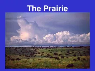
A g r i c u l t u r e a n d A g r i c u l t u r e e t A g r i - F o o d C a n a d a A g r o a l i m e n t a i r e C a n a d a Gross and Effective Drainage Area Delineation in the Prairie Provinces Presentation at PPWB Prairie Hydrology Workshop January 29, 2013
A g r i c u l t u r e a n d A g r i c u l t u r e e t A g r i - F o o d C a n a d a A g r o a l i m e n t a i r e C a n a d a Overview • Concepts • Why is this of concern to the PPWB? • Background • Manual Process • Migration to GIS Environment • Recent Changes • What Does the Future Hold?
A g r i c u l t u r e a n d A g r i c u l t u r e e t A g r i - F o o d C a n a d a A g r o a l i m e n t a i r e C a n a d a Concepts • Stichling and Blackwell (1957) presented a paper proposing the concept of fluctuating drainage area by year, by season, by event • Godwin and Martin (1975) presented a paper refining the concept of gross, effective and dead drainage areas
A g r i c u l t u r e a n d A g r i c u l t u r e e t A g r i - F o o d C a n a d a A g r o a l i m e n t a i r e C a n a d a Gross Drainage Area “The gross drainage area of a stream at a specified location is that plane area, enclosed by its drainage divide, which might be expected to entirely contribute runoff to that specified location under extremely wet conditions. The gross drainage boundary is the drainage divide (i.e. the height of land between adjoining watersheds).”
A g r i c u l t u r e a n d A g r i c u l t u r e e t A g r i - F o o d C a n a d a A g r o a l i m e n t a i r e C a n a d a Effective Drainage Area “The effective drainage area is that portion of a drainage basin which might be expected to entirely contribute runoff to the main stream during a flood with a return period of two years. This area excludes marsh and slough areas and other natural storage areas which would prevent runoff from reaching the main stream in a year of ‘average runoff’.”
A g r i c u l t u r e a n d A g r i c u l t u r e e t A g r i - F o o d C a n a d a A g r o a l i m e n t a i r e C a n a d a Dead Drainage Area “Drainage is considered dead if there is no outflow from an area even under very wet conditions. This situation is common on the Canadian Prairies where major depressions having sloughs and shallow lakes with no outlets are usually associated with dead drainage. A dead drainage basin includes all of the area tributary to such a depression.”
Why is this of concern to the PPWB? Need drainage areas that are acceptable to all member agencies For purposes of apportionable flow determination, only projects within the effective drainage area are considered as depletions to the natural flow
A g r i c u l t u r e a n d A g r i c u l t u r e e t A g r i - F o o d C a n a d a A g r o a l i m e n t a i r e C a n a d a Background • 1970 - PFRA, as part of an IHD Study, undertook task of delineating drainage areas (543 stations) • Early 1970s - Need for standardization • 1975 - at PPWB’s request, PFRA accepted responsibility for delineating areas on streams; covered by Master Agreement on Apportionment; commitment reaffirmed in June 2003 • 1978 - Hydrology Memorandum #25 (1191 stations) and 3 subsequent addendums
A g r i c u l t u r e a n d A g r i c u l t u r e e t A g r i - F o o d C a n a d a A g r o a l i m e n t a i r e C a n a d a • 1983 - Hydrology Report #104 (1687 stations) with 8 subsequent addendums (Addendum #8 published in 2001 included 2689 stations) • 1994 - Decision made to migrate data base and process to a GIS environment • Late 1990s - digitizing lines and developing a GIS process • 2001 - Completed migration from manual to GIS environment • 2008 - Current GIS version (8) includes entire Prairie Provinces area (3312 stations)
A g r i c u l t u r e a n d A g r i c u l t u r e e t A g r i - F o o d C a n a d a A g r o a l i m e n t a i r e C a n a d a Manual Process • Time consuming and resource intensive • Difficult to update data base • Limited product usability
A g r i c u l t u r e a n d A g r i c u l t u r e e t A g r i - F o o d C a n a d a A g r o a l i m e n t a i r e C a n a d a Index Cardsand Summary Reports
A g r i c u l t u r e a n d A g r i c u l t u r e e t A g r i - F o o d C a n a d a A g r o a l i m e n t a i r e C a n a d a Migration to GIS Environment • Process - digitize delineated boundaries - develop gross & effective polygons - develop linkage network - compare manual & GIS tabulations to check/confirm linkages
A g r i c u l t u r e a n d A g r i c u l t u r e e t A g r i - F o o d C a n a d a A g r o a l i m e n t a i r e C a n a d a Migration to GIS Environment • Benefits - data base easy to update/maintain - quick automated revision of areas - easy access of data base by users - unlimited application potential
A g r i c u l t u r e a n d A g r i c u l t u r e e t A g r i - F o o d C a n a d a A g r o a l i m e n t a i r e C a n a d a Recent Changes • Association of all dead drainage areas with a drainage basin • Addition of “artificial” stations to give complete coverage of Prairies
A g r i c u l t u r e a n d A g r i c u l t u r e e t A g r i - F o o d C a n a d a A g r o a l i m e n t a i r e C a n a d a
A g r i c u l t u r e a n d A g r i c u l t u r e e t A g r i - F o o d C a n a d a A g r o a l i m e n t a i r e C a n a d a Ongoing Enhancements • Continue to refine delineations - use 1:20,000 scale coverage where available - check delineations using digital NTS maps (DEMs) • Incorporate local information provided by users
Current (Version 8, 2008) Product http://www.agr.gc.ca/nlwis-snite/index_e.cfm?s1=data_donnees&s2=details&s3=lc-ct&page=wb-bv_plus
What Does the Future Hold? ?????? – PFRA no longer exists, and there is no mandate in the current organization to continue drainage area delineation activities International Harmonization of Watershed Boundaries and Hydrographic Features (IJC) Development of Watershed Delineation Tool – for specific projects, not for drainage area database maintenance
Features of the Watershed Delineation Toolhttp://www.agr.gc.ca/watersheddelineation Delineate watershed boundaries anywhere within the Canadian Prairies Produce maps and hydrology reports containing standard watershed information Delineated watershed boundary and area Contributing and non-contributing areas Longest flow path, stream length and slope, draiange density Location of WSC gauging stations Download watershed boundaries to standard geographic formats (KML or shape file) Easy to use and interactive
A g r i c u l t u r e a n d A g r i c u l t u r e e t A g r i - F o o d C a n a d a A g r o a l i m e n t a i r e C a n a d a QUESTIONS???