Northern Agricultural Region Environmental Account: Challenges, Successes, and Future Directions
This report outlines challenges faced, successes achieved, and future direction in the Northern Agricultural Region (WA) environmental account, including vegetation surveys, expert opinions, and bird accounts. It discusses data access, partnerships, using expert opinion to calculate vegetation configuration and composition, and the importance of improving native vegetation accounts through ground surveys and satellite imagery. The report also highlights the significance of cooperation and investment in preserving the region's biodiversity.

Northern Agricultural Region Environmental Account: Challenges, Successes, and Future Directions
E N D
Presentation Transcript
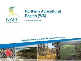
Northern Agricultural Region (WA) Environmental Account
CONTENTS • Region overview • Challenges • Successes and benefits • Using expert opinion • Bird account • Future direction • Questions Kalannie
Challenges with the Trial • Data access and quality • Scale Variations in both the age of the survey and its capture scale. • Vegetation surveys used different methodologies Vegetation was assessed using varying classification schemes for both vegetation type and condition. • Asking the right questions Heal’s breakaway
Successes and benefits • Closer partnerships with other agencies Linkages with Department of Water and the Department of Environment and Conservation • Identification of knowledge gaps • Data compilation • Standardised methodologies • Identification of areas to target for investment • Access to researchers and scientists
Using expert opinion Native vegetation account
Calculating vegetation configuration • Assessment of difference between Pre-European and current configuration Expert panel assigned each vegetation association with a value out of 5, based on a visual comparison between the current and Pre-European extent. This value was then converted to a value out of 100 to be incorporated in the account. Vegetation associations that were totally fragmented when compared to the Pre-European extent were given a 0 Configuration = 100 Configuration = 0
Calculating vegetation composition Hakea open shrubland Configuration = 60
Calculating vegetation composition • Available survey data was compiled and standardised Survey data from 5 different surveys was compiled together and standardised to the same Keighery Scale for vegetation condition. Survey points were then intersected with the vegetation association layer. Vegetation survey data
Calculating vegetation composition • Where survey data was available, the median value was taken • Aerial interpretation was used where no other survey data existed Panel looked for signs of disturbance, surrounding land use and reserve status. Aerial photos used for analysis
Final native vegetation account • Final Econd values for native vegetation Mapped using natural breaks Final Econd values
Bird account Complied by Denis Saunders
DATA USED IN THE ACCOUNT • Presence / absence surveys collected by volunteers Two long-term studies: Woopenatty (1987-2002) and Koobabbie (1988-2011) where data was collected weekly by land owners over four weeks each month. • Bird Atlas data • 12 species lists from 1903 to 1979 • Conservation status Carnaby'sCockatoos
MAKING THE ACCOUNT • Residential status Species defined as either residents, regular visitors, irregular visitors and vagrants. • Presence rating Calculated out of 1 for each species for each of the different recording periods/sources. • Assigned conservation value Based on vulnerability status and regional significance, out of 100. Mallee fowl
IMPROVING THE NATIVE VEGETATION ACCOUNT • On ground surveys / ground truthing • Updates of datasets • Investigation of using SPOT imagery • Patch metrics Shark Bay Photo: www.astrium-geo
SUPPORT TO INCREASE THE ACCOUNT • Not just a matter of money • Investigate a coastal account The community has identified the coast as a priority asset in the NAR, how can it be valued using the new LiDAR and hyperspectral imagery it acquired. • Using the Econd to set management targets NACC is in the process of updating its NRM Plan, the rigours process of the account is a good framework to provide substance to our targets.
THANK YOU for your time