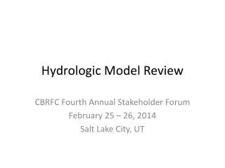
Hydrologic Model Review
Hydrologic Model Review. CBRFC Fourth Annual Stakeholder Forum February 25 – 26, 2014 Salt Lake City, UT. Overview. Model Description Calibration Operations (current and planned methods) Daily deterministic forecast mode Ensemble Streamflow Prediction (ESP) mode Unregulated

Hydrologic Model Review
E N D
Presentation Transcript
Hydrologic Model Review CBRFC Fourth Annual Stakeholder Forum February 25 – 26, 2014 Salt Lake City, UT
Overview • Model Description • Calibration • Operations (current and planned methods) • Daily deterministic forecast mode • Ensemble Streamflow Prediction (ESP) mode • Unregulated • Regulated • Statistical Water Supply (SWS)
NWS River Forecast Model • Same model we have always run, but moved within the Community Hydrologic Prediction System (CHPS) framework at the start of Water Year 2012. • More/better graphics. • Provides ability to plug in new model modules. • Continuous – meant to be run all the time, not just during events. • Conceptual – physically based, but uses parameters in place of hard-to-get data. • Lumped – uses mean areal inputs; not distributed.
Calibration System • determine model parameters • store historical data • Daily Operational Forecasts • generate short term deterministic river forecasts • maintain model states • Ensemble Streamflow Prediction • generate ensemble of hydrographs • generate probabilistic forecasts NWS River Forecast Model Composed of three major interrelated components.
CBRFC Model Setup • Each river point in the model is called a segment. • There are 181 segments above Lake Powell • There are 486 total segments in the CBRFC area. • Segments are calibrated to the unregulated flow. • Remove effects of known diversions and reservoirs. • Individual segment areas only include the contributing area between it and any upstream point(s). • Headwater calibration: All water comes from this segment alone. • Local calibration: Upstream water is routed downstream and added to the local water to get the total. • Each segment is broken into 2-3 subareas by elevation. • These subareas should have similar soil, land cover, and snow accumulation/melt characteristics. • Because it is a lumped model each of these subareas is represented by a single point. • Model inputs needed to simulate unregulated river flow: • Precipitation • Temperature • Freezing level – calculated from temperature when not available.
CBRFC Model Setup Blue River Basin Diversions (Regulation) Headwater Calibration Unregulated = Observed + Diversions • Upper Area • 11,500 ft – 13,779 ft Headwater Calibration Unregulated = Observed • Lower Area • 9196 ft – 11,500 ft Local Calibration Total Unregulated = Observed + Total Upstream Diversions
Calibration – Basics • Initial conditions are not important. • Evaporation is determined through water balance and is regionalized. • Forced by 30 years (1981-2010) of 6 hourly precipitation and temperature. • Mean Areal Precipitation (MAP) for each subarea is calculated using pre-determined station weights. • Mean Areal Temperature (MAT) for each subarea is calculated similarly to MAP. • Operationally MAP and MAT are calculated in a similar way to ensure our forecasts will have similar quality/characteristics to 30 years of calibration.
Calibration – Basics • The accuracy of the results are mostly dependent upon the quality of our temperature and precipitation network (mostly SNOTEL). • This network is not expected to change much in the next several years. • Therefore, improvements in the calibration process must come from: • Model improvement (e.g. , a higher resolution model physically based). However, any chance for significant improvement is strongly bound by the temperature and precipitation network! • Remote sensing (e.g. , areal extent of snow). Relating to SWE is not obvious.
Blue River Basin Data Points DLL CLX • (2 COOP Temperature Points) • CLX: Climax • DLL: Dillon
Blue River Basin • Ten Mile Ck at Frisco • Headwater • No (known) upstream reservoirs or diversions • 2 subareas • Lower: 9196 ft – 11,500 ft (56 mi2) • Upper: 11,500 ft – 13,779 ft (32 mi2)
Calibration – Precipitation • Each subarea MAP is calculated using precipitation stations that (hopefully) have similar characteristics to that area. • Weights are chosen to guarantee water balance in each area. • The water balance is calculated using the PRISM sets. • Station weights for TCFC2: • Upper area – Fremont Pass .67, Copper Mountain .67 • Lower area – Fremont Pass .52, Copper Mountain .52
Calibration – Temperature • Each subarea MAT represents the mid-point elevation of the area. • Nearby stations (whose climatologies are known) are used to calculate the temperature of the MAT (whose climatology is calculated using the climatologies of the nearby stations). • Temperature is calculated by using the ratio between the station and area climatologies. • Temperature stations used by TCFC2: • Dillon COOP • Climax COOP • Vail SNOTEL
Bare ground or snow cover Precipitation and Air Temperature SNOW ACCUMULATION AND ABLATION MODEL (SNOW-17) Rain or Snow Accumulated Snow Cover Energy Exchange at Snow-Air Interface Areal Extent of the Snow Cover Deficit = 0 Snow Cover Heat Deficit Liquid Water Storage Rain on Bare Ground Ground Melt Transmission of Excess Water This is a temperature index model Snow Cover Outflow Rain plus Melt
Sacramento Soil Moisture Accounting Model TENSION WATER STORAGE DIRECT RUNOFF UPPER ZONE FREE WATER STORAGE SURFACE RUNOFF INTERFLOW LOWER ZONE PRIMARY FREE WATER STORAGE TENSION WATER STORAGE TENSION WATER STORAGE SUPPLEMENTARY FREE WATER STORAGE BASEFLOW SUBSURFACE OUTFLOW
Calibration – Parameters • Determine calibration parameters for each subarea • SNOW-17 • 5 Major • Snow Correction Factor, Max and Min Melt Factors, Wind Function, Snow Cover Index, Areal Depletion Curve • 5 Minor • Temperature indexes and minor melt parameters • SAC-SMA • 11 Major • Tank sizes (5) and rates of drainage (interflow, percolation) • 5 Minor • Impervious area, Riparian Vegetation effects • For TCFC2 this is done for 2 areas: Upper and Lower
Calibration – Results Observed (unreg) Simulated (unreg) Lower Area Sim Upper Area Sim
Calibration – Results Observed (unreg) Simulated (unreg) Upper Area Sim Lower Area Sim
Calibration – Techniques • The segment is calibrated using the total unregulated flow: • buec2unreg = buec2obs • +ublc2+hptc2 • The simulated flow resulting from the calibration should be similar to this unregulated flow: • buec2sim ~ buec2unreg We need to account for the diversions (ublc2, hptc2) at buec2. We add the daily diversion at ublc2 and hptc2 to the observed daily flow at buec2 to get the unregulated flow at buec2. Blue River
Calibration – Techniques • We have to send the buec2unreg and buec2sim downstream to the next segment, bswc2l. Although there are no diversions at bswc2, we need to account for the diversions upstream. So the total unregulated flow is: • bswc2unreg = bswc2obs • +total upstream diversions • And the total simulated flow is: • bswc2sim=buec2sim+bswc2locsim • where bswc2locsim is the model simulation of the ‘local’ flow – the water from the area between buec2 and bswc2 only. As we move downstream, we always make sure the total simulation and total unregulated flows have reasonably good balance. Blue River
Calibration – Techniques • Finally, we need to calibrate the Dillon Reservoir inflow. The total unregulated flow for Dillon is: • dirc2unreg = dirc2outflow • +dirc2storage • +rbtc2 • +total upstream diversions • We sum up all the simulations upstream: • dirc2sim=bswc2sim+tcfc2sim+skec2sim • +dirc2locsim • As before, the total simulation and the total unregulated flow are always checked: dirc2unreg ~ dirc2sim For unregulated flow, all reservoirs are removed from the calculations. So the entire dirc2 unregulated flow and dirc2 simulated flow are passed downstream to the next segment, gmrc2l, which is the Green Mountain Reservoir inflow. Blue River
Calibration – Techniques • This process is continued for all basins above Lake Powell, for instance. • When we reach the Lake Powell inflow point, we have the total simulation and total unregulated flow for the entire area. • In-stream diversions (consumptive use) are accounted for internally but not added back into the unregulated flow. • This is why we call our simulations and forecasts ‘unregulated’ vs. ‘natural’ flow.
Operations Daily Deterministic Forecasts ESP Probabilistic Forecasts Unregulated or Regulated INITIAL CONDITIONS ARE VERY IMPORTANT Soil moisture SWE Current reservoir and diversion information not used in Unregulated mode. Forcings are probabilistic Uses 30 years of MAP and MAT from calibration to create 30 hydrologic traces/scenarios. QPF and QTF Deterministic QPF (5 days) and QTF (10 days) Can use ensemble QPF and QTF from weather and/or climate models (test mode this year) • Regulated • INITIAL CONDITIONS ARE VERY IMPORTANT • Soil moisture • SWE • Reservoir elevations/releases • Diversions • Forcings are deterministic • Five days of forecast precipitation (QPF) • Zero beyond this • 10 days of forecast temperature (QTF) • Climatological average beyond this • Creates and saves model states that become starting point for ESP
OperationsInitial Conditions – Soil Moisture LZFPC (baseflow or free water) Carryover from previous season Affected some by fall precipitation Adjusted by flow observations in fall/early winter Initial fall soil moisture Can have a moderate impact on spring runoff (+/- 5-10 %) Typical Capacity of LZTWC+LZFPC ~ 15 inches TENSION WATER STORAGE UPPER ZONE LZTWC (tension water) Little carryover from previous season Affected strongly by fall precipitation Regionally adjusted FREE WATER STORAGE SURFACE RUNOFF LOWER ZONE INTERFLOW PRIMARY FREE WATER STORAGE TENSION WATER STORAGE TENSION WATER STORAGE SUPPLEMENTARY FREE WATER STORAGE LZFPC LZTWC NRCS soil moisture observations BASEFLOW SUBSURFACE OUTFLOW
Operations Initial Conditions – Soil Moisture LZFPC (baseflow)
Initial Conditions – Soil Moisture LZTWC (tension water)
OperationsInitial Conditions – SWEAccumulation Period Daily quality control of: Precipitation Freezing level Temperature Create MAPS from points using pre-determined station weights (from calibration) Update by calculating precipitation over a longer time step (weeks to months). This update done every 1-2 weeks. SWE
OperationsInitial Conditions – SWEMelt Period Daily quality control of: Precipitation Freezing level Temperature Type precipitation using freezing level Liquid Frozen Compare AESC with model AESC. Develop gross error check SWE Use temperature to calculate MAT and then melt Modify melt rate using flow at Gauge (MFC) Snow contamination Grid RAIM (rain and melt) Updated Land Cover Grid To SAC-SMA model
Daily Deterministic Forecasts • Start run 10 days back so can see how model simulation compares to observed flows • Make sure inputs and forcings are correct • End 10 days into the future • Upper Colorado (above Powell) and Great Basin run on a 6 hour timestep • Lower Colorado (below Powell) and Sevier Basin run on a 1 hour timestep • Regulated (trying to match observed flow in river) • Future diversions: • Set to current • Specified • Best guess • Future reservoir releases: • Set to current • Specified • Spill • 5 day deterministic precipitation forecast • 6 hour timestep (evenly divided for 1 hour segments) • Zero beyond 5 days • 10 day deterministic temperature forecast • Max/Min forecasts converted to 6 hour timestep
Daily Deterministic Forecasts Upper Area Mid Area Lower Area Observed MAP ‘s & MAT’s Forecast MAP ‘s & MAT’s Past Future Observed Flow ForecastFlow Model Simulated Flow
Daily Deterministic Forecasts Past Future Observed Flow Model Total Simulated Flow Routed Upstream Flow Model Local Simulated Flow
Ensemble Streamflow Prediction Probabilistic Forecasts 1981 …. 1982 1983 2010 • Start with current conditions • Apply precipitation and temperature from each historical year (1981-2010) going forward • A forecast is generated for each of the years (1981-2010) as if, going forward, that year will happen • This creates 30 possible future streamflowpatterns. Each year is given a 1/30 chance of occurring Current hydrologic states : River / Res. Levels Soil Moisture Snowpack -> Future Time Past <-
ESP Probabilistic Forecasts The flows are summed into volumes for the period of interest (typically 4/1-7/31) The statistics are simplified And formatted for the web
ESP Probabilistic Forecasts Unregulated Mode Regulated Mode Reservoirs use rules defined in model Releases set based on time of year or simulated elevation of reservoir. Spill, pass flow. Can input a single release schedule if known that far into future. Diversions use historical data Trace that uses 1995 MAP/MAT also uses 1995 diversions. Consumptive Use water still removed Used mostly for mean daily Peak Flow forecasts • Reservoirs ignored • Water is just passed through them. • Diversions ignored • All measured diversions into and out of the basin are set to zero. • Consumptive Use water still removed • Used for Water Supply volume forecasts • Some exceptions in Sevier and Great Basin
ESP Probabilistic Forecasts Unregulated Mode Regulated Mode Reservoir Diversion
Statistical Water Supply (SWS) • Regression equations that relate observed data to future seasonal streamflow volume. • Inputs are monthly values. • Total precipitation (can be multiple months) • First of month snow water equivalent • Monthly flow volume • Output is a seasonal volume (i.e. April-July). • It is really a conditional probability distribution, not a single value; the equation result is the 50% exceedance. • Other exceedance levels (10%, 90%, etc.) can be calculated by using the standard error.
Statistical Water Supply (SWS) r2 = .60 Standard Error = 32.02 Average = 167
Sources of Error • Data • Undetected errors in historical as well as current observations • Errors in streamflow measurements due to poor channel ratings/controls • Data density • Ungaged/unknown diversions (especially in low years) • Consumptiveuse estimation • Distribution of snow vs. point measurements • Model • Initial conditions (see data errors) • Calibration error (bias) • Future weather • QPF (accuracy, distribution in space & time) • Spring temperatures affect melt/runoff pattern • Climate outlooks
Questions • Was this presentation helpful and what additional information would you like on CBRFC modeling techniques? • During low flow conditions, the consumptive use (largely unknown) can be larger than the observed flow and is the largest source of error in the forecast. What additional information would be useful during these conditions?
Simulated Unregulated=Natural-Consumptive use Observed Unregulated=Regulated Observed + Known Diversions Calibration attempts to make Simulated Unregulated =Observed Unregulated Since Consumptive Use is not known, Neither is Natural