The
130 likes | 308 Vues
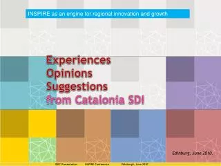
INSPIRE as an engine for regional innovation and growth. The. Catalan. Spatial. Data. Experiences Opinions Suggestions from Catalonia SDI. Edinburg, June 2010. IDEC Presentation INSPIRE Conference Edinburgh, June 2010 . Content. IDEC situation IDEC impact.

The
E N D
Presentation Transcript
INSPIRE as an engine for regional innovation and growth The Catalan Spatial Data Experiences Opinions Suggestions from Catalonia SDI Edinburg, June 2010. IDEC Presentation INSPIRE Conference Edinburgh, June 2010
Content IDEC situation IDEC impact IDEC Presentation INSPIRE Conference Edinburgh, June 2010
QuickView: Whatmeans IDEC? Whatitoffers? A network of tagged web map services containing documented geoinformation and other resources A CATALOGwith: 37.839(catalan, 36.345spanish, 33.757 english)Registers of data metadata 474 (catalan, 476 spanish, 458 english) Services metadataregisters 162 Data metadataproviders 170 Services metadataproviders Accededby9.000 visits/ year(plus 6.000 to OfficialCartographicRegistry) ACCESS to: 474 Services 6.500 Layers(4.000 from local entities) Accededby350.000 visits/ year Complementary SERVICES: Applications: Viewers, editors, WFS editor, Thematicbuilder, ... IDEC Presentation INSPIRE Conference Edinburgh, June 2010
ThematicSDI’s: the best way to theparticipation LITORAL (COAST) TSDI(the first, under updating process) LOCAL TSDI(the most important one) 650 local authorities involved 9.000 data metadata registers 283 services 4.000 layers 300.000 Accesses to viewers (2010) Applications: Viewers, editors, WFS editor, Thematic builder, ... UNIVERS(the most interesting one) 13 entities involved 5.200 data metadata registers 13 WMS 105 services 1.500 layers Othet thematic SDI under development: IMAGERY (Catalan Earth Observation Plan) WebSensors INSPIRE IDEC Presentation INSPIRE Conference Edinburgh, June 2010
WHO USES ITS RESOURCES? FOR WHAT USES? From a survey of 100 geoportalvisitors (2008/2009) Total visitors: 90.000 NoticethatIDEC.Localusers&uses arenotincluded Are our services good enough to repeat the visit to the geoportal? 73.4% of the users had visited the Geoportal more than once. Where are our custormers from? 42% of the respondents were from public administration 40% from the private sector 14% from universities. How they evaluate the services? 66% value quality of all the services (Catalog of Metadata with a high interest (value 4) or very high (value 5)). Benefits valuation: 55.7% Time savings (2 - 5 hours saved by each visitor per month) 50.8% Quality improvement 27.9% Increase better decision making Main USES Reports and projects Help to elaborate environmental audits Teaching, presentations Land analysis and thematic maps IDEC Presentation INSPIRE Conference Edinburgh, June 2010
IDEC situation • We have achieved a CRITICAL MASS • Our goal is to become a UNIVERSAL SDI (geo in Internet) Both circumstances have increased the interest of providers: • They want to appear in the Metadata Catalog • They are interested in updating their metadada • They have interest in improving the quality of their data and services IDEC Presentation INSPIRE Conference Edinburgh, June 2010
IDEC situation • We are driving the artifact to become a GEORESOURCES INFRASTRUCTURE • Extending the area of interest to images, data from sensors, applications....(ex. UPC tracking app.) • Introducing new missions, visions, goals, activities, avoiding the flat growth IDEC Presentation INSPIRE Conference Edinburgh, June 2010
IDEC ECONOMIC and SOCIAL impact • Economic • (see the JRC report – 2007 ) • Actually trying to update the former survey, with more users, more resources... • Tools for improving efficiency and efficacy in Public Sector • JRC Report: 6 months R.O.I. • 2006 benefit: 2.500.000 € • 2002-2006 expenses & investment: 1.300.000 € • Annual expenses: 350.000 € • Social • Disminishing the digital gap in small organizations • Tools for the social capital development and users participation IDEC Presentation INSPIRE Conference Edinburgh, June 2010
IDEC TECHNICAL impact (ii) • Technical • Innovation • Helping the development of e-Gov. • Integrating Web Sensor Data into GIS • Interoperability projects • After two successful pilot projects, now new ones are in preparation IDEC Presentation INSPIRE Conference Edinburg, June 2010
IDEC ORGANIZATIONAL impact • Organizational: • Rol of INSPIRE • INSPIRE as a framework: it is helping us to apply methodology, planning, standards management, culture of sharing,.... The Coordination Commission and the Cartographic Plan, as key elements for GI development. • Collaborative projects&processes between Regional and Local Authorities • A PLATFORM to meet and work together • Better use of regional and local resources: • Ex. Civil Protection (Emergencies) • Maintenance of Street maps (Notifications) • Maintenance of Public Equipments • New relationships, new data flows IDEC Presentation INSPIRE Conference Edinburgh, June 2010
IDEC impact • Increasing interest in GI and its technologies • New business opportunities (slow progress) • NEGATIVE impacts: • Some fears about the quality of data how do we trust in the geoinformation available in the SDI? • How can we trust in this kind of distributed system? How can we guarantee its perfomance? IDEC Presentation INSPIRE Conference Edinburgh, June 2010
Thanks http://www.geoportal-idec.cat/geoportal/eng/ IDEC Presentation Cartography and GIS Edinburg June 2011