Geography, Farming, and Trade in Ancient Mesopotamia and Nearby Empires
This project explores the geographical and agricultural developments in ancient Mesopotamia, Phoenicia, the Ottoman Empire, the Mughal Empire, and the Safavid Empire. It highlights the innovations in irrigation that allowed Mesopotamia to flourish despite flooding challenges and their surplus food production, which facilitated trade and job diversification. The project also discusses Phoenicia's trade by sea, the powerful influences of surrounding mountains, and the empires' expansions, showcasing their geographical advantages and trade routes that influenced the rise and fall of civilizations.

Geography, Farming, and Trade in Ancient Mesopotamia and Nearby Empires
E N D
Presentation Transcript
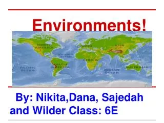
Environments! By: Nikita,Dana, Sajedah and Wilder Class: 6E
Farming and irrigation ( Dana) First Mesopotamia could not control the waterways and they had flooding problems which damaged their houses and killed their crops. Second Mesopotamia build a way of supplying water to protect their homes from flooding and protect their crops. Third Mesopotamians were able to grow a surplus of food because of irrigation, it helped them grow more food than they needed. Lastly this way of supplying water helped them farm and allowed other people to get other jobs.
Geography of Phoenicia (Nikita) Phoenicia was located at the western end of the Fertile crescent along the mediterranean. Byblos one of the cities in Phoenicia still exists today! The phoenicians were a group of people that traded by sea. The phoenicians did not have much to trade but they had cedar trees. Cedar trees were good for timber. The Phoenicians invented one of the first set of letters that can be combined to form words. ( also known as the alphabet). The phoenicians were isolated by mountains to all sides,But to the west was the mediterranean.
Where the Empires where. ( Wilder ) Ottoman empire spread to Turkey, Egypt, Greece, Bulgaria, Romania, Macedonia, Hungary, Israel, Jordan, Lebanon, Syria. It was desert mixed with a lot of mountain ranges in Turkey and the Balkans and the whole coast of these places bordered the Mediterranean sea. The ottomans had the biggest amount of land and it could go to Europe with trade. Mughal Empire had all of India. It was by the Arabian sea and the bay of Bengal. It also had lots of rivers. The Mughal Empire was very big and had access to lots of trade routes because of the seas they have near them. Safavid Empire Was in Persia and Iran. It was bye the Persian Gulf and the Caprican sea.I was small and had little places to go to by trade.
The Geography of Sumer! (Sajedah) 1.Sumerians 2.Sargon 3.Akkadians Take notes here: What Were important supplies of water? What Was it used for? The Tigris River and the Euphrates River was a way to get fresh water to Sumer and that is what they used to irrigate their crops and farmland. How did the city state supply food for the people? They used the water that they get to transport to other places so they can trade instead of walking. Inside the city’s walls was another canal and a large harbor, where foreigners docked their boats while they traded with Ur’s merchants. Ur carried on a rich trade with merchants from distant lands like India. How did the geography in sumer impact trade? City States in Sumer fought each other to gain more farmland and Food and Vegetables with fruits. City States built up strong armies. Sumerians also built strong, thick walls around their cities for protection from the City states.Farmers grew crops like wheat and barley outside the city walls. There was Massive walls that also protected Ur from attack.
Geography of the Ottoman, Mughal, and Safavis empires (Wilder)
Bibliography "Ãæà Google." Ãæà Google. N.p., n.d. Web. 27 Feb. 2013. "Google Images." Google Images. N.p., n.d. Web. 27 Feb. 2013. "Google Images." Google Images. N.p., n.d. Web. 27 Feb. 2013. "Google Images." Google Images. N.p., n.d. Web. 27 Feb. 2013. Salter, Christopher L. Southwest and Central Asia. Orlando: Holt, Rinehart and Winston, 2009. Print.