Spheroids, datums, Projections, etc.
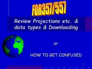
FOR357/557. Spheroids, datums, Projections, etc. Spatial data comes in many forms . So How does a GIS work with the data so that it can put it in the right place? . 2 Ways to Represent data. On the spherical earth (globe) On flat maps. Syracuse. - 76.19 W 43.07N. Where is it?

Spheroids, datums, Projections, etc.
E N D
Presentation Transcript
FOR357/557 Spheroids, datums, Projections, etc. Spatial data comes in many forms. So How does a GIS work with the data so that it can put it in the right place?
2 Ways to Represent data • On the spherical earth (globe) • On flat maps
Syracuse -76.19 W 43.07N • Where is it? • How do we locate it on earth?
Flat Map -76.19, 43.07
Coordinate Systems • On the spherical earth (globe)-Geographic Coordinate System are used • On flat maps-Projected Coordinate System are used • The distinction between these is important!
So… • That is what this lecture is about • The shape of the earth • The coordinate system of the earth • Models of the earth • Spheroids • Datums • Date projected to flat maps
Overview of what you need to know • Spherical earth (globe) • Longitude, Latitude (X,Y) • Spheroids • Datums • Flat maps • Projections • Coordinate Systems • UTM (Universal Transverse Mercator) • SP (State Plane) • Definition and Conversion lat, long (Y,X)
Meridians Longitude Equator Parallels Latitude Coordinates on Earth North Pole South Pole
-76.12, 43.08 Syracuse
Stretch the top Stretch the bottom X, Y = Longitude, Latitude 90 60 30 Equator 0 -30 -60 -90 -180 -90 0 +90 +180 Lines of constant Longitude Lines of constant Latitude
-76.12° 43.08° W76.15° N43.04° X, Y = Longitude, Latitude 90E, 30N +90, +30 90 60 30 Equator 0 -30 -60 -90 -30 90W, 30S -90 -180 -90 0 +90 +180 Lines of constant Longitude Lines of constant Latitude
The world in Geographic Coordinates Is Antarctica Really that big?
Spheroids & Datums • Model the earth with a sphere? • N0! It is more Pear shaped! • So how do we locate stuff on a pear? • Even approximately (since it is a bumpy pear!) • Use a model • There are many models of these and each has its own properties
The Models of the Earth • Involve… • Spheroids -the three-dimensional shape obtained by rotating an ellipse about its minor axis. This is also called an ellipsoid • Datums – define a local reference for a spheroid surface.
Earth Spheroid Earth Centered Spheroid Best fit over the entire earth World geodetic system of ‘72 (WSG72) and of ’84 (WSG84) = NAD84
Recent Spheroids WGS = World Geodetic System GRS = Geodetic Reference System • Clark 1866 not earth centered • WGS 1966 • WGS 1972 TBE • WGS 1972 • WGS 1982 • WGS 1984 (= GRS 1980)
Datum • A spheroid does not match the earths surface everywhere • A datum is used to align the spheroid with the surface where you are • So the datum specifies • The spheroid • And the point where it will match the earths surface exactly • So you don’t have to worry about Spheroids much but you do have to worry about datums
Fit Earth Spheroid Spheroids & Datums • A spheroid can be moved mathematically to fit different parts of the earth… FIT They then become datums
NAD27 • North American Datum of 1927 • References a surface fit to US • Point of perfect fit is Mead’s Ranch in Kansas • Older data is often in NAD27
NAD 83 • Based on earth centered WGS 72 • WGS 72 is mathematically moved to make it fit a specific location
Datum differences • The change in datum can change your location measure • Not your actual location! • Redlands • NAD83 • –117° 12' 57.75961" (longitude)34° 01' 43.77884" (latitude) • NAD27 • –117° 12' 54.61539" (longitude)34° 01' 43.72995" (latitude) ~ 1.1 minutes long ~ 1.6 min lat
Overview • Spherical earth (globe) • Longitude, Latitude (X,Y) • Spheroids • Datums • Flat maps • Projections • Coordinate Systems • UTM • SP • Conversion
PROJECTED COORDS • Projected Coordinate systems • Flat maps • Feature coordinates are mathematically projected onto flat surfaces • There are many projections • And then there are Coordinate Systems
Oops! Can't flatten a Sphere Without distortion
The Mercator Projection Making a Projection
Mercator • The equations for mapping objects (math term here) on a sphere onto a flat paper are, for Mercator, surprisingly simple: X = l, X is Mercator value, l is longitude And Y = ln Tan ( t/2 + p/4), t is latitude
Projections: Distortion • In going from spherical coordinates (surface) to a flat surface THERE WILL BE DISTORTIONS in • Shape • Area • Distance • Direction
Projections: Distortion • Shape: If shapes look the same on the map and on the globe then the projection is conformal • Area: If area is preserved then you have an equal area map • Distance: If distance is preserved then the map is of uniform scale and you have an equidistance map. • Direction. maps If directions from a central location to all other points are correct then the map is Azmuthal
No flat map is conformal Equal area Equal distance & constant direction
Common Datums • NAD27 – N. American datum of 1927 (based on the Clark 1866 spheroid, Mead’s Ranch, KS is origin) • NAD83 – N. American datum of 1983 based on spheroid GRS80 • WGS 1984 (spheroid IS a datum) • Most GPS systems use WGS spheroids but can report coordinates based on either of the NADs
Just to make life difficult… • The term Coordinate System has TWO (2) meanings • One we have covered – it can mean either geographic or projected coordinate systems • Within the class of projected coordinate systems it can specifically mean: • The UTM coordinated system • The State Plane coordinate system
Prime Meridian Errors are Zero! UTM Coordinate Systems • The Universal Transverse Mercator or UTM Coordinate system – • based on the Mercator projection • A world wide system • Toilet PaperTube is nowHorizontal sois tangent to theearth along its prime meridian andand passes throughthe Poles
UTM coordinate system • A projected coordinate system that divides the world into 60 north and south zones, six degrees wide. • Why? • The Transverse Mercator is only bang-on accurate on the meridian that is tangent to the toilet paper tube • The further away you are the more inaccurate the data
UTM coordinate system • So the way to make accurate maps on flat surfaces when working with features the size of, say, states or counties, is to have a bunch of TM projections • NY has 3 UTM zones (see handout) • Usually data for the state is done in Zone 18 (central) without causing too much error at either end. • YOU CANNOT USE MORE THAN 1 ZONE IN ANY MAP –Edges won’t match!
Most of NY is in UTM Zone 18 UTM Zones
O(4,000,000) m in NY Northing O(100,000) m in NY Easting UTM Coordinate • The units in UTM are usually Meters • You need to specify the zone • Example: Location of CCC is: • 373,800 Meters E, 4,756,000 Meters N, • Zone 18, N
Eastings and Northings in UTM • Each UTM zone is 6 degrees wide. • The scheme below is used for Eastings so that no negative values are present. • Northings are from the equator OFFSET Central meridian 1 UTM ZONE OF 6 DEGREES 200,000m 300,000m 400,000m 500,000m 600,000m 700,000m 800,000m
The State Plane Coordinate Sys • A projected coordinate system used in the United States • Divides each state into one or more zones • Also known as SPCS and SPC. • States running N-S (VT) are in Transverse Mercator • States running E-W (TN) are in Lambert Conformal
State Plane • Different projections for different states • Horizontal zones (Tenn) are Lambert Conformal projections • Vertical zones are Transverse Mercator projections • Each state has its own origins for its own system • States may have multiple zones in different projections • UNITS are usually feet BUT NOT ALWAYS(another BOOBY TRAP)
NY East Zone 4801 State Plane Zones NY Central Zone 4826 NY West Zone 4851 NY Long Island Zone 4876
NY East Zone 4801 State Plane Zones NY Central Zone 4826 NY West Zone 4851 Transverse Mercator NY Long Island Zone 4876 Lambert Conformal
ArcMap Problem (or NOT) • ArcGIS can project on-the-fly • By that, we mean that if you add a layer that is NOT in the same Coordinate System, Projection, or Datum ArcMap will project (verb) it to match the data already loaded • So what’s the problem??
Booby Trap • The trap lies in the fact that if you load data that does NOT have a .prj file ArcGIS will just say to itself • “OK, the current coordinate system is what this Bozo wants to use!” • This is a problem? • Yes and no – depends…
Booby Trap • Assume that Bozo loaded a layer that was in Long, lat first (w/o .prj file) • Now suppose Bozo loads a file that is in UTM that does not have a .prj file. • In this case ArcGIS says to itself “Well, Bozo didn’t tell me different so this one must be DD also” • Bozo then says “Where the #$%@ is my data?” • Bozo then zooms-to-layer – Hmm – it is there! But not with the rest of my stuff • Bozo then says “what are the coordinates?’ • Wow – 434,890 degrees East and 4,987,652 degrees N!