Download
1 / 50
510 likes | 647 Vues
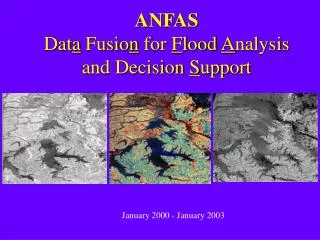
ANFAS Dat a Fusio n for F lood A nalysis and Decision S upport. January 2000 - January 2003. Contents. Project presentation Work plan Final/Minimal objectives Deliverables for first year. European Commission 5 th RTD Framework Information Society Directorate (DGXIII)

E N D
ANFASData Fusion for Flood Analysis and Decision Support January 2000 - January 2003
Contents • Project presentation • Work plan • Final/Minimal objectives • Deliverables for first year
European Commission 5th RTD Framework Information Society Directorate (DGXIII) Information Society Technologies program (IST)
Background • IOA/Matra-MSI/INRIA joint project since 1997 : “Flood monitoring using Image processing” • IAP/IMAG joint project since 1998 : “Data assimilation for geophysical flows” • IRSA Web GIS : “GeoBeans” • European expertise on Integrated Information Systems
Impact • Firstintegrated information system using the most advanced Computer Science and Applied Mathematics tools for flood risk management. • Most important scientific cooperation between China and European Commission
Europe European Research Consortium in Informatics and Mathematics France Bureau de Recherche en Géologie et Minerais Matra Systèmes et Information Institut National de Recherche en Informatique et Automatique Greece FORT-H PR China Institute of Automation Institute of Remote Sensing Applications Institute of Atmospheric Physics Slovakia Institute of Informatics , Slovak Academy of Sciences UK University of Reading RAL/CCLRC Partnership
Budget Total : 3.947 Meuros = 32.76 Mrmb • European contribution : 2.947 Meuros • IST : 1.6 Meuros • Partners : 1.347 Meuros • Chinese contribution : 1 Meuros • Ministry of Science and Technology : 900 Keuros • Partners : 100 Keuros 1 euro = 1US$
Objectives • Science • Application • System Prototype
Scientific goals • Computer Vision Numerical simulation • Computer Vision : Data fusion for updating • Numerical simulation : Data Models
Application goals • To evaluate scenarios • To perform large scale simulation • Risk management
System Prototype Support Decision Systemfor Risk Management flood analysis and simulation flood prevention and monitoring
A multi-disciplinary project • Computer vision • Scientific computing • Remote sensing • Geographic information system (GIS) • Internet/intranet technology • Hydrology, hydraulic science
Pilot sites • China : • Poyang lake (Jiangxi) • Three gorges reservoir (Hubei, Sichuan) • Europe : • Loire river (France) • Vah river (Slovakia)
Contents • Project presentation • Work plan • Final/Minimal objectives • Deliverables for first year
System integration Work Plan Scene modelling from images Pilot operations Flood modelling and simulation Geographic Information System
Workpackage 1: GIS • WP1.1 : Specification of the relevant data WP4, WP2, WP3 t0------t0+6 • WP1.2 : Acquisition of the Data WP4 t0------------t0+12 • WP1.3 : Specification of the GIS to be used WP5, WP4 t0------t0+6
Workpackage 1 : GIS • WP1.4 : Preparing and converting the data in electronic format t0+6------------t0+18 • WP1.5 : Integrating the Data in the GIS t0+12------------t0+24 • WP1.6 : Integration of the WP2 Dataset WP2 t0+18------------t0+30
Workpackage 2 : Computer Vision • WP2.1 : Specification and acquisition of the images WP4 t0------t0+6 • WP2.2 : Ortho-geocoding of the 2D images t0------t0+6 • WP2.3 : Lithological information extraction t0+6------------t0+18
Workpackage 2 : Computer Vision • WP2.4 : High resolution Digital Terrain Model (DTM) reconstruction t0+6------------t0+18 • WP2.5 : Matching 2D/2D images data for classification and change detection multi-modality, multi-temporal t0+6------------t0+18
Workpackage 2 : Computer Vision • WP2.6 : Matching information from 2D images (WP2.5) and DTM/DEM (WP2.4, WP2.7) t0+12------------t0+24 WP1 • WP2.7 : Registration of 3D reconstruction results (DTM) and low resolution Digital Elevation Model (DEM) t0+12------------t0+24 WP1
Workpackage 2 : Computer Vision • WP2.8 : Integration in an operational system t0+18------------------t0+36 Images, DTM 3D geometric and photometric model
Workpackage 3 : Flood simulation • WP3.1 : Data identification t0------------------------------------t0+36 WP4 • WP3.2 : Physical Model specification t0------------------------t0+24 WP4 • WP3.3 : Numerical simulation and model validation t0+0------------t0+30 WP1
Workpackage 3 : Flood simulation • WP3.4 : Calibration procedure t0+18------------------t0+36 • WP3.5 : HPCN Implementation t0+12------------------------t0+36 • WP3.6 : Data assimilation t0------------------------------------t0+36
Workpackage 4 : Pilot operations • WP4.1 : End-users requirements t0------t0+6 • WP4.2 : Needs specification t0------------t0+12 • WP4.3 : Specification of scenarios t0+12------------t0+24
Workpackage 4 : Pilot operations • WP4.4 : Impact assessment t0+18------------t0+30 WP1 • WP4.5 : Demonstrations t0+24------------t0+36 WP1, WP5
Workpackage 5 : System Integration • WP5.1 : Design of the Information System architecture t0+6------t0+12 • WP5.2 : Development of the software facilities t0+6------------------------t0+30 • WP5.3 : Integration and Implementation t0+12------------------------t0+36
Workpackage 6 : Management • Manager (EC) : Olivier Monga (ERCIM) Co-Manager (MST) : Ma Songde (IOA) • Assistant Managers : Bruno Le Dantec (ERCIM), Véronique Prinet (IOA) • Secretary : Laetitia Jodas (ERCIM), Zhang Fan (IOA)
Workpackage 6 : Management • WP1 • Responsible : Poulicos Prastacos (Forth) ; Co-responsible : Yang Chongjun (IRSA) • Tasks responsibility sharing : • Poulicos Prastacos : Data in European sites, GIS in European sites,... • Yang Chongjun : Data in Chinese sites, GIS in Chinese sites,…
Workpackage 6 : Management • WP2 • Responsible : Steve Maybank (Reading) ; Co-responsible : Tan Tienu (IOA) • Common tasks : Both sides will process all site images
Workpackage 6 : Management • WP3 • Responsible : François Xavier Le Dimet (INRIA) Co-responsible : Zeng Qingcun (IAP) • Task responsibility sharing : • F.X. Le Dimet : Data assimilation, Models,... • Zeng Q.C. : Meteorological forecasting,...
Workpackage 6 : Management • WP4 • Responsible : François Giraud (BRGM) Co-responsible : Yang Chongjun (IRSA) • Task responsibility sharing : • F. Giraud : European sites, demonstrations in European sites • Yang C.J. : Chinese sites, demonstrations in Chinese sites
Workpackage 6 : Management • WP5 • Responsible : Patrick Houdry (Aerospatiale-MSI) Co-responsible : Ma Songde (IOA) • Task responsibility sharing : • P. Houdry : Conception, Development… • Ma S.D. : Adaptation to Chinese users, Development
Workpackage 6 : Management • WP7 : Assessment and evaluation • Responsible : Bruno Le Dantec (ERCIM) Co-responsible : Yang ChongJun (IRSA) • task responsibility sharing : • B. Le Dantec : peer review in Europe • Yang C.J. : peer review in China
Workpackage 6 : Management • WP8 : Dissemination and implementation • Responsible : Bruno Le Dantec (ERCIM) Co-responsible : Ma Songde (IOA) • Task sharing • B. Le Dantec : Europe • Ma S.D. : China
Workpackage 7 :Assessment and evaluation • Projectreviewsevery six months(first one : July 2000) • Comparison with existing systems
Workpackage 8 : Dissemination and Implementation • Project Web server : http://www.ercim.org/anfas http://lotus.ia.ac.cn/ANFAS • Users group • Workshops (first one scheduled in July 2000) • Concertation meetings • Technology implementation plan
Contents • Project presentation • Work plan • Final/Minimal objectives • Deliverables for first year
GIS Computer Vision Numerical Simulation Integrated System System : 3 autonomous sub-systems : • Geographic Information System • Computer Vision • Numerical Simulation
GIS Computer Vision Numerical Simulation Integrated System : minimal objective • Minimal objectives for each subsystem • “We will not hesitate to prefer simple but robust methods (eventually interactive) rather than a complex but not reliable approach. In particular the system should be able to run with a small amount of data” (Technical Annex, page 12)
GIS GIS : Minimal Objective • Minimal layers • Minimal data set
Computer Vision Computer Vision : Minimal Objective • scene representation using interactive tools : • DTM from GIS matched interactively with 2D images • Manual segmentation
Numerical Simulation : Minimal Objective To estimate by the simulation the flooded areas with an acceptable maximal error Numerical Simulation
GIS Computer Vision Numerical Simulation Sub-system interdependence The Integrated System should work if one (or two) subsystem fails
Integrated System : Key points GIS • Sub-systems interfaces • Data format • Specific Man-Machine Interfaces for each sub-system ? Computer Vision Numerical Simulation
Contents • Project presentation • Work plan • Final/Minimal objectives • Deliverables for first year
Questions ? • Objective of each partner about the project and the kick-off meeting.