Grids and GeoStatistics
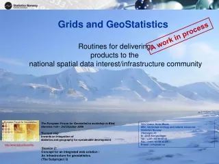
Grids and GeoStatistics. A work in process. Routines for delivering products to the national spatial data interest/infrastructure community. The European Forum for Geostatistics workshop in Bled, Slovenia 1rst – 3rd October 2008 The next step towards an integration of

Grids and GeoStatistics
E N D
Presentation Transcript
Grids and GeoStatistics A work in process Routines for delivering products to the national spatial data interest/infrastructure community The European Forum for Geostatistics workshop in Bled, Slovenia 1rst – 3rd October 2008 The next step towards an integration of statistics and geography for sustainable development Vilni Verner Holst Bloch MSc. landscape ecology and natural resources Statistics Norway Otervegen 23 N - 2225 Kongsvinger Tel : ++47 / 62 88 50 62 Fax : ++47 / 62 88 50 97 E-mail : vvh@ssb.no http://www.stat.si/forumGs/ Session 2: Concept for an integrated web solution / An infrastructure for geostatistics. (The Subproject 3)
Overview of the presentation • Background – introduction • Defining the grid • Making guidelines for geostatistics • Standards and metadata • Confidentiality and quality • Further work and deliveries
Background • Partnership in Norway Digital (obligations) • Expressed needs from partners • Statistics Norway • Registers on address level • Population • Buildings • Ground Properties • Sport facilities • Farms • Businesses And many more
Background Download page for Norway Digital partners
Background • Formalising a national grid for geostatistics • Internal drive within Statistics Norway (coming censuses, preparations for a geodatabase)
Defining the grid SSBgrid is an open-ended definition of a family of spatial tessellation models for use in Norway. The models are all built with quadratic grid cells. The naming convention of the grids is to use the grid cell size, measured as the length of a side of a grid cell in meters or kilometers concatenated to the capital letters ‘SSB. cell size is also denoted K, and with either m or km to indicate length measure.
Defining the grid A system of standard grids • Grid name Cell size Number of cells • SSB100m (1) 0.01 km2 Approx. 35 000 000 cells • SSB250m (1) 0.0625 km2 Approx. 5 600 000 cells • SSB500m (1) 0.25 km2 Approx. 1 400 000 cells • SSB1km 1 km2 Approx. 350 000 cells • SSB5km 25 km2 Approx. 15 000 cells • SSB10km 100 km2 Approx. 15 000 cells • SSB25km (2) 625 km2 Approx. 500 cells • SSB50km (2) 2 500 km2 Approx. 150 cells • SSB100km (2) 10 000 km2 Approx. 40 cells • SSB250km (2) 62 500 km2 Approx. 10 cells • SSB500km (2) 250 000 km2 Approx. 4 cells • Because of limitations in many software packages and for practical use, • these grids are recommended as grids with a county coverage. • (2) These grids might also cover sea territories. Number of cells refers to coverage of Norwegian mainland. • One has however to be aware of deviations in grid cell areas for regions remote from the Norwegian mainland and Svalbard.
Defining the grid Identification • The identification (ID) of a grid cell with its southwestern corner at [XC,YC] in an SSBgrid with grid cell size K is Computational efficiency • Since a false easting is needed to compute XC and YC for locations along the western coast of Norway, the false easting used in the ID should be also used for this purpose when the ID is calculated directly from point coordinates:
Defining the grid Projection and datum All SSBgrids are defined in UTM33/EUREF89. Extention SSBgrids have no definite extention. Exchange format SSBgrids have no particular exchange format.
Organisation – responsibility and contact points • S320 Population statistics Paul Inge Severeide (Head of division) Gjermund Nygårdseter (GIS contact 62 88 52 25) • S410 Enterprise register Jan Ole Furseth (Head of division) Beate Bartsch (GIS contact 62 88 50 38) • S430 Agricultural statistics Ole Osvald Moss (Head of division) Anne Snellingen Bye (GIS contact 62 88 52 39) • S460 Construction and services statistics Roger Jensen (Head of division) Birgit Bjørnsgard (GIS contact 62 88 50 97)
Confidentiality rules Population by 1 square kilometre grid. Finnmark county. 1.1.2008.
Metadata Task: To transfer existing metadata to an xml-document
Metadata Lots of standards and tools
Metadata Example : UML modell for adm. boundaries
Making guidelines • Use • Presentation • Delimitations • Interpretation Article in print Example: Identification of residents within a distance from a hospital.
Preliminary suggestions Buildings Employees Population Topography Bathymetry
Possible future deliveries • Households • Dwellings • Income • Migration • Education • Agricultural statistics • Historical statistics
Further work and cooperation • Products developed in cooperation with users • Enhanced metadata • Improve quality checks and measures • Make guidelines for use of products • System for exchange of data Thank you☺