Download
1 / 35
350 likes | 542 Vues
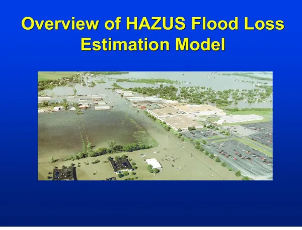
HAZUS – MH FEMA’s Tool for Natural Hazard Loss Estimation & Why it matters to West Virginia West Virginia GIS Conference June 4, 2014. Agenda. How Disasters have Impacted WV Historically What is HAZUS-MH & why is it important? How can HAZUS-MH serve WV? FEMA Geospatial Activities

E N D
HAZUS – MH FEMA’s Tool for Natural Hazard Loss Estimation &Why it matters to West Virginia West Virginia GIS ConferenceJune 4, 2014
Agenda • How Disasters have Impacted WV Historically • What is HAZUS-MH & why is it important? • How can HAZUS-MH serve WV? • FEMA Geospatial Activities • Geospatial Vision for WV
Introductions Cynthia McCoy Risk Analyst at FEMA Region III • Mitigation Division: Risk Analysis Branch • Flood Hazard Mapping, Mitigation Planning, Risk Assessment • HAZUS Point of Contact • GoalReduce loss of life and property by lessening the impact of disasters.
Raise your hand if you represent one of these areas… • State or Local Government • Community Development • Environmental Protection • Historic Preservation • Transportation • Urban Design • City Planning • Architecture • Engineering • Real Estate • Education
What is the Connection? HAZUS-MH We are here to talk about a loss estimation tool which tasks the user to be both analyst and communicator • Analyze potential threats • Illustrate how those threats effect people, homes and businesses • Communicate their impact to minimize the loss of life and property
How and why? IDENTIFYvulnerable areas. ASSESSlevel of readiness and preparedness to deal with a disaster before disaster occurs. ESTIMATEpotential losses from specific hazard events. DECIDEon how to allocate resources for most effective and efficient response and recovery. PRIORITIZEmitigation measures that need to be implemented to reduce future losses (what if)
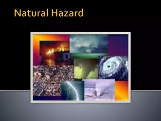
How Disasters Impact West Virginia
How disasters have impacted WV, Historically Since 1954 • 52Disaster Declarations Due to: Severe flooding, Severe winter storms, High winds, Blizzard, Drought, Tornados and Landslides Since 2003 17Presidential Disaster declarations From 1969-2010 these counties have experienced 15 + declared disasters: Cabell, Greenbrier, Kanawha, Lincoln, Logan, McDowell, Mercer, Mingo, Nicholas, Raleigh Wayne, Wyoming • Flooding has caused the most damage to the state and its citizens
How disasters have impacted WV, Historically Since 2000 • Nationwide – Repetitive loss structures cost the US Gov. $200 Million • WV has2800Repetitive Loss structures and 50 Severe Repetitive Loss Structures • > 900 Critical Facilities are located in the 1% or 0.2% Floodplain Since 2003 • > 18,000 households have had disaster related damage. • (qualified households) received >$31 Million 80% of jobs are at high risk for failure after a disaster.
What is Hazus-MH & why is it important?
What is Hazus-MH? • Software tools and support system designed by FEMA for the purpose of providing communities with the means to identify and reduce risk from natural hazards • Program elements include: • Hazus-MH • User Groups • Education Program • Other Resources • Available from FEMA free of charge (requires ArcGIS license)
Study regions • Population and inventory are defined for whole region • Hazard may affect part of region, or whole region • No damage assessment performed outside of study region
Loss Estimation Process Produce maps, tables, and reports Analyze social and economic impacts Consider what is at risk Identify hazard Identify physical landscape
Improving the model Enhanced Basic
HAZUS-MH Local Data Integration • HAZUS Inventory can be updated to reflect current conditions or illustrate proposed development and population growth • More accurately reflect actual risk • Non Hazard Data Integration • Comprehensive Data Management System (CDMS) • Hazard Data Integration • User-provided hazard maps (soils, elevation, user developed depthgrids, etc.) • User Defined Data • HAZUS allows the user to input Arc GIS point shapefiles with necessary attributes to analyze potential losses for specific structures or facilities
What Impacts the HAZUS-MH Accuracy? How well is what is at risk defined?(Inventory) How accurate is the loss estimation methodology? How well is the hazard defined?
The Reality of Data • In a perfect world, the data you need would already be collected and available, but the reality is far more complex. • Some data owners charge a fee • An MOU may be required • Data stewards change from state to state and local jurisdiction to local jurisdiction (e.g. Assessor’s Office vs. Auditor’s Office) • The data may be incomplete or out of date • The data may not be geospatial, geocoded…or even digital! • The data you need may not exist • Each County/Municipality may collect the data in multiple formats. • Implementing inventory Tools and Workflows can address these issues • created for transforming local assessor/parcel data to a Hazus compliant format
Georgia Project elements • Integration of improved inventory and hazard data • Analysis of flood, hurricane, and tornado hazards • Creation of risk assessment maps, tables and reports Supported by tools and a detailed workflow
Georgia Local data quality allowed for detailed point level analysis
Georgia Tools created for transforming local assessor/parcel data to a Hazus compliant format
Indiana • Data is centralized and standardized in two locations • IndianaMAP (parcels) available for 90 of 92 counties • Department of Local Government Finance (assessment data) • Hazus-MH data has been enhanced for the entire state to rooftop level accuracy. • Tools created to convert the centralized data to Hazus-MH required format
Why Collaborate? • IN understands the value of this data to everyone in Indiana! • IN understands that the return on investment from these statewide initiatives is significant! • IN understands that no single organization has the resources to fund these statewide projects, so partnerships are critical to their success. • Credit for these accomplishments • Federal government->state government ->private industry->local government partnerships
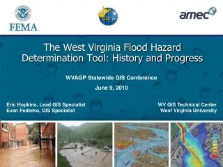
West Virginia Risk MAP Ongoing Project - Conocoheague-Opequon Watershed Upcoming Project - Upper Monongahela Watershed Marion, Monongalia, Preston, Taylor and Wetzel Counties Discovery Meetings: • Monday June 9, 2014 – 2:30-6:30 1-79 Technology Park, Robert H. Mollohan Research Center, Exhibition Hall, 1000 Galliher Dr., Fairmount WV • Tuesday June 10, 2014 – 2:30-6:30 West Virginia University, Dept. of Geology & Geography, 325 Brooks Hall, 98 Beechurst Ave., Morgantown WV
Upcoming HAZUS Training in WV FEMA Region III E172 HAZUS for Flood Training For FEMA Region III Federal, State, County, Local Gov. & University partners7 Seats currently available!!! Contact Cynthia McCoy - cynthia.mccoy@fema.dhs.gov if interested Attention: A representative from each Regional PDC is expected to attend. Should have GIS technical skills Required by the WVDEM, State Hazard Mitigation Officer 4 day Course at WVUJuly 28-31, 2014 Day 1-3E172 HAZUS for Flood training course Day 4Interactive session with dynamic discussion, on how to develop strategies for Statewide data coordinationand tangible tasks in which HAZUS can be used to inform real projects, and improve risk awareness in WV.
WV Statewide Geospatial Data Coordination • Goal: Evaluate the location of GIS datasets throughout the State • Can be utilized to inform decision making in the fields Emergency Management, Risk Assessment, Hazard Mitigation, Climate Adaptation and Urban Planning. • Completed - First Step: Perform State Level Gap analysis • Participants – WVDEM, WV Geographic Information Officer (GIO), West Virginia University GIS Tech Center • Starting Today- Second Step: Outreach to the Local Governments Regional Planning Commissions • Assess level of data maintained at the local level • Proposed End Result • Use for State and Local Analysis and Mitigation Planning • Use for Response Activities • Develop projects/analyses which qualify for CRS credit
West Virginia Geospatial Data Coordination Datasets • General Building Stock • Essential Facilities • Transportation • Utilities • Demographics • Airport Facilities and Runways • Bridges • Levee • National Monuments & Icons • Museums and Cultural Resources • Historic Districts and Structures • Public Institutions • Terrain Attributes • Data Projection • Address • Year Built • Foundation Type • Number of Stories • Available Backup Power • Height of Structure • First Floor Elevation (NAVD88) • Basement Including Garage Elevation (NAVD88) • Latitude • Longitude • Building Value • Building Content Value
Vision for West Virginia • Improved data accessibility • Improved awareness of existing data resources • Consistent Statewide data coordination
Contact Cynthia McCoy FEMA cynthia.mccoy@fema.dhs.govPhiladelphia, PA 215.931.5530