A River's Profile Changes Study | 60 Second Challenge
Explore the long and cross profile changes of a river from its source to its mouth. Test your knowledge of hydrological cycle words in a fun 60-second challenge. Understand the valley long profiles and river characteristics as it moves downstream.

A River's Profile Changes Study | 60 Second Challenge
E N D
Presentation Transcript
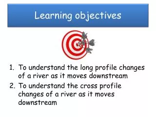
Learning objectives • To understand the long profile changes of a river as it moves downstream • To understand the cross profile changes of a river as it moves downstream
We have learnt lots of new words associated with the Hydrological cycle and rivers. How many can you remember in 60 seconds? 60 second challenge
A River’s journey…..from source to the mouth Where a river begins= SOURCE Where the river flows into the sea= MOUTH What does this show?
Today we are going to study how these profiles change as the river moves from its SOURCE to the MOUTH
A rivers journey…. Watch this!!!
1. Valley Long Profiles • The gradient of the land is the cause of the changes in the characteristics of a river from source to mouth • At the source of the river there are high mountains with a steep gradient. • As the river reaches the lowlands the gradient becomes gentler.
1. Valley Long Profiles • However the river is determined by its environment - it also shapes the environment too! • It does this through erosion. • The river is in balance with its environment creating a graded profile.
The graded profile In reality the shape of a profile is never this smooth. e.g. rocky outcrops of resistant rock that are difficult to erode. Concave shape altitude Distance downstream
Upper valley characteristics “V”shape valley, vertical erosion dominant
Upper valley characteristics “V”shape valley, vertical erosion dominant Interlocking spurs
Upper valley characteristics “V”shape valley, vertical erosion dominant Interlocking spurs Slumping and landslides - very active hillslopes
Upper valley characteristics “V”shape valley, vertical erosion dominant Terracettes formed by soil creep Interlocking spurs Slumping and landslides - very active hillslopes
Upper valley characteristics “V”shape valley, vertical erosion dominant Narrow, shallow channel, low velocity and discharge Interlocking spurs Slumping and landslides - very active hillslopes
Upper valley characteristics “V”shape valley, vertical erosion dominant Terracettes formed by soil creep Narrow, shallow channel, low velocity and discharge Interlocking spurs Slumping and landslides - very active hillslopes Large bedload derived from upstream and from valley sides
Interlocking spurs, Robinson, Lake District A typical upper course valley with interlocking spurs, steep valley sides and active slope processes
River load in upper course Load is dumped in summer due to the low discharge unable to carry the c________and c__________of load at higher flow levels
River load in upper course Load is dumped in summer due to the low discharge unable to carry the capacity and competence of load at higher flow levels
River load in upper course Load is dumped in summer due to the low discharge unable to carry the capacity and competence of load at higher flow levels
River load in upper course Boulders are large and semi-rounded, due to attrition within the loadand abrasion with the stream bed and banks Load is dumped in summer due to the low discharge unable to carry the capacity and competence of load at higher flow levels
Middle course, R. Tees Valley opens out, more gentle slopes, wider valley bottom First signs of meanders
Middle course, R. Tees Valley opens out, more gentle slopes, wider valley bottom First signs of meanders Floodplain
Middle course, R. Tees Valley opens out, more gentle slopes, wider valley bottom First signs of meanders Floodplain River channel wider, deeper, greater velocity and discharge
Lower Severn Valley Well developed meanders with bars in the channel indicating high sediment load Very wide floodplain Very gentle valley side gradients