Lecture 11 (11/18)
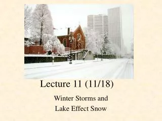
Lecture 11 (11/18). Winter Storms and Lake Effect Snow. Winter Storms. A winter storm is just a low pressure area (storm) that moves across the U.S. with particular cold air behind it. Important to forecast a couple days in advance so public can prepare, close airports, close schools, etc.

Lecture 11 (11/18)
E N D
Presentation Transcript
Lecture 11 (11/18) Winter Storms and Lake Effect Snow
Winter Storms • A winter storm is just a low pressure area (storm) that moves across the U.S. with particular cold air behind it. • Important to forecast a couple days in advance so public can prepare, close airports, close schools, etc.
Winter Storms • Snowfall almost always occurs in the cold sector of a cyclone (NW of cold front and N of warm front). • Most common just to the North or Northwest of the center of the cyclone. • Exception: Upslope snow in Denver – when moist, cold air blows in from Kansas, it must go uphill (2000 ft) • This is often enough to induce clouds and snow
Precipitation Types • Freezing Rain • Snow melts in warm layer • The cold layer below is too shallow and water only freezes on contact • Sleet • Snow melts in warm layer • Refreezes in the lower cold layer • Snow • Begins as snow and layer is cold enough to remain frozen
Blizzards (not the thing at DQ) • Blizzard = A snowstorm with winds of at least 35 mph, and visibility reduced to less than 1/4 mile with snow and blowing snow • A severe blizzard has 45 mph or greater winds • Blizzards can make “white out conditions” where visibility is so bad you cannot tell the ground from the sky (everything is white) • Also make snow drifts
Snow Drifts • Snow drifts happen when the wind blows snow and deposits it into mounds • Remember the snow fence example in the book • In extreme cases, snow drifts can get as high as 40+ feet!
Not a typical Snow Drift Start shoveling lady!
Lake Effect Snow • Lake Effect Snows (LES) most common in late fall through early winter • Cold arctic air (typically associated with strong surface high pressure from Canada) flows over the warm lakes • Heat and moisture from the lake surface is transferred into the boundary layer (the layer where the air from the ground is mixed into the air above it.)
LES process • Surface heating beneath cold air above destabilizes the lowest 1 to 2 km of the atmosphere • Initiates convection • If the air resides over a lake long enough, it picks up enough moisture to condense water vapor and form clouds • Condensation and freezing in the clouds releases latent heat which adds to buoyancy
Moving towards shore • The warm, moist, unstable air moves onshore • Rougher surface beneath and topography (if there is any) decelerates the air and induces convergence winds coming together) • Enhanced lift at the shore • Cumulus and stratocumulus clouds precipitate
Results of LES • Land breeze circulation occurs (circulation from land to water at surface and water to land aloft) • All of this produces heavy snow squalls in narrow regions • Skies can be clear just a few miles away • If these heavy snow resides in same area for hours or even days you can get huge snow accumulations
Forecasting Lake Effect Snow • Lake effect snow is seriously under-forecasted by the models • If the models predict lake-effect snow, it will most likely happen • Determine the wind direction: examine the 850mb analysis or forecast. • Add 13 deg F to the 850mb temp over the lake (to calculate potential temp and determine stability of air between lake and 850
Rule of Thumb • If temp at 850 + 13° > temp of lake then you won’t get LES situation (since air is stable) • Cyclonic curvature favors lake effect snow of winds • If the 850 mb height contours curve to the left as you go downstream, strong lake-effect snow is more likely
For Next Time • Do your homework. • Read Chapter 8 (Thunderstorms and Tornadoes). I know, I’m really getting into wishful thinking.

