24 May 2002 WCR & KA data
320 likes | 462 Vues
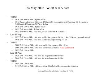
24 May 2002 WCR & KA data. VPDD: 19:10 Z @ 2000 m AGL: dryline below 19:14 Z descending from 2000 m to 1500 m AGL: intercept the cold front in a 180 degree turn. Cold front is 16 km to the WNW of dryline 19:18 Z @ 1500 m AGL: dryline below 19:29 Z @ 900 m AGL: dryline below

24 May 2002 WCR & KA data
E N D
Presentation Transcript
24 May 2002 WCR & KA data • VPDD: • 19:10 Z @ 2000 m AGL: dryline below • 19:14 Z descending from 2000 m to 1500 m AGL: intercept the cold front in a 180 degree turn. Cold front is 16 km to the WNW of dryline • 19:18 Z @ 1500 m AGL: dryline below • 19:29 Z @ 900 m AGL: dryline below • 19:32 Z @ 900 m AGL: cold front, 14 km to the WNW of dryline • Low SSP up: • 19:35 Z @ 360 m AGL: cold front and dryline, separated some 11 km (10 km at corrspndg angle) • 19:49 Z @ 170 m AGL: cold front and dryline, separated by 3-4 km • VPDD: • 20:00 Z @ 2300 m AGL: cold front and dryline, separated by 1-2 km • 20:09 Z @ 2300 m AGL: cold front and dryline collapsed (wind synthesized) • 20:25 Z @ 1200 m AGL • Low SSP up: • 20:28 Z @ 170 m AGL: cold front has surged under the dryline • 20:46 Z @ 170 m AGL; cold front has surged under the dryline • VPDD: • 20:54 Z @ 1200 m AGL • 21:11 Z @ 2400 m AGL: cold front, about 9 km behind deep-convective initiation (estimated frontal speed relative to dryline : 6-7 m/s)
19:10 Z Moist side sounding: cold front 16 km dryline Ground ~650 m high Clouds between 1200-2100 m AGL
nadir beam ESE 110 WSW 290 19:10:09- 19:11:20 dryline Time match correct
19:14 Z cold front Cold front Cold front SE NW SE NW 19:13:48 19:15:22 nadir beam
19:18 Z Flight level: ~1500 m AGL Wind shift
Dryline? Moist air Ahead of cold front, in the dry sector?? nadir beam WSW 290 Time match correct ESE 110 Dryline? cold front?
19:29-19:32 Z cold front dryline
dry sector thermal ?? dryline cold frontal surface @900 m foreward beam!!! WSW 290 14 km ESE 110 Moist air Cold air
Low SSP up 360 m 360 m 170 m cold front @ 360m @ 19:35 170 m cold front @ 170m @ 19:49 dryline @ 170m @ 19:48 cold front cold front dryline dryline
UWKA 19:33 19:52 19:43
Height above flight level (m) NW 315 frontal motion SE 135 flight level: 360 m AGL total length: 11.2 km aspect ratio: 1:1 Relative humidity cold front Mixing ratio q q e
NW 315 frontal motion SE 135 cold front kft km Height above flt level total length: 5.9 km flight level: 360 m AGL SE NW convergence! ascent
frontal motion SE 135 NW 315 cold frontal surface @360 m u m/s v m/s
cold frontal surface @360 m dryline 11 km Time matched OK westerly v m/s southerly northerly u m/s
20:00 Z VPDD Flight level: ~2300 m AGL
frontal motion 19:59:08-20:02:38 front Dryline? Moist air WNW 290 ESE 110
20:10 Z VPDD Flight level: ~2300 m AGL cold front below @ 20:09 Z
frontal motion SSE 164 NNW 344 front & dryline moist air cold air Time match OK
Height below flight level (m) Time (UTC) WCR nadir antenna reflectivity Flight level: 2300 m AGL dBZ Aspect ratio : 2:1
20:25 Z VPDD Flight level: ~1200 m AGL cold front below @ 20:25 Z descending to 170 m
possibly stratus clouds km frontal motion 20:21:50-20:25:40 WNW 344 front ESE 164
cold front @ 170m @ 20:46 cold front @ 170m @ 20:28
-5 frontal motion SSE 164 NNW 344 km dBZ 6 8 -45 Total length: 11.7 km, flight level: 170 m
km NW 300 frontal motion SE 120 Total length: 11.7 km, flight level: 170 m vertical velocity
20:54 Z VPDD Flight level: ~1200 m AGL cold front below around 20:54 Z ascending from 170 m
frontal motion 20:51:58-20:56:28 ESE 110 Embryo of a Cb cell that develops here in the next 15 min? WNW 290 Dry air above the cold front Not sure about time match Moist air ahead of dryline If the air ahead of the sharp gradient is drier and warmer, why does it seem to have a cloud at flight level?
21:11 Z VPDD Flight level: ~2400 m AGL Last leg First cumulonimbus formation (~21:12:30) cold front below around 21:11 Z (ascending after this time)
21:06:36-21:13:20 WNW 290 Gravity waves in the cold-frontal stratus? Questionable (dixit Sam) frontal motion ESE 110 This is a cloud whose towering tops had grown well above 4 km AGL, part of a line of storm cells aligned with the cold front 9 km Deep convection develops 9 km ahead of sfc cold front
UWKA AMA 21:05 21:15


