Download
1 / 52
520 likes | 654 Vues
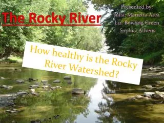
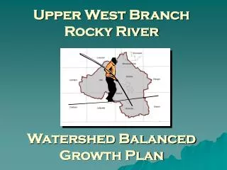
Upper West Branch Rocky River Watershed Balanced Growth Plan. The Rocky River Watershed Planning Partnership. Medina County Department of Planning Services. Rocky River Watershed Council. Medina County Soil & Water Conservation District. Medina County Park District. Medina County

E N D
Upper West BranchRocky River Watershed Balanced Growth Plan
The Rocky RiverWatershed Planning Partnership Medina County Department of Planning Services Rocky River Watershed Council Medina County Soil & Water Conservation District Medina County Park District Medina County Sanitary Engineer Medina County Highway Engineer Western Reserve Land Conservancy Medina-Summit Chapter Medina County Home Builders Association Medina County Emergency Management Agency Medina County Farm Bureau Northeast Ohio Areawide Coordinating Agency Medina County Economic Development Corporation
Land Suitability Analysis • Developed for the Ohio Lake Erie Commission by • EcoCity Cleveland • The Ohio Lake Erie Commission • Representatives of the 3 pilot watersheds for the Balanced Growth Initiative (Chagrin, Swan Creek and the Upper West Branch of the Rocky River)
AGRICULTURE Factor: Important Farmlands Classification • designated by NRCS, USDA Land Category Suitability : • HIGH: all PRIME classifications • MODERATE: not prime, but deemednoteworthy (unique or locally important) • LOW: not PRIME or not unique or of local importance
CONSERVATION Factors: • RIPARIAN CORRIDOR • FLOODPLAIN • WETLAND • INFILTRATIVE CAPACITY
CONSERVATION Factor #1:RIPARIAN CORRIDOR • designation by USGS digitized topographic maps at 1:24,000 scale Factor Suitability: • HIGH:areas that meet ONE of the following conditions: • within 300 ft of a stream edge, stream drains over 300 square miles • within 120 feet of a stream edge, stream drains 20-300 square miles • within 75 feet of a stream edge, stream drains 0.5-20 square miles • within 25 feet of a stream edge, stream drains under 0.5 square miles • LOW: areas that do not meet ANY of the above conditions
CONSERVATION Factor #2: FLOODPLAIN • 100 year FEMA from ODNR and floodplain soils designated by NRCS Factor Suitability: • HIGH: areas that meet ONE of the following conditions: • within a 100-year floodplain designated by FEMA • classified as floodplain soils by NRCS • LOW: areas that do not meet ANY of the above conditions
CONSERVATION Factor #3:WETLAND • OWI or NWI and types of hydric soils from NRCS Factor Suitability: • HIGH: areas that meet ONE of the following conditions: • within the confluence of an OWI-designated wetland AND hydric soils OR non-hydric soils with hydric inclusions • within the confluence of a NWI-designated wetland AND hydric soils OR non-hydric soils with hydric inclusions • within 165 feet of Category 3 Wetlands (designated as high quality by OhioEPA) • LOW: areas that do not meet ANY of the above conditions
CONSERVATION Factor #4:INFILTRATIVE CAPACITY • TR-55 runoff curve numbers • combinations of NRCS hydrologic soil groups (A,B,C,D) and 2003 EPA Land Cover categories prepared by University of Cincinnati Factor Suitability: • HIGH: all areas where the combination of hydrologic soil and land cover category generate a runoff curve number no greater than 79 • LOW: all areas where the combination of hydrologic soil and land cover category generate a runoff curve number greater than 79
CONSERVATION Land Category Suitability: • HIGH: if an area has a HIGH suitability rating for any of the conservation factors (Riparian Corridor OR Floodplain OR Wetland OR Infiltrative Capacity) • LOW: if an area does NOT have a HIGH suitability rating for ANY of the conservation factors
DEVELOPMENTResidential Factor:Public Sewer Service • Facility Planning Areas (208 Plans) Land Category Suitability : • HIGH: areas that currently have sewers • MODERATE: areas likely to have sewers within 20 years of last plan update • LOW: areas not likely to have sewers within 20 years of last plan update
Areas of HIGH and MODERATE SUITABILITY for Residential Development
DEVELOPMENTCommercial Factors: • Public Sewer Service • Highways • Highway Interchanges • Fiber-optic Networks • Electric Power Lines
DEVELOPMENTCommercial Factor #1:Public Sewer Service • Facility Planning Areas (208 Plans) Factor Suitability: • HIGH: areas that currently have sewers • MODERATE: areas likely to have sewers within 20 years of last plan update • LOW: areas not likely to have sewers within 20 years of last plan update
DEVELOPMENTCommercial Factor #2:Highways • Limited Access, Federal, State mapped by ODOT Factor Suitability: • HIGH: within ¼ mile • MODERATE: between ¼ and ½ mile • LOW: greater than ½ mile
DEVELOPMENTCommercial Factor #3:Highway Interchanges • mapped by ODOT Factor Suitability: • HIGH: within ½ mile • MODERATE: between ½ and 1 mile • LOW: greater than 1 mile
DEVELOPMENTCommercial Factor #4:Fiber-optic Networks • Mapped by FCC? Factor Suitability: • HIGH: TBD • MODERATE: TBD • LOW: TBD
DEVELOPMENTCommercial Factor #5:Electric Power Lines • Mapped by PUCO Factor Suitability: • HIGH: within ¼ mile • MODERATE: between ¼ and ½ mile • LOW: greater than ½ mile
DEVELOPMENTCommercial Land Category Suitability : • HIGH: must have HIGH suitability for both SEWER and ELECTRIC POWER and NOT LOW suitability for HIGHWAY or HIGHWAY INTERCHANGE • MODERATE: must have at least MODERATE suitability for both SEWER and ELECTRIC POWER and NOT LOW suitability for HIGHWAY or HIGHWAY INTERCHANGE • LOW: all areas that do not qualify as HIGH or MODERATE commercial development suitability
DEVELOPMENTIndustrial Factors: • Public Sewer Service • Highways • Highway Interchanges • Fiberoptic Networks • Freight Rail Lines • Gas Lines • Electric Power Lines
DEVELOPMENTIndustrial Factor #1:Public Sewer Service • Facility Planning Areas (208 Plans) Factor Suitability: • HIGH: areas that currently have sewers • MODERATE: areas likely to have sewers within 20 years of last plan update • LOW: areas not likely to have sewers within 20 years of last plan update
DEVELOPMENTIndustrial Factor #2:Highways • Limited Access, Federal, State mapped by ODOT Factor Suitability: • HIGH: within ¼ mile • MODERATE: between ¼ and ½ mile • LOW: greater than ½ mile
DEVELOPMENTIndustrial Factor #3:Highway Interchanges • mapped by ODOT Factor Suitability: • HIGH: within ½ mile • MODERATE: between ½ and 1 mile • LOW: greater than 1 mile
DEVELOPMENTIndustrial Factor #4:Fiber-optic Networks • Mapped by FCC? Factor Suitability: • HIGH: TBD • MODERATE: TBD • LOW: TBD
DEVELOPMENTIndustrial Factor #5:Freight Rail Lines • Mapped by PUCO Factor Suitability: • HIGH: within ¼ mile • MODERATE: between ¼ and ½ mile • LOW: greater than ½ mile
DEVELOPMENTIndustrial Factor #6:Gas Lines • Mapped by NPMS (National Pipeline Mapping System) Factor Suitability: • HIGH: TBD • MODERATE: TBD • LOW: TBD
DEVELOPMENTIndustrial Factor #7:Electric Power Lines • Mapped by PUCO Factor Suitability: • HIGH: within ¼ mile • MODERATE: between ¼ and ½ mile • LOW: greater than ½ mile
DEVELOPMENTIndustrial Land Category Suitability : • HIGH: must have HIGH suitability for both SEWER and ELECTRIC POWER and NOT LOW suitability for HIGHWAY or HIGHWAY INTERCHANGE • MODERATE: must have at least MODERATE suitability for both SEWER and ELECTRIC POWER and NOT LOW suitability for HIGHWAY or HIGHWAY INTERCHANGE • LOW: all areas that do not qualify as HIGH or MODERATE industrial development suitability
Areas with HIGH SUITABLITY for BOTHAGRICULTURE AND CONSERVATION
Areas with HIGH SUITABLITY for BOTHAGRICULTURE AND DEVELOPMENT
Areas with HIGH SUITABLITY for BOTHCONSERVATION AND DEVELOPMENT