Download
1 / 17
170 likes | 261 Vues
A Collaborative Approach to Assessing Watershed Conditions in Coastal National Parks Kristen Keteles, Cliff McCreedy, Jim Tilmant and Mark Flora. NPS Coastal Watershed Portfolio. >3 million ac marine area 5,000 miles shoreline

E N D
A Collaborative Approach to Assessing Watershed Conditions in Coastal National ParksKristen Keteles, Cliff McCreedy, Jim Tilmant and Mark Flora
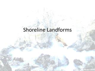
NPS Coastal Watershed Portfolio • >3 million ac marine area • 5,000 miles shoreline • Coastal fjords, bays, rivers, estuaries, barrier islands, coral reefs, wetlands, Great Lakes, open ocean • Coast and uplands inextricably linked via watersheds
Stressed Coasts • 53% population occupy less than 17% entire U.S. land area (coastal zone) • 75% by 2020 • Wetland loss >20,000 acres year • Water quality problems, algal blooms, pfiesteria, salinity changes, hypoxia • Recreational overuse, overfishing • Shoreline, sediment flow alterations
Coastal Watershed Condition Assessment (CWCA) • Funded by the NPS Watershed Condition Assessment Program (WCAP) began funding assessments of Coastal parks in 2003 • NPS plans to complete assessments of 52 coastal park units by 2008 • As of April 2006 assessments have been completed in 9 parks (SE/Gulf coasts, SE Alaska, Hawai’i) • Assessments currently underway in 37 parks
Goals of the Coastal Watershed Condition Assessments • Determine the state of knowledge concerning overall water resources condition • Identify information gaps and resource threats • Assess overall ecosystem health • Sets the stage to establish the context for management actions and collaborations
Describe coastal water resources (marine, estuarine, island) Determine state of knowledge on their condition using existing data Identify information gaps Draw a conclusion or hypothesis re: relative condition (unknown, degraded, unimpaired) Identify resource threats or potential issues affecting ecosystem health Recommend further studies, if needed (Phase II Collaborations) NPS Coastal Watershed Condition Assessment Reports
Components of the CWCA Assessments • Land Use Patterns & Trends • Water Quality Data & Assessments • Biological Inventories and Studies • Habitat Quality Assessments • Invasive Species Issues • Resource Utilization Issues
Who does the work? • Thru CESU Networks • Universities with regional/local orientation near Park • Interdisciplinary Teams • Marine expertise • Provide geospatial information,water quality analysis, biological assessments
South Atlantic & Gulf Coast National Seashores & Parks • Protect last remaining undeveloped beaches • Rare habitat for T&E species: sea turtles, amphibians, manatees, shorebirds, etc. • Productive estuarine habitats: seagrass beds, salt marshes • Fish, bird and invertebrate nurseries and feeding grounds • Valuable recreation sites > 15 million visitors per year
Cumberland Island NS Land Cover/Land Use • Park area: 36,402 ac • Beaches & dunes: 2,405 ac • Salt marsh: 10,717 ac • Forested wetlands: 804 ac • Evergreen forest: 10,924 • Roads: 1,190 ac • Open water: 9,651 ac
Stressor Table for Cumberland Island National Seashore OK=Not currently a problem, PP =Potential problem, EP=Existing problem, ND: No data, Shaded=limited data
CUIS Assessment Summary: Habitat Disruption and Other Threats
Collaborative Monitoring and Assessment Goal: Fill information gaps to clarify condition and identify stressors on coastal resources • National Coastal Condition Assessment: Use of protocols, similar indicators • Park Service Leads: NPS Water Resources Division/NPS Vital Signs Monitoring Networks (parks grouped by bioregions) Partners: • State agencies • Coastal Parks overlapping or located near NOAA Estuarine Research Reserves, National Marine Sanctuaries, EPA National Estuary Program sites, State parks, etc. • Monitoring Programs: U.S. Geological Survey, EPA, NOAA • Local Watershed Councils and Planning Agencies
Park-Level Management Action Goal: Work cooperatively with states and local groups to address impacts on park resources • Point Reyes National Seashore/Pacific Coast Science and Learning Center/Tomales Bay Watershed Council • Assateague National Seashore/Maryland DNR/Maryland Coastal Bays Program • Olympic National Park/Olympic National Marine Sanctuary