Download
1 / 57
570 likes | 591 Vues
Join Ellen van Schoten and Jacqueline Williams-Bridgers at ICGFM Miami as they discuss the added value of GIS in auditing, focusing on INTOSAI Tsunami Initiative and global aid transparency.

E N D
The added value of geographical information in auditing Ellen van Schoten and Jacqueline Williams-Bridgers
This presentation will cover • INTOSAI Tsunami Initiative • What is GIS? • Use of GIS at GAO • Pilot study GIS & Audit • Conclusion ICGFM Miami
Before and after Tsunami IQuickbird, 23-6-04 & 28-12-2004 [Digital Globe] ICGFM Miami
Before and after Tsunami II IKONOS, 10-01-03 & 29-12-04 [DLR] ICGFM Miami
The essence of aid ICGFM Miami
Donor and recipient want to know if … • … the aid pledged has been provided (trust) • … the aid provided has been spent on the purpose it was meant for (regularity) • … the aid provided has been spent in the most efficient way (efficiency) • … the aid provided has been spent in the most effective way (effectiveness) ICGFM Miami
Global complexity of aid sector ICGFM Miami
Accountability & transparency international aid sector • Complexity of organizational chain of aid flows (many organizations involved) • No single entity has full overview • No single entity is responsible for accountability and transparency of chain of aid delivery • Donor-side: waste and competition • Recipient-side: fraud and corruption ICGFM Miami
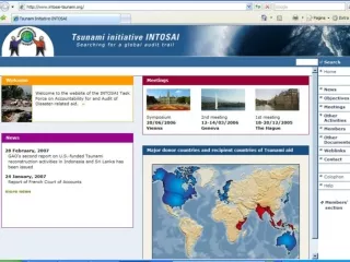
Good governance is needed • SAIs have an important role in safeguarding and stimulating good governance by enhancing accountability and transparency • This is also the case for good governance of aid flows. • That’s why INTOSAI launched a Tsunami initiative … • … and established a Task Force on the Accountability for and Audit of Disaster-related Aid ICGFM Miami
INTOSAI Tsunami Initiative • Establishment of the Task Force on the Accountability for and Audit of Disaster-related Aid with the aim to: • Enhance the tranparency and accountability of disaster-related aid • Aim is to be realized in two steps: • Gather lessons from constructing an audit trail for Tsunami-related aid flows (Congress INTOSAI 2007 in Mexico) • Develop best practices and guidelines (Congress INTOSAI 2010 in South Africa) ICGFM Miami
Objectives • Creating an insight into Tsunami aid flows; • Developing a geographical tracking approach to assist disaster-related auditing; • Identifying lessons learned and flashing out issues to be addressed; • Formulating guidelines for SAIs; • Identifying and sharing best practices for other relevant stakeholders. ICGFM Miami
GIS Results in Pictures Together with all sorts of data ICGFM Miami
What can GIS do? • Display data spatially (geographically) • “Spatially” query data by location • Store and view data as layers (layers can be “turned on or off”) • Analyze spatial locations or relationships (Where is…? Where is the closest…? What is inside the boundary of, or next to…?) ICGFM Miami
Demographics Flood Zones Land Ownership Landcover Transportation Surface Waters Boundaries Water Lines Elevation Sewer Lines Geodetic Control Soils Aerial Imagery GIS Layers (or themes) ICGFM Miami
Use of GIS at GAO Jacqueline Williams-Bridgers
Use of GIS at GAO • GIS techniques have been found useful in 3 aspects of our work • Design • Analysis • Reporting ICGFM Miami
Use of GIS: Design • GIS techniques have been used to aid in site selection for field visits. • Identifying school districts more than 100 miles from urban areas • Proximity of sites to each other and transportation • Allowed team to choose regions to visit that had largest concentrations of different project types. ICGFM Miami
Use of GIS: Analysis • RURAL HOUSING :Changing the Definition of Rural Could Improve Eligibility Determinations (GAO-05-110) • Study examined the Rural Housing Service’s boundary areas and proposed that GIS be used to help determine program eligibility. • Identified 1,300 communities eligible to participate but GIS revealed that they may not have met program criteria. ICGFM Miami
Analysis (cont) • VA Health Care: Access for Chattanooga-Area Veterans Needs Improvement (GAO-04-162) • Used GIS and routing model techniques to determine estimated time for veterans to drive to closest hospital. • Calculated percent of veterans whose drive times were within Department guidelines. ICGFM Miami
Veterans’ Access to Health Care ICGFM Miami
Use of GIS: Reporting • GIS is also useful for visually summarizing detailed information. • Teams may work with GIS specialists or with graphic artist depending on complexity of map required. ICGFM Miami
Paths of Hurricanes Katrina and RitaRelative to Oil and Natural Gas Platforms Source: GAO analysis of data provided by the National Weather Service and the Mineral Management Service ICGFM Miami
Fire Size Over Time As Fire Management Teams Respond ICGFM Miami
Use of GIS Some other examples
Other examples of the use of GIS • World Food Programme • Locating refugees • International Criminal Court • Map the area of Darfur • European Court of Audit • Auditing agricultural subsidies ICGFM Miami
Pilot study GIS & Audit Focus on Tsunami-related aid in Aceh
Pilot study GIS & Audit • Pilot study into the possibilities of using geographical information for auditing disaster-related aid has to answer the following question: • In what way and under what conditions can the use of geographical information in auditing disaster-related aid help to ensure the regularity, efficiency and effectiveness of disaster-related? ICGFM Miami
Pilot study GIS & Audit • Cooperation between • Task Force (SAIs of Indonesia, Korea, Netherlands and the United States) • Agency of the Rehabilitation and Reconstruction for the Region and Community of Aceh and Nias (BRR) • Korean Aerospace Research Institute • Netherlands Institute for Aerospace Programmes • Office of the United Nations Recovery Coordinator for Aceh and Nias (UN ORC) • United Nations Development Programme • And others ICGFM Miami
Activities • Design pilot study • Training on GIS & Remote Sensing • Gathering data from various sources • Analysis of results • Mapping and communicating results • Adjust design and methodology ICGFM Miami
Approach pilot study GIS & Audit • Comparing planning and realization of aid projects by using: • Data on selected aid projects; • Satellite pictures on selected areas; • Statistical data on economy, households, etc. • On-the-ground observations of selected aid projects in selected areas ICGFM Miami
Data on selected aid projects • Sources of data: • Development Assistance Database • Expenditure and Financial Tracking Service UN OCHA • Statistical data UNORC • Plans and year reports of 7 selected international NGOs ICGFM Miami
Project information in DAD • Funding agency & implementer: • Turkish Red Crescent • Purpose: • To design and implement a project to permanently housing needs of IDP’s so as to cover the construction of 1200 housing units including their infrastructure (sewer systemelectric and sanitary system) and environmental designing ICGFM Miami
Financial overview in DAD ICGFM Miami
Performance in DAD ICGFM Miami
Statistical information Example