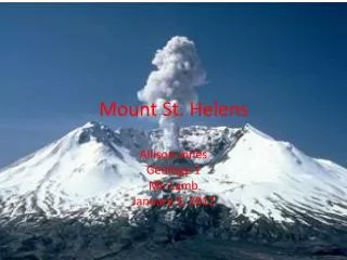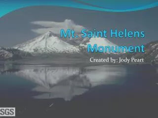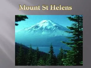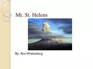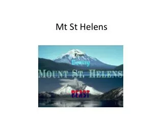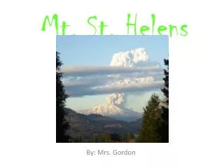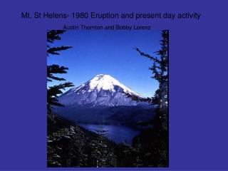
Mt. St. Helens
May 18, 1980 Eruption. Mt. St. Helens. Spirit Lake . Before May 18, 1980. Spirit Lake . Before May 18, 1980. Mt. St. Helens. Summit - 1965. Mt. St. Helens. Pre- 1980. Mt. St. Helens. March 20, 1980. First Crater. March 27, 1980. Mt. St. Helens. March 30, 1980 ash on summit.


Mt. St. Helens
E N D
Presentation Transcript
May 18, 1980 Eruption Mt. St. Helens
Spirit Lake Before May 18, 1980
Spirit Lake Before May 18, 1980
Mt. St. Helens Summit - 1965
Mt. St. Helens Pre- 1980
Mt. St. Helens March 20, 1980
First Crater March 27, 1980
Mt. St. Helens March 30, 1980ash on summit
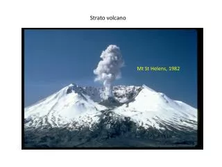
Mt. St. Helens April 6 Steam blast
Mt. St. Helens April 10
Mt. St. Helens April 12, 1980Chehelis, I-5
Mt. St. Helens April 27, 1980Bulge on north side grows (5 ft. per day)
Mt. St. Helens May 3, 1980Bulge on north side grows to 400 ft.
Mt. St. Helens May 17, 1980Bulge on north side grows to 450 ft.View from Johnston’s Ridge 6 miles NW
Mt. St. Helens May 17, 1980David Johnston’s campView from Johnston’s Ridge 6 miles NW
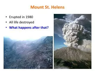
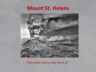
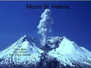
Mt. St. Helens May 18, 1980Eruption after largest knownrock slide, avalanche releasedpressure and triggered a 9 hour ash and pumice eruption. Plumemoved east at 60 miles per hr. 1300 ft. (400 meters) of thepeak collapsed. 200 million cubic yards (150 million cubic meters) of material deposited directly by lahars , volcanic mudflows,into river channels. 57 people killed or missing.
Mt. St. Helens May 18, 1980 Mt. Adams in background
Mt. St. Helens May 18, 1980
Mt. St. Helens May 18, 1980 Mt. Adams in background
Mt. St. Helens May 18, 1980 Blowdown in the North Fork Toutle drainage, with singed area on left.
Mt. St. Helens May 18, 1980 Blowdown in the South Fork Toutle drainage, with singed area in middle.
Mt. St. Helens May 18, 1980 The slopes of Smith Creek valley, east of Mount St. Helens, show trees blown down by the May 18, 1980 lateral blast. Over four billion board feet of usable timber, enough to build 150,000 homes, was damaged or destroyed.
Mt. St. Helens May 18, 1980 May 18, 1980 lahar covering highway at the Toutle River. The bridge was wiped out
Mt. St. Helens May 18, 1980 More than 200 homes and over 185 miles (300 kilometers) of roads were destroyed by the 1980 lahars. Pictured here is a damaged home along the South Fork Toutle River.
Mt. St. Helens May 18, 1980 Debris avalanche, with the beginnings of the mudflow heading down the North Fork Toutle River Valley.
Mt. St. Helens May 31, 1980 Reid Blackburn's car, located approximately 10 miles from Mount St. Helens. Reid was a photographer for National Geographic as well as the Vancouver's Columbian newspaper
Mt. St. Helens May 18, 1980 Spirit Lake, Pumice Plain, and phreatic explosions, soon after the May 18, 1980 eruption of Mount St. Helens
Mt. St. Helens May 18, 1980 Ash along the roadside, Connell, Washington.
Mt. St. Helens May 18, 1980 ,Connell, Washington.
Mt. St. Helens After - Sept. 16, 1980 Volcanic ash collected in Randle, Washington, located about 40 km NNE of Mount St. Helens.
Mt. St. Helens After - Oct. 4, 1980 Spirit Lake, once surrounded by lush forest, is within the area devastated by blast. Remnants of the forest float on the surface of the lake
Mt. St. Helens After – August 22, 1980 For weeks volcanic ash covered the landscape around the volcano and for several hundred miles downwind to the east. Ash fell in eleven states. The total volume of ash (before compacted by rainfall) was enough ash to cover a football field to a depth of 150 miles (240 kilometers).
Mt. St. Helens After- Sept 30 , 1980 Harrys Ridge, five miles north of Mount St. Helens' crater was within the blast zone. The view is from the southeast.
Mt. St. Helens After - Sept. 30, 1980 Aerial view of Mount St. Helens volcano, with Harrys Ridge in the foreground.
Mt. St. Helens After – May 19View of denuded slope and blowdown timber
Mt. St. Helens After – May 19View of denuded slope and blowdown timber
Photos and information:USCS As an unbiased, multi-disciplinary science organization that focuses on biology, geography, geology, geospatial information, and water, we are dedicated to the timely, relevant, and impartial study of the landscape, our natural resources, and the natural hazards that threaten us. Learn more about our goals and priorities for the coming decade in our Science Strategy. “Mount St. Helens, WashingtonBefore, During, and After May 18, 19801980 – 2004”http://vulcan.wr.usgs.gov/Volcanoes/MSH/Images/MSH80/framework.html “Mount St. Helens, Washington May 18, 1980 Eruption Images” http://vulcan.wr.usgs.gov/Volcanoes/MSH/Images/may18_images.html