Mastering Map & Compass Navigation: A Comprehensive Guide
Explore the world of compass navigation with details on types of compasses, using a compass alone, deciphering maps, understanding declination, and more. Enhance your directional skills and venture confidently outdoors.

Mastering Map & Compass Navigation: A Comprehensive Guide
E N D
Presentation Transcript
Map & Compass Bob Steele Scout Roundtable Commissioner
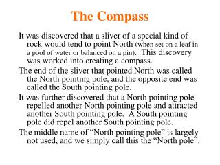
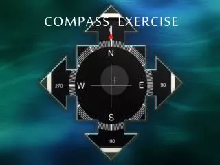
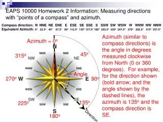
COMPASSES • Compass Needle Points to Magnetic North • watch out for interference • Power lines overhead or underground • Large metal objects; vehicles or buildings • Rail Road Tracks Azimuth Works in a circle starting with 0 or 360 pointing north 180 pointing south Bearing Works from the North or the South toward the east or the west up to 90 degrees
Using the compass alone • Say you want to go N.W. • Move the compass housing to N.W. or 315°
Compass • Turn the compass so the needle aligns with the orienting arrow in the housings
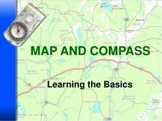
Maps • The most common map used in the out doors is a topographical map. • You can get these on line or from a sporting goods store. • The ones on line only have the North azimuth on it. • There are a lot of different symbols on the map that we will go over later.
Compass • Now, you should be pointing in the N.W. direction. • Make sure the red part of the needle is pointing to North. • Aim at a point ahead of you with the travel arrow and walk toward the point.
. Map & Compass • You want to go from A to B. • Put edge of compass at A and line up B. • Look at travel direction arrow is inline with A & B
Map & Compass • Move the housing and put North pointing North. • The degree that the compass housing is lined up with is the direction to travel.
Maps & Declination • Magnetic North • Geographical North • Grid North
North & Declination • Grid North - The direction of a grid line which is parallel to the central meridian on a map. Note: Grid North does not match true north because a map is a flat representation of a curved surface. • True North - The direction of a meridian of longitude that converges on the North Pole. Note: This is just a technical way of saying that True North describes a direct line to the North Pole and the Earth's spin axis. • Magnetic North- The direction indicated by a magnetic compass. Note: Magnetic North moves very slowly with a variable rate. • Declination -The vertical angle difference between True North and this year's Magnetic North. The current year's declination is oftentimes marked in degrees on your map. That's one reason why you might need a current map. For many purposes declination can be ignored, especially for leisure purposes.
Magnetic North • Magnetic North At 0 degrees declination runs through the middle of the United States. • The declination in this area is 12° 23´ West. • Remember, East is lease, West is best. • The declination in this area moves about 1´ a year.
Magnetic Declination • To find the declination of where you are going, before you start, go on the internet to WWW.ngdc.noaa.gov/geomagmodles/declination.jsp • You have to put in the ZIP code of where the location you will be hiking and it will give you the correct declination.
USGS Topo Maps Black - man-made features such as roads, buildings, etc. Blue - water, lakes, rivers, streams, etc. Brown - contour lines Green - areas with substantial vegetation (could be forest, scrub, etc.) White - areas with little or no vegetation; white is also used to depict permanent snowfields and glaciers Red - major highways; boundaries of public land areas Purple - features added to the map since the original survey.
I Thank You • bvrbob@yahoo.com