Download
1 / 33
330 likes | 473 Vues
Modeling Navigation Channel Infilling and Migration at Tidal Inlets: . Sensitivity To Waves And Tidal Prism. Kenneth J. Connell. Morphologic Features of Navigable Tidal Inlets. Assateague Island. Ocean City Beaches. WA. Moriches Inlet, NY. Ocean City Inlet, MD. Bypassing Path.

E N D
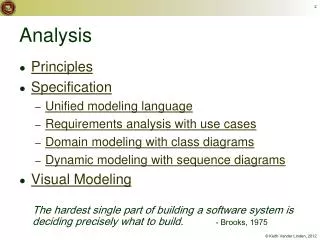
Modeling Navigation Channel Infilling and Migration at Tidal Inlets: Sensitivity To Waves And Tidal Prism Kenneth J. Connell
Morphologic Features of Navigable Tidal Inlets Assateague Island Ocean City Beaches WA Moriches Inlet, NY Ocean City Inlet, MD Bypassing Path Mouth of the Columbia River OR
Presentation Overview • Discussion of Scope and Methods • Presentation of some of the results obtained • Concluding remarks and significance of findings
Scope and Methods • Idealized simulations to examine 1st-order effects • Varied channel-bar systems • Sensitivity to wave forcing • Sensitivity to tidal prism forcing
Coastal Modeling System (CMS) Existing Alt 1 Alt 2 Alt 3 • 2-D and 3-D Numerical modeling at local- to regional-scale • coastal projects including: • Inlets • Navigation channels • Coastal structures Matagorda Ship Channel, TX Flood Current analysis of design alternatives Mouth of the Columbia River
CMS Capabilities Initial Forcing: Measured WSE, ADCIRC Tidal Constituent generated WSE, Wind, River input Hydrodynamic Module Hydro∆t CMS-M2D Circulation-Wave Steering interval CMS-M3D CMS-WABED or STWAVE Sediment transport∆t Sediment Transport Morphology Change Morphology∆t • CMS model interconnectivity - all supported within the SMS interface: • CMS-M2D (w/explicit and implicit modes) • CMS-WABED • CMS-M3D • STWAVE • ADCIRC • Efficient, high-resolution calculation of: • Hydrodynamic circulation & water level • Tide (including flooding & drying) • Waves • Wind forcing • Flow from river input • Advection • Storm surge and wave setup • Sediment Transport • Geomorphic evolution • Salinity
Waves Wave Angle: 30
Results Wave Angle 30º Bay Barrier Island Barrier Island navigation channel infilling Ocean
Concluding Remarks • Morphologic features systematically linked to channel morphology • Storm condition bypassing occurs at greater depths due to increased depth of closure under the large wave regime • Numerical modeling of channel infilling, migration, and sediment bypassing is becoming more reliable
Acknowledgements • PIANC USA • John Paul Woodley, Jr. – Chairman • Major General Don T. Riley – President • Bruce Lambert – Secretary • Edmond J. Russo, Jr. – Publications Chairman • Coastal Inlets Research Program (CIRP) • Nicholas C. Kraus – Program Manager • Jack Davis, Jim Clausner – Technical Directors
Wave Angle 30º Bay Barrier Island Barrier Island Thank You! navigation channel infilling Ocean
Cohesive Transportin Navigation Channels Turbidity maximum water surface freshwater discharge flocculation salt water intrusion Fluff impedes navigation bed Channel Bed Hindered settling ‘fluff layer’ Important considerations in bays and sheltered areas were fine material is source of channel infilling Matagorda Ship Channel, TX
![Data Modeling [Comparison of data modeling techniques ]](https://cdn0.slideserve.com/205866/data-modeling-comparison-of-data-modeling-techniques-dt.jpg)