Download
1 / 71
730 likes | 1.26k Vues
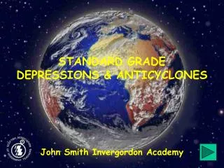
STANDARD GRADE DEPRESSIONS & ANTICYCLONES. John Smith Invergordon Academy. CONTENTS. Atmospheric pressure. Low pressure (Depressions). High Pressure (Anticyclones). Weather Maps. Exit. INTRODUCTION TO ATMOSPHERIC PRESSURE. There are two types of weather systems:.

E N D
STANDARD GRADEDEPRESSIONS &ANTICYCLONES John Smith Invergordon Academy
CONTENTS Atmospheric pressure Low pressure (Depressions) High Pressure (Anticyclones) Weather Maps Exit
INTRODUCTION TO ATMOSPHERIC PRESSURE There are two types of weather systems: • Low pressure systems • High pressure systems These systems affect the weather we receive from day to day. They are caused by differences in atmospheric pressure
WHAT DO WE MEAN BY AIR PRESSURE? • oxygen • carbon dioxide • nitrogen The earth’s atmosphere is made up of many gases, eg Atmospheric pressure is the weight of these gases pressing down on the surface of the earth. If we could take a column of air covering 1 square centimetre, from sea level to the outer edge of the atmosphere, it would weigh 1 kilogram.
ATMOSPHERIC PRESSURE Outer edge of the atmosphere The Earth’s atmosphere presses down on the surface of the Earth. The Earth’s surface
CHANGES IN ATMOSPHERIC PRESSURE Atmospheric pressure is the weight of gases pressing down on the surface of the earth. Atmospheric pressure is measured in millibars (mb). Average atmospheric pressure is 1000mb. Sometimes atmospheric pressure is higher than average. We call this high pressure. Sometimes atmospheric pressure is lower than average. We call this low pressure.
WHY DOES ATMOSPHERIC PRESSURE CHANGE? 1 If air is heated it rises away from the Earth’s surface. Rising air reduces the weight of air pressing down on the Earth’s surface. This means that air pressure is low.
LOW ATMOSPHERIC PRESSURE Outer edge of the atmosphere The Earth’s atmosphere presses down on the surface of the Earth. Warm air rises. This reduces the weight of air pressing down on the Earth’s surface. The Earth’s surface is warmed by the sun’s rays.
WHY DOES ATMOSPHERIC PRESSURE CHANGE? 2 When air is cold, high up in the atmosphere it falls towards the earth’s surface. Falling air increases the weight of air pressing down on the Earth’s surface. This means that air pressure is high.
HIGH ATMOSPHERIC PRESSURE Outer edge of the atmosphere The Earth’s atmosphere presses down on the surface of the Earth. Cold, dense air falls. This increases the weight of the air pressing down on the Earth’s surface. The Earth’s surface
HIGH AND LOW PRESSURE TOGETHER Outer edge of the atmosphere Warm air rising causes LOW pressure. Cold air falling causes HIGH pressure. WIND The Earth’s surface is warmed by the sun’s rays.
PRESSURE SYSTEMS Low pressure systems are also known as depressions. High pressure systems are also known as anticyclones. The aim of this presentation is to help you understand how these pressure systems affect our weather. Click on the buttons on the next page to carry on.
LOW PRESSURE SYSTEMS How depressions form What happens at the warm front? What happens at the cold front? What happens in the warm sector? What happens at the occluded front? Main Menu
LOW PRESSURE SYSTEMS Imagine an area out in the North Atlantic Ocean, to the West of the UK where the air is fairly cool. This cool air is represented by the light blue background on the following slides. Cold air will be shown in darker blue. Warm air will be shown in red.
THE AIRMASSES OVER THE ATLANTIC Imagine you are looking down on a large area of the North Atlantic Ocean. The air is quite cool (light blue). In this area, different types of air masses meet. We will look at two of these. 1. Cold Arctic air blowing from the North East 2. Warm moist Tropical air blowing from the South West
THE AIRMASSES MEET…… Cold Arctic air blows from the North East Warm, moist Tropical air blows from the South West
……BUT THEY DO NOT MIX The two sets of air do not mix together As they blow past each other, friction causes them to swirl round
WARM AND COLD SECTORS Cold Arctic air Warm, moist Tropical air This means that we now have a cool area (shown by the light blue background)…. …with a wedge of very cold Arctic air (shown by the darker blue triangle)…. There is also a wedge of warm moist Tropical air. (red triangle)... …this is called the COLD SECTOR. …this is called the WARM SECTOR.
DIRECTION OF MOVEMENT Cold Arctic air Cold Arctic air Cold Arctic air Cold Arctic air Cold Arctic air Cold Arctic air Warm, moist Tropical air Warm, moist Tropical air Warm, moist Tropical air Warm, moist Tropical air Warm, moist Tropical air Warm, moist Tropical air These systems usually move either East, or North East
WARM AND COLD FRONTS The line between the warm sector and the cold sector is called the COLD FRONT. Cold Arctic air Cool air Warm, moist Tropical air The line between the cooler air and the warm sector is called the WARM FRONT.
A SIMPLE CROSS SECTION THROUGH A DEPRESSION THE WARM SECTOR (warm, moist air) C O L D F R O N T W A R M F R ON T COLD SECTOR (cold, dense air) Dense cool air
CONDITIONS AT STATION X (1) Cold Arctic air Warm, moist Tropical air X • What conditions would be felt at X? • Cool • Cold • Warm
CONDITIONS AT STATION X (2) Cold Arctic air Cold Arctic air Cold Arctic air Cold Arctic air Warm, moist Tropical air Warm, moist Tropical air Warm, moist Tropical air Warm, moist Tropical air • What has passed over X? • Warm Front • Western Front • Cold Front • What conditions would be felt at X? • Cool • Cold • Warm X • From which way are the winds blowing at X? • South East • North West • South West
CONDITIONS AT STATION X (3) Cold Arctic air Cold Arctic air Cold Arctic air Cold Arctic air Warm, moist Tropical air Warm, moist Tropical air Warm, moist Tropical air Warm, moist Tropical air • What has passed over X? • Warm Front • Western Front • Cold Front X • What conditions would be felt at X? • Cool • Cold • Warm • From which way are the winds blowing at X? • North East • North West • South West
WHAT HAVE YOU LEARNED SO FAR? Low pressure systems are also called depressions Cold Arctic winds blow from the North East Warm moist Tropical winds blow from the South West The wedge of cold air is called the cold sector The wedge of warm air is called the warm sector The leading edge of the cold sector is the cold front The leading edge of the warm sector is the warm front
WHAT HAPPENS AT THE WARM FRONT? Warm air begins to rise over the cooler air As this air rises, it begins to cool Cool air can hold less water vapour than warm air Water vapour begins to condense into water droplets Water droplets begin to form clouds The first – and highest – type of cloud to form along the warm front is called Cirrus
AIR RISING ALONG THE WARM FRONT (1) These high-level wispy clouds are called CIRRUS Water vapour condenses and forms clouds As the warm air rises, it cools. Warm air is forced to rise over denser, cool air. Dense cool air
PRECIPITATION AT THE WARM FRONT Clouds form lower down, and give prolonged rain CIRRUS These are CUMULUS More moist air rises and cools Dense cool air
THE WARM FRONT - SUMMARY CIRRUS are very high and wispy. They are usually the first clouds we see as the warm front approaches CUMULUS clouds bring prolonged rain at the warm front More moist air rises over the cooler air. As it does so it cools. Dense cool air Warm Front
AN APPROACHING WARM FRONT CIRRUS CUMULUS
WHAT HAPPENS AT THE COLD FRONT? The cold Arctic air moves faster than the warm air. The cold Arctic air is denser than the warm air. The cold Arctic air undercuts the warm air, forcing it up. Water vapour begins to condense into water droplets Water droplets begin to form very tall clouds The clouds along the cold front are called Cumulonimbus.
THE COLD FRONT The cold front rapidly undercuts the air in the warm sector, making it rise very quickly. The Warm Sector (warm, moist air)
PRECIPITATION AT THE COLD FRONT Very tall clouds are formed by the rapidly rising air. These are called CUMULONIMBUS. CUMULONIMBUS give very heavy showers, sometimes with thunder and lightning. The Warm Sector (warm, moist air)
IN THE WARM SECTOR Warm, moist winds blow from the South West Air is forced to rise over cooler air Condensation occurs, and forms Stratus clouds The sky is very overcast Showers are common
THE WARM SECTOR Warm, moist air in the warm sector is rising. Warm front Dense cool air
CLOUD & PRECIPITATION IN THE WARM SECTOR Warm, moist air in the warm sector is rising. The clouds formed here are mostly Stratus Stratus are flat layer clouds. They give showers. STRATUS W A R M F R O N T Dense cool air
CLOUD & PRECIPITATION – SUMMARY 1 CUMULONIMBUS CIRRUS CUMULUS STRATUS W A R M F R O N T Dense cool air HEAVY SHOWERS LIGHT SHOWERS PERSISTENT RAIN
CROSS SECTION THROUGH A DEPRESSION Cumulonimbus Stratus Cumulus Cirrus Heavy showers Showers Prolonged rain Cool Cold Warm N.W. or N S.W. E or N.E. Rising Falling Low
HIGH PRESSURE SYSTEMS High pressure systems are also known as anticyclones
HIGH ATMOSPHERIC PRESSURE Outer edge of the atmosphere The Earth’s atmosphere presses down on the surface of the Earth. Cold, dense air falls. This increases the weight of the air pressing down on the Earth’s surface. The Earth’s surface
WHAT CAUSES HIGH PRESSURE? When air high in the atmosphere is cold, it falls towards the earth’s surface. Falling air increases the weight of air pressing down on the Earth’s surface. This means that air pressure is high.
WHAT WEATHER DOES HIGH PRESSURE BRING? As the cold air falls through the atmosphere, it becomes slightly warmer. Because warm air can hold more moisture than cold air, no condensation or clouds occur. There are no warm or cold fronts in high pressure areas. This means that high pressure systems bring clear skies. Winds are usually light, and blow out of the high pressure area.
HIGH PRESSURE IN WINTER High pressure in winter gives us clear skies very low temperatures calm, or light winds no precipitation frosty conditions
HIGH PRESSURE IN SUMMER High pressure in summer gives us clear skies high temperatures calm, or light winds no precipitation © Microsoft Word clipart
WEATHER MAPS Weather symbols Low pressure Systems (Depressions) High Pressure Systems (Anticyclones) Main Menu