Download
1 / 51
520 likes | 876 Vues
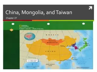
Chapter 24 China, Mongolia, and Taiwan. 7 th Grade Social Studies. CHAPTER 24. China, Mongolia, and Taiwan. Section 1: Physical Geography Section 2: China’s History and Culture Section 3: China Today Section 4: Mongolia and Taiwan. Section 1: Physical Geography.

E N D
Chapter 24 China, Mongolia, and Taiwan 7th Grade Social Studies
CHAPTER 24 China, Mongolia, and Taiwan Section 1:Physical Geography Section 2:China’sHistory and Culture Section 3:China Today Section 4: Mongolia and Taiwan
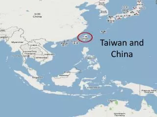
Section 1: Physical Geography Continent View (Asia)
Locate • Himalyas (him a la ya) • Mt. Everest • Kunlun Mts. (Koon –loon) • Tian Shan (tyen shahn) • Plateau of Tibet • Taklimakan Desert (tah-kluh-mu-khan)
Locate • Tarim Basin (Dah- reem) • Gobi (Goh-bee) • North China Plain • Sichuan (Red) Basin (See-Chwahn) • Xi River (Shee) • Huang He (wong) • Chang River
Travel could be difficult due to mountains, rivers, and vast deserts. The largest three island countries are the Philippines, Japan, and Indonesia. Physical Map (p.535)
Both China and Malaysia have land on both the mainland and the islands. Physical Map (p.535)
People might not live in western China because of the mountains and deserts; people live in eastern China because of the rivers and plains. Physical/Population Maps (p.535 538)
Why study China, Mongolia, and Taiwan? • Americans buy many goods that were produced in China and Taiwan; these countries are important trading partners of the United States • China has the largest population of any country • China’s strategic location and its status as a nuclear power influence the foreign policy of the United States.
Why study this region? • Mongolia and China have shaped world history, and China has made important cultural and technological contributions to the world
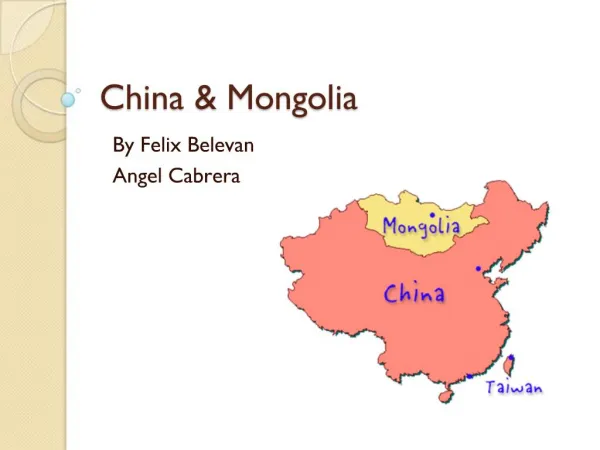
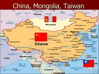
Mongolia shares a border with just one of the region’s other countries. In SE Asia Laos is landlocked, in East Asia Mongolia is landlocked. Political Map (p.536)
The Himalayas form the border of SW China; rivers also form borders in this region. Political/Physical Maps (p. 535 536)
Mongolia has a steppe climate. The wet monsoons flow from south to north; the dry monsoons flow from north to south. Climate Map (p.537) N S N S
This region has a variety of climates because it includes a wide variety of latitudes, landforms, and elevations. Climate Map (p.537)
The South China Sea is stormy due to the warm climate and monsoon winds. Climate Map (p.537)
The population density in the area between Shanghai and Beijing is more than 520 people per square mile (200 per sq km) Population Map (p.538)
The Taklimakan Desert is the reason for the low population density in western China. Population/Physical Maps (p.538)
The largest three island countries are the Philippines, Japan, and Indonesia. Both China and Malaysia have land on both the mainland and the islands. Physical Map (p. 535)
Which SE Asia country entirely on the mainland shares a border with just one of this region’s other countries? It is the only landlocked country in SE Asia? Political Map
Comparing • Compare this map to the physical map of the region. Which physical feature forms a natural border of southwestern China?
Vocabulary • Dikes – High banks of earth or concrete built along waterfronts to help reduce flooding • Arable - Suitable for growing crops
Vocabulary • Emperor- A ruler of a large empire • Dynasty- A ruling family that passes power from one generation to the next • Porcelain- A type of very fine pottery • Martial law- Military rule • Pagodas- Buddhist temples
Vocabulary • Command economy- an economy where the government owns most industries and makes most economic decisions • Multiple cropping- 2 or 3 crops are raised each year on the same land • Most-favored-nation status- countries with this status get special trade advantages from the US
Gers - (GURHZ) Large, circular tents that are easy to raise, dismantle, and move; used by nomadic herders in Mongolia Vocabulary What in this photo tells you about Mongolian life?
Main Ideas • The Plateau of Tibet between the Himalayas and the Kunlun Mts. is the world’s largest plateau. Mount Everest is the world’s tallest mountain and it is located on China’s border with Nepal.
Main Idea • The Huang, Chang, and Xi Rivers are 3 major rivers in eastern and southern China. The Huang affects the people of China because it often floods. • The Gobi and Taklimakan deserts are the regions driest areas.
SECTION 1 Physical Geography Climate Type Region Humid and wet Southeastern coastal region Dry Northwest Extreme northwest Desert
Section 2: China’s History and Culture Great Wall of China
The Great Wall of China • The Great wall of China was built to protect against northern invaders • Runs about 4500 miles east to west • Over 2000 years old • Joined together by the Qin dynasty
Located in the exact center of the ancient city of Beijing Imperial Palace of the mid-Ming and Qin Dynasties China’s Forbidden City
Museum of Heroes Mao Tse-tung or Mao Zedong was the chairman of the communist party of China
Main Ideas • The Qin dynasty built the Great Wall and recorded history. They also gave the country its name. The Han dynasty expanded the kingdom, extended the Great Wall, invented the compass, paper, and porcelain.
Main Idea • The Mao government took control of property, housing, and jobs. It gave women equal status, instituted one child family law and suppressed religion.
Main Idea • The government is now modernized and it turned parts of the economy over to private sectors.
SECTION 2 Featuresof ChineseCulture China’s History and Culture Values and Beliefs Lifestyle • Education highly valued • One-child policy • Government control of newspapers and telephone system • Varied regional cuisines • Taoism—emphasizes path that agrees with everyday concerns • Confucianism—respect for parents and rulers; parents and rulers act with justice • Buddhism—search for truth, knowledge, and enlightenment Languages • Seven major Chinese dialects • Mandarin the official language
Main Ideas • Most people live in China’s eastern half because the western half is mostly desert and mountain ranges.
Main Idea • Most of China’s important cities are located along the Chang and Xi rivers because they began as trading ports.
Main Idea • By cutting terraces into hillsides and practicing multiple cropping the Chinese have been able to increase production.
SECTION 3 China Today Eastern China • Beijing—China’s capital, largest city in northern China • Nanjing—iron-ore and coal mines • Shanghai—China’s largest city, leading industrial center and a major seaport, much new construction • Wuhan—iron-ore and coal mines • Guangzhou—southern China’s largest city, major industrial city • Hong Kong—former British colony that maintains free-market economy, densely populated, a major seaport, major banking center, commerce, and tourism • Macao—former Portuguese colony, port Interior Chongqing—one of few large cities in China’s interior
Main Ideas • Most people in Mongolia earn a living by herding animals. • Taiwan has changed from an economy based on agriculture to one based on industry
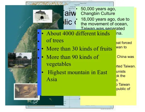
Main Idea • A brief outline of the significant groups that have influenced Taiwan’s history. • Chinese settle in 600s • Japanese control in 1100s • Chinese raiders drive out Europeans in 1600s • Treaty gives Japan control in 1895 • China gets control after WWII • Chiang Kai-shek and nationalists flee to Taiwan
SECTION 4 Dominated by Chinese ways Population is 85% native Taiwanese. TAIWAN’S CULTURE Americans and Europeans have exerted influence in recent years. Japanese influenced building styles and some foods. Mongolia and Taiwan