Download
1 / 20
200 likes | 323 Vues
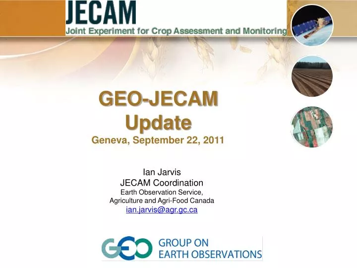
Ian Jarvis JECAM Coordination Earth Observation Service, Agriculture and Agri-Food Canada ian.jarvis@agr.gc.ca. GEO-JECAM Update Geneva, September 22, 2011. Overview of GEO-JECAM The GEO Agricultural Community of Practice Established the JECAM to:

E N D
Ian Jarvis JECAM Coordination Earth Observation Service, Agriculture and Agri-Food Canada ian.jarvis@agr.gc.ca GEO-JECAM Update Geneva, September 22, 2011
Overview of GEO-JECAM The GEO Agricultural Community of Practice Established theJECAM to: Enhance international collaboration around agricultural monitoring towards the development of a “systems of systems” to address issues associated with food security and a sustainable and a profitable agricultural sector worldwide JECAM will achieve this objective by: Facilitating the inter-comparison of monitoring and modeling methods, product accuracy assessments, data fusion and product integration, for agricultural monitoring Network distributed regional experiments on cropland pilot sites around the world representing a range of agricultural systems Share time series datasets from a variety of earth observing satellites and in-situ data and assess them for agricultural assessment and monitoring
Overview… 2 Synthesis of the results from JECAM will enable: • Development of international standards for monitoring and reporting protocols • A convergence of the monitoring science approaches to define best practices for different agricultural systems • Identify requirements for future Earth Observation systems for agriculture monitoring The Approach: • Collect and share time-series datasets from a variety of Earth observing satellites and in-situ crop and meteorological measurements for each site. • The Committee on Earth Observing Satellites (CEOS) and several member agencies are supporting this activity with the acquisition and timely provision of data for JECAM.
Progress • November 2009, the first JECAM meeting was held at the SAR for agricultural monitoring workshop, Kananaskis Alberta, Canada • December 2009, at the request of the GEO Agricultural Community of Practice, Canada took on JECAM coordination • January 2010, call to international community to provide standardized documentation of research sites, 7 sites initially submitted • March 2010, a website was launched for the JECAM initiative: http://www.umanitoba.ca/outreach/aesb-jecam/
Progress, continued • September 2010, JECAM Hong Kong to focus on Asian sites and data sharing issues. In-situ data sharing protocols were developed and agreed to. • October 2010, JECAM Brussels, Europe and Africa Focus • May, 2011, Curitiba Brazil South America Meeting tied to XV SBSR Symp. Brazil. Focus on South America • September 2011, Nairobi Kenya. Crop and Rangeland Monitoring Meeting, JECAM focus on Africa • October 2011, JECAM presentation at GEOSS in the Americas meeting, Chile
USA Paraguay 6 JECAM activities are being undertaken at a series of study sites which represent the world’s main cropping systems and agricultural practices. 12 sites currently exist. Additional sites will be added to meet science objectives and ensure all major crop systems are addressed.
Progress, Earth Observation Data Access Developing the “Virtual Constellation” • A JECAM user needs document has been drafted by JECAM that outlines the science plan and detailed data needs for the 12 sites. • A meeting between JECAM coordination, CEOS, Public Space agencies and Commercial satellite providers took place June 21-22 in Ottawa, Canada • At the Ottawa meeting the space agencies and commercial providers pledged support for JECAM, JECAM was afforded a high priority by all data providers • We are currently implementing a process for data acquisition for the Southern Hemisphere sites, anticipate data will be flowing within weeks 7
EO Data Acquisition Process Currently being piloted for Southern Hemisphere sites • JECAM sites identify needs on a template containing participating sensors (Slides to follow) • NASA-CEOS COVE tool is used to identify potential acquisition • JECAM coordination has worked with data providers to create a streamlined “cookbook” on how to order and access data from each provider. The entire data acquisition process is being assembled in one comprehensive document • Space agencies and commercial providers acquire and distribute the data to the JECAM site leads. 8
Current Status • The data acquisition planning with CEOS, Space Agencies and Commercial providers is going very well and we are on track for full coordinated implementation of the data plan early next year (S. Hemisphere September-October) Current Priorities • JECAM needs representation from all major cropping systems of the world, at this point Africa and India is not represented (Africa meeting next week) • JECAM website is out of date and does not reflect new sites. • Need to align JECAM activities with G20 work plan Looking Forward • Once data acquisition process is in place JECAM focus will shift to enhanced collaboration between sites and the development of comparative studies towards informing the “system of systems” for agricultural monitoring
Looking Forward, GEO-GLAM and JECAM • We can not have a global “system of systems” for agricultural monitoring without the interaction of national and regional monitoring systems • Collaboration may take many forms, for example: • Around capacity building • Within similar cropping systems/ecosystem types • Within Sensor type (i.e. SAR over a variety of systems) • Comparative studies for the identification of best practices over many crop systems • The Geneva G20 GEO-GLAM work planning meeting may provide an opportunity to move collaboration forward
Questions? http://umanitoba.ca/outreach/aesb-jecam/
CEOS Visualization Tool (COVE) • JECAM EO Planning • Tool developed by NASA (Brian Killough) • COVE (www.ceos-cove.org) has two major objectives ….(1) Satellite sensor groundtrack visualization(2) Single point or multi-satellite coincidence calculations • Includes forecasts for 30 current missions and notional data for 7 future missions. Numerous instrument modes are accommodated for each mission. • Output includes solar inclination, solar zenith, day/night viewing. Other features include EXCEL output, collaborative sessions, shapefile conversion, and saving viewing states. ALOS-AVNIR2 over Tuz Golu
Future Enhancements • Expanded Mission Database – add more missions for land imaging to support JECAM. • Create a dedicated COVE Website – improved support for COVE access, general information, videos, sample cases, applications, user feedback and user registration. • New Features for 2012 – Rapid acquisition planning tool, automated forecasting, sensor viewing angles, IPAD application.
NASA - COVE support for the JECAM Project • With the relevant mission and instrument combinations in COVE, it is possible to forecast sensor ground tracks over JECAM agricultural regions. • COVE currently includes 8-optical and 11-radar current missions and 5 future missions relevant to JECAM. • COVE forecasts are being used to plan potential satellite acquisitions in support of JECAM objectives. • COVE will develop a dedicated JECAM link on its new website to display relevant mission information, shapefiles and KML files of JECAM regions, future data acquisition reports, and other supporting data for JECAM.
How do sites join JECAM • JECAM needs representation from all major cropping systems of the world • Develop a brief description of a monitoring research site and submit this for JECAM review. (note: can be an new or existing site) • Information should include Location, site leadership, research topics and cropping system(s) studied. • Once approved you will be asked to complete more detailed information templates describing your science plan, in situ and detailed satellite data needs What's next for JECAM • Once the virtual constellation is established the JECAM focus will shift to enhanced collaboration between sites and the development of comparative studies in support of the G20 GEO-Global Agricultural Monitoring Initiative • At this point Africa and India is not represented