Download
1 / 18
180 likes | 199 Vues
This workshop discusses the implementation of a generic road matching approach for integrating postal data into road layers. It covers the motivation behind the project, the matching strategy used, assessment of matching certainty, and the application of integrating postal data. The workshop took place in Vienna in 2006.

E N D
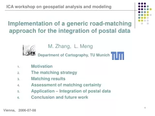
ICA workshop on geospatial analysis and modeling Implementation of a generic road-matching approach for the integration of postal data M. Zhang, L. Meng Department of Cartography, TU Munich • Motivation • The matching strategy • Matching results • Assessment of matching certainty • Application – Integration of postal data • Conclusion and future work Vienna, 2006-07-08
1. Motivation - Project “Postal data integration” Task Enriching Basis DLM with post addresses, which are bound to the road layers of TeleAtlas. Problem Absence of some important road attributes, such as street name, etc. Solution Matching between Basis DLM und TeleAtlas
2. The matching strategy An integrative matching process (1) Data preprocessing (2) Matching of road objects (3) Unsymmetrical Buffer Growing (4) Conflict solution Data Matching Data integration
2.1 Data preprocessing (a) Reduction of noisy or irrelevant details
Classification 0 . 1 The direction of AA‘. 2 The direction of AA‘. Classification 0 1 2.1 Data preprocessing (b) Description of topology with node geometry
A 0 B B 2 1 B 0 : objects in dataset 1 Improvement process: Point B : B B 1 1 0 B Point B : B : objects in dataset 2 2 2 0 Line B B : Delete 1 2 : improved objects in dataset 2 2.1 Data preprocessing (c) Reduction of topological differences
2.2 Matching of road objects Step1: Instantiation of the reference polyline
s 2.2 Matching of road objects Step 2: Identification of possible matching candidates Step 3: Exclusion of incorrect candidates α
2.2 Matching of road objects Step 4: Exactness inspection of the matching candidates 0: an entirely wrong match 1: a perfect match. {
2.2 Matching of road objects Step 5: Establishment of link file
2.3 Unsymmetrical Buffer Growing A C B D 46 M The mean and variance of the position discrepancies between the matched pairs can be used as the indicators to capture the global deviation in the current matching area. 41 M
2.4 Conflict solution Conflict Criterion: Larger or Largest “Matching_SumW” Solution
3. Matching result (a) (b) (c)
4. Assessment of matching certainty ? ? Matching Errors (a) Definition of the Variable „Matching_Certainty“ Definition { IF Conflicting match THEN Matching_Certainty = ELSE Matching_Certainty = END IF }
4. Assessment of matching certainty (b) Distribution of “Matching_Certainty”
4. Assessment of matching certainty (c) Classification of the Matching Certainty
5. Application – Integration of postal data Integration process of postal data
6. Conclusion and future work • Conclusion • Unsymmetrical Buffer Growing - generic nature • Definition of Matching Certainty and classification of matching results - a more comfortable interaction. • Future work • Refining the current matching approach • Dealing with the special matching cases