Download
1 / 35
360 likes | 591 Vues
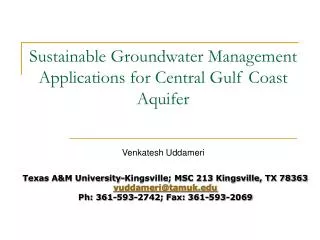
Sustainable Groundwater Management Applications for Central Gulf Coast Aquifer. Venkatesh Uddameri. Texas A&M University-Kingsville; MSC 213 Kingsville, TX 78363 vuddameri@tamuk.edu Ph: 361-593-2742; Fax: 361-593-2069. Background.

E N D
Sustainable Groundwater ManagementApplications for Central Gulf Coast Aquifer Venkatesh Uddameri Texas A&M University-Kingsville; MSC 213 Kingsville, TX 78363 vuddameri@tamuk.edu Ph: 361-593-2742; Fax: 361-593-2069
Background • Effective groundwater management is necessary for sustainable use of aquifer resources • Groundwater resource consists of two components • Natural capital – Groundwater in stock • Physical capital – Groundwater utility • Benefits obtained from groundwater use • Often quantified in monetary terms • Sustainability current generation does not threaten future generations access to this resource • Weak Sustainability – Future generations have same access to total groundwater capital as the current • Does not differentiate between physical and natural capital • Availability of alternative water resources • Strong Sustainability – Future generation have same access to each individual components • Differentiates between physical and natural capital • May curtain economic growth and utilities
Groundwater Planning and Management • Aquifer management requires two interconnected pieces of information • How much water is in the aquifer? • Hydrogeology aspect • How much do we want to extract? • Policy making aspect Q
Policy H1 H2 F = 1 Conservation F = 0 Mining Groundwater Management • Groundwater Planning can be mathematically expressed as follows: Hydrogeology H2 = F * H1 Risk-Attitudes
Groundwater Management • The hydrogeology aspect is derived using a groundwater flow model • Provide estimates for groundwater head under different scenarios • Hydraulic head defines amount of water in the aquifer • Use water balance and Darcy’s law • Groundwater planning requires a crystal ball • The flow model provides one • Flow model can characterize the head variability due to: • Hydroclimatology • Precipitation, evapotranspiration • Anthropogenic factors • Abstractions for various uses • Alterations to land use and land cover • Hydrogeologic variability • Changes in geologic features in space / time • Surface water-Groundwater Interactions • Exchange between rivers/creeks and aquifers Hydrogeology
Questions related to flow modeling • What is the right model to use? • Depends upon the application context • Models are like maps • Need a different map for different purposes • “Scale” of the model is an important factor • Large scale models capture regional interactions • Usually better for screening purposes • Does Refugio has more groundwater than Goliad • The resolution of the model has to be fairly coarse • Refined models capture local interactions • Required for contaminant transport • Are persons in House A exposed to chemical A more than those in House B • Data requirements magnify significantly Selection of an appropriate model is often an iterative process Hydrogeology
Case-Study Groundwater Flow Models for use in Central Gulf Coast Aquifer (Refugio Groundwater District)
A County-scale Model • A two-layer county scale model was calibrated for Refugio county • GHB and horizontal hydraulic conductivity as calibration parameters • 0.3 mi x 0.3 mi grid size Layer -II Hydrogeology
County-scale Model – Post-audit • The county scale model post-audit revealed the following: • Model captured current trends fairly reasonably • Parsimonious model • Model domain consistent with GW district boundary • Need for arbitrary boundary conditions on the western side • Checked for reasonableness and conservatism • Recharge areas of the aquifer outside the district boundary • Actions of other districts can affect GW in Refugio and vice-versa • Goliad and Bee counties • Need a model to incorporate these effects • Satisfactory for preliminary planning & provided insights on data limitations and future modeling efforts Hydrogeology
State GAM Basin-scale modeling • TWDB recently released a basin-scale model for the Central Gulf Coast aquifer • 1 mile x 1 mile grid • Model domain is large • Wharton to Kenedy counties • Model was reasonably calibrated • Focus was on high GW use areas • Jackson county & Kleberg county Hydrogeology
Basin-scale modeling - Post Audit • Model was qualitatively evaluated for use in the Central section of the central gulf coast aquifer • Refugio, Bee, Goliad, DeWitt, Victoria and Live Oak • Provides useful information on geology, hydrology • Estimates for recharge, geologic cross-sections, etc. • Limited data from the six county area was used in the model development / calibration • Model underpredicted baseflows in several streams within the area of interest • Not suited when wells screen entire (or lower sections) of the Evangeline aquifer • Useful starting point for a more-refined modeling effort Hydrogeology
Multi-County scale flow model • A Multi-county groundwater flow model is currently being developed • Phase-I is the development of a steady-state model • Incorporate lessons learnt from previous efforts • Use TWDB GAM information as basis • Refine some of its limitations • Close interactions with several groundwater districts • Update water use data; identify new pumping wells • Technical Stakeholder Group - provide guidance and data • Representatives from a wide section of stakeholders with differing interests Hydrogeology
State GAM Lavaca River San Diego, San Fernando Creek Model Domain Hydrogeology
Model Conceptualization - Geology • Model follows TWDB GAM conceptualization • Model has 4 aquifer formations • Chicot • Evangeline • Goliad sands • Burkeville • Aquitard • Jasper • Each water-bearing formation is represented by two layers • Better distribution of well pumping Hydrogeology
Chicot 2 Layers Evangeline 2 Layers Burkeville 1 Layer Jasper 2 Layers Cross-Section Lavaca river Carrizo-Wilcox Coast Sanjose,Sandiego, Sanfernando creeks TOP VIEW Model Conceptualization - Geology • Stratigraphy from Baker (1979) and Ryder and Carr (1985); Solis (1981) • Drillers records • 35 e-logs used to construct the cross-sections • ~ 10 used for QA/QC Hydrogeology
Model Conceptualization - Discretization • Use 0.5 x 0.5 mile grid (0.25 sq. miles) • 216 x 170 grids (36720 cells) • Orientation parallel to the regional groundwater flow Hydrogeology
CHICOT Evangeline Burkeville Jasper Discharge Anthropogenic demand Evapotranspiration General Head boundary Cross formational flow Precipitation Groundwater flow No Flow Boundary Model Conceptualization – Boundary Conditions • No-Flow boundary on the west • Carrizo-Wilcox – Gulf Coast Interface • General Head / No flow Boundary on the east • Coastal region • Lavaca River on the north • San Jose/San Diego/San Fernando creeks in south Hydrogeology
Current efforts • Finalize the water use information • Start calibration • Hydraulic conductivity and conductance as calibration parameters • Use TWDB groundwater database to identify calibration and evaluation wells • Use PEST for automatic calibration Hydrogeology
Groundwater Management – Policy Instruments • Groundwater Districts need to: • Assess existing total usable amount of groundwater in the district • Develop production rules for permitting wells • Develop well-spacing guidelines • Protect against negative externalities • Drying up of shallow wells due to large-scale pumping • Reductions in baseflows to streams and creeks • Fish kills and other surface water impairments • Intrusion of salt-water • Subsidence • Enhanced vulnerability to water supplies • Groundwater models can be used to address these issues • Will help make a more informed decision • Decision-support tools
Optimization Model • Coupled the groundwater model with a management model to estimate available groundwater under pre-specified constraints • Preserve baseflows, prevent salt-water intrusion, etc. • Use optimization technique Simulation Model Optimization Model • Roughly 40,000 acre-feet of water is available for the conditions specified • Saltwater intrusion constraint is very significant • Most of the groundwater recharge occurs in adjoining counties • Cooperation amongst adjoining districts is vital
What about Uncertainties? Does geologic variability or diverse preferences of decision-makers have a bigger impact on water availability estimates?
Problem Statement • Geologic variability is to be expected • Lack of data • Calibration is non-unique • Stakeholders have different viewpoints • Place all the pumping wells in recharge areas • Economically-inclined • Restrict pumping to discharge areas • Conservation-oriented • Should be spend our resources collecting better geologic data OR reconcile differences between stakeholders?
Interval Optimization • Used interval optimization technique to assess water availability under uncertainty • All geologic parameters were assumed to be accurate only within two orders of magnitude • Typical variability • Pumping was mostly restricted to either recharge areas or discharge areas
Interval Optimization • Both had almost equal impacts • Collect more data AND reconcile stakeholder differences • Consensus necessary on salt-water constraint Field Sampling Efforts Stakeholder Technical Group
Impacts of Model Discretization • Do model development decisions affect groundwater availability estimates? • Do we need to specify “safety factors” to induce conservatism • Factorial Sensitivity Testing to study discretization effects • Discretization can have some effect, but not as much as geology or management choices • Coarser grids yield conservative estimates when permeability is low (all other things being equal) • Finer grids yield conservative estimates in highly permeable sand and gravel (all other things being equal)
Developing Well Spacing Guidelines How can we use models to obtain well spacing guidelines
Well Spacing Guidelines • A nonlinear optimization approach was used to determine Well spacing guidelines for Refugio GCD using Theis equation • Applicable to confined aquifers • Conservative in unconfined aquifers • Unconfined aquifers have greater storage
Well Spacing Guidelines • Well spacing based on identifying the radius of influence of the well • Drawdown at the perimeter should be negligible • < 0.05 ft • No negative externalities • Well spacing determined as a function of pumpage • Using multiple optimization runs • Well spacing ranges from 0.63 ft/gpm – 4.2 ft/gpm • Average well spacing ~ 2 ft/gpm • Well spacing is not an issue when pumping is less than 20 gpm • Not an issue for exempt domestic wells ( < 25000 gpd)
Baseflow Externalities Reconcile Competing Economic and Ecological Objectives to estimate water availability
Problem Statement • Pumping groundwater can lead to economic benefits • Costs associated with pumping • Marginal costs increase with increased pumping • Benefits associated with pumping • Marginal benefits decrease with increased pumping • Pumping groundwater can reduce baseflows • Impairment and lost recreational opportunties • Maximize economic gains over the planning horizon while avoiding baseflow externality Q Critical Limit
Baseflow Externality • Hydroeconomic analysis to identify allowable pumping rates during the planning period • Optimal control theory • Model results indicated that explicit policy statements are necessary to avoid baseflow externality • If pumping is not curtailed to some critical limit, there will be significant reductions to baseflows • Comparison with a purely economic-driven policy was helpful • Shadow price of maintaining a particular baseflow • Compare shadow price with willingness to pay
Closing Remarks • Models are useful tools to guide policy planning endeavors • Will never provide exact answers • Models need to be understood and accepted by stakeholders • Modeling is a process not an event • Models should be evaluated in the context of the application • Keep the “big picture” in mind • Easy to lose sight of forest for the trees • Evaluating models => Assessing its assumptions • All models have assumptions!!
Closing Remarks • Emphasize simplicity – Goal is to find the simplest model that will fit your needs • Not any simpler or complex • Avoid “cosmetic complexity” traps • Evaluate cost-benefits • Be skeptical but not cynical about models • Carryout post-audit analysis • Proceed with caution • Coupling flow models with other tools is beneficial • Optimization; data collection; pump tests
Sponsors • Refugio Groundwater Conservation District • South Texas Alliance of Groundwater Districts • Goliad Groundwater Conservation district (lead) • National Science Foundation – Center for Research Excellence in Science and Technology – CREST-RESSACA • National Oceanic and Atmospheric Administration (NOAA) • Texas Water Resources Institute (TWRI/USGS)