
Introduction
Spatially and Temporally Complete Surface Albedo Product Over the ARM SGP Area for 2000-2003 Period. Luo, Y. a , Trishchenko,A.P. b , Latifovic, R. b , Khlopenkov, K. b , and Li, Z. c a Noetix Research Inc., b Canada Centre for Remote Sensing, c University of Maryland. Introduction

Introduction
E N D
Presentation Transcript
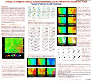
Spatially and Temporally Complete Surface Albedo Product Over the ARM SGP Area for 2000-2003 Period Luo, Y.a, Trishchenko,A.P.b, Latifovic, R. b, Khlopenkov, K. b, and Li, Z.c a Noetix Research Inc., b Canada Centre for Remote Sensing, c University of Maryland Introduction Spatially and temporally complete surface albedo product over the ARM SGP area was generated using data from two Moderate Resolution Imaging Spectroradiometer (MODIS) sensors on Terra and Aqua satellites. A landcover-based algorithm was developed to derive the BRDF model parameters used for albedo retrieval. The approach employs landcover map and multi-day clear-sky composites of directional surface reflectance. Landcover maps were derived from the Landsat TM 30-meter data set, and surface reflectances are from MODIS 8-day, 500m resolution clear-sky composite data products (MOD09). MOD09 data were re-arranged into 10-day intervals for compatibility with other satellite products, such as those from NOVA/AVHRR and SPOT/VGT sensors. Separate datasets for MODIS on Terra and Aqua as well as combined data product were generated at 500-meter spatial resolution every 10 days since March 2000 and March 2003. To fill the data gaps due to cloud presence, we applied various interpolation procedures and data filling methods based on multi-year observation database and referring to results from other locations with similar landcover type. Special seasonal smoothing procedure was applied to remove outliers and artifacts in data series. Surface anisotropic properties derived from MODIS, which is a cross-track scanning instrument, were compared with multiangular observations available from Terra/MISR system. In general, the results compare quite favorably with MISR. For example, the correlation coefficients are between 0.7-0.95 for albedo. The biases are 0.01 on average and standard deviations are 0.02. Selected datasets are currently available at CCRS ftp site: ftp://ftp.ccrs.nrcan.gc.ca/ftp/ad/CCRS_ARM/Satellites. Entire dataset for the period 2000- 2003 will be placed into the ARM archive soon. MODIS Albedo, May 2003 Albedo: When BRDF model parameters are available, they can be used to compute the hemispheric reflectance, i.e. albedo. The direct albedo is defined as albedo of the surface illuminated by a parallel beam of radiation. The diffuse albedo is defined as albedo of the surface when downward radiance field is fully isotropic. For a liner BRDF model such as the Ross-Li, both types of albedo can be computed either by using look-up table of pre-computed kernel integrals or through the analytical approximations expressing albedo as function of BRDF parameters and SZAs. Figure 5 displays the direct albedo maps computed at local solar noon for the red and NIR bands for May of 2003, when an aerosol IOP was conducted around ARM-SGP Central Facility (CF). The top three are the LBF results based on MODIS 10-day clear-sky composite datasets. The MISR images at the bottom represent 1-month composite of albedo product generated by mosaicking individual MISR swaths from day 121 to 151 of 2003. The MISR data were extracted from MISR Level 2 Land Surface Data product and the albedo was derived based on modified Rahman's BRDF model. The mosaicking MISR data for time intervals shorter than 1 month leaves significant amount of missing pixels due to MISR's narrow swath and cloud presence. Even for 1-month interval there are still considerable number of missing surface pixels, which is indicated by white color boxes. The three MODIS maps clearly show significant variation of surface albedo with time; namely, the decreasing of albedo in NIR band around CF indicates a fast change of vegetated canopy during this season (i.e. wheat fields matured) . Figure 5 also emphasizes the advantage of LBF approach for mapping rapid changes in surface properties over short-time intervals. MISR vs MODIS albedo: Pixel-by-pixel comparisons between MISR and MODIS LBF albedo for the red and NIR bands are presented in Figure 6 for April 2001. We grouped results by five major landcover types in the ARM SGP area. Considering the significant short-term variability shown in Figure 5, the MODIS albedo for each pixel is selected from one of the three composites whose date is closest to that of MISR pixel data. Figure 2. Polar plots for Terra and Aqua MODIS reflectances. BRDF and Albedo Retrievals Model Fitting: The fitting of MODIS reflectances by Ross-Li model using our approach is shown in Figure 3. The reflectances are plotted against the VZA. The red and NIR bands are shown for two major landcover types (grasslands and croplands) for two seasons (May and October of 2003) and various NDVI levels. Each black square represents one binned MODIS reflectance obtained at the pre-processing step. Red triangles show fitting results of the Ross-Li BRDF model. BRDF Landcover Based Fitting Approach Basic idea:The landcover based fitting (LBF) approach is to use a multi-day composite surface reflectance dataset for a certain area, and to group the pixels according to landcover type as well as green biomass levels (e.g. NDVI). With these grouped data, which may include observations at various solar zenith angle (SZA), view zenith angle (VZA) and Sun-satellite relative azimuth angle (RAA) conditions, the BRDF model parameters can be fitted optimally for each landcover type. The particular BRDFs for each pixel are then determined through the adjusting of the general landcover-grouped BRDF to the observed reflectances corresponding to that pixel. Landcover map: We selected the National Land Cover Dataset as our initial map of landcover types, which was compiled from the Landsat TM imagery with a spatial resolution of 30 meters and supplemented by various ancillary data. We aggregated it to 500m and mapped it to the ARM-SGP area, which is shown in Figure 1. MISR Albedo, May 2003 Figure 5. MODIS and MISR albedo maps. It should be noted that some additional noise in this comparison might be caused by the difference in the spectral response function between the two systems and also due to the re-projection and spatial mismatch between two independent products. Despite these reasons, in most cases the data points fall around the line with slope equal to one. The correlation coefficients (R) are normally larger than 0.80. Mean biases () are usually small, and standard deviations () are at the level of 0.01 or 0.02 for red and NIR bands. Figure 3. BRDF fitting. MODIS BRDF parameters: For theoretical modeling kernels the weights a0, a1 and a2are considered being functions of surface structural parameters, optical properties of canopy elements and Leaf Area Index (LAI). Figure 4 show these three parameters for red and NIR channels for May 1-10, 2003, which was derived based on combined Terra and Aqua MODIS datasets. 38N 36N Figure 1. Landcover map derived from Landsat TM data. Figure 5. MISR vs MODIS albedo. BRDF model:The RossThick-LiSparse reciprocal model was used for its good performance for data with limited angular distributions, computational efficiency and linear structure. f1 is called RossThick kernel representing scattering from a dense leaf canopy based on a single-scattering approximation of radiative transfer theory. f2 is LiSparse kernel which is derived, assuming a sparse ensemble of surface objects, from the geometric-optical mutual shadowing model. Parameters a0, a1 and a2 are coefficients of the kernels and related to isotropic, volumetric and geometric reflectances, respectively. Data-bin pre-processing: The number of pixels for dominant landcover classes (i.e. grasslands) is very large, and their distribution with respect to VZA and RAA is irregular. Unequal weights for different angles may lead biasing the fitting results toward most frequently observed data points and ignoring valuable but less frequent data. To address this problem, all data points of certain landcover class are sorted into small bins with certain angular and NDVI intervals, e.g. 5°, 5°, 10° and 0.1 for SZA, VZA, RAA and NDVI, respectively. Data collected within each data bin are statistically processed to eliminate outliers and reduce noise in the data. An example of such pre-processed data for grasslands is given in Figure 2, i.e. the polar plots of VGT surface reflectance of three spectral bands for 4 months in the ARM SGP area. The radius of the polar plot represents the VZA, and the polar angle is the RAA. 34N • Summary • The purpose of this work was to develop an approach suitable for generating surface BRDF/Albedo product using multi-day composite datasets obtained from satellite observations. • The proposed LBF approach has several advantages with respect to pixel-based method. It increases the number of samples used in BRDF fitting procedure and thus makes retrieval of the BRDF shape more reliable. It performs data binning process which reduces noise or outliers and prevents biasing due to uneven distribution of observational conditions. It can generate albedo based on short time interval composite and capture the rapid variations of the surface properties. • The LBF approach can be easily applied for joint data processing of multi-day clear-sky composite data assembled from multiple platforms. Spectral correction procedure has to be implemented to merge data from similar but not identical sensors to reduce spectral response function effect. • The potential limitation of this approach is that it may not always capture subtle spatial differences in the BRDF behavior within the same landcover class. • Results shown in this poster are based on our primary studies. Further validation and comparison among different sensors, with ground measurements, and improvement are in process. • Generated BRDF model parameters and albedo has been released through the CCRS ftp site: • ftp://ftp.ccrs.nrcan.gc.ca/ftp/ad/CCRS_ARM/Satellites/. 96W 94W 100W 98W VEGETATION/SPOT4 Figure 4. RossThick-LiSparse BRDF parameters, i.e. isotropic, volumetric, and geometric parameter.


