Jeff Kargel/USGS GLIMS summary presentation
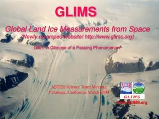
GLIMS Global Land Ice Measurements from Space (Newly revamped website! http://www.glims.org) Glim: “A Glimpse of a Passing Phenomenon”. Jeff Kargel/USGS GLIMS summary presentation. ASTER Science Team Meeting Pasadena, California, March 2004. www.GLIMS.org. • Programmatic developments

Jeff Kargel/USGS GLIMS summary presentation
E N D
Presentation Transcript
GLIMSGlobal Land Ice Measurements from Space (Newly revamped website! http://www.glims.org) Glim: “A Glimpse of a Passing Phenomenon” Jeff Kargel/USGS GLIMS summary presentation ASTER Science Team Meeting Pasadena, California, March 2004 www.GLIMS.org
• Programmatic developments -- U.S. funding/projects -- GLIMS consortium organizational development • NSIDC mini-presentation -- GLIMS Data archive -- Data analysis quality assessment “round-robin” • Sample results of ASTER/glacier science results, Himalaya • New GLIMS-related collaborations (and you are invited) -- HIGH ICE (High Asian Institutes of Glaciology: Hydrology, Ice, Climate, and Environment) -- Siachen International Peace Park (Kashmir)
NASA OES-02ASTER Science Team Member Proposal(funded)Global Land Ice Measurements from Space (GLIMS) Core Functions: International Organization, ASTER Glacier Image Data Management, and Glacier Hazard/Emergency ResponsePI, Jeffrey S. Kargel
New NSIDC GLIMS Funding REASoN CAN: Detection and Evaluation of Change in Glacier Systems Using the Global Land Ice Measurements from Space (GLIMS) Database ( PI: Richard Armstrong) NRA-03-OES-02: GLIMS Core Functions (PI: Richard Armstrong)
Other funded GLIMS proposals • M. Bishop and J. Shroder, UNO/Omaha, OES-02, “Climate Forcing and Glaciers in the Western Himalaya: Assessing Glacier Fluctuations using ASTER Data” • G. Hamilton, U Maine, OES-02, “High-resolution Satellite Image Mapping of Arctic Glacier and Ice-cap Fluctuations: Evidence for Regional Climate Change and their Contribution to Sealevel” • A. Fountain, PSU/Portland, OES-02, Topic: ELA and glaciers of Alaska and the Conterminous U.S.
Global Land Ice Measurements from Space www.GLIMS.org GLIMS primary goal: Determine extent and changes of Earth’s glaciers PREVIOUS RESULTS AND CONTINUING TASKS: • Acquired ~40,000 ASTER L1A scenes (of any quality) • Archived and distributed over 5000 L1B glacier scenes • Timely ASTER imaging response to glacier hazard events • Purchased 150+ Landsat ETM+ scenes for RC ftp download • 25 Regional Centers producing digital maps of glaciers and glacier change • Mapping current extent of exposed land ice and debris-covered ice • High resolution surface displacement fields • Automating data extraction from ASTER • GLIMSView tool for glacier analysis • Glacier lake extent and temperature variations using multi TIR bands • Designed GIS digital database for GLIMS glacier inventory (NSIDC) • GLIMS book (Praxis-Springer) in the works! • FUNDING: • -- U.S. institutions funded by six NASA grants (Office of Earth Science), $1.6M/yr • -- GLIMS Coordination Center (USGS/Flagstaff) and ASTER Science Team member- • ship funded by NASA and USGS Cryosphere Program.
GLIMS Regions and Regional Centers • GLIMS is an international consortium of 25 regional centers • 82 cooperating institutions worldwide • Coordinated by U.S. Geological Survey - Flagstaff
Science Questions from the Research Strategy Variability Forcing Response Consequence Prediction Precipitation, evaporation & cycling of water changing? Atmospheric constituents & solar radiation on climate? Clouds & surface hydrological processes on climate? Weather variation related to climate variation? Weather forecasting improvement? * * * Global ocean circulation varying? Changes in land cover & land use? Consequences in land cover & land use? Transient climate variations? Ecosystem responses & affects on global carbon cycle? * Surface transformation? Changes in global ocean circulation? Coastal region change? Trends in long-term climate? Global ecosystems changing? * * * * Stratospheric ozone changing? Stratospheric trace constituent responses? Future atmospheric chemical impacts? Ice cover mass changing? Sea level affected by climate change? Future concentrations of carbon dioxide and methane? * Motions of Earth & interior processes? Pollution effects?
Glaciers in the context of 12 major national research applications Major research applications Potentially significant research applications
Kolka Glacier disaster - ASTER rapid response From: Kääb, Wessels, Haeberli, Huggel, Kargel, and Singh Khalsa. Rapid ASTER imaging facilitates timely assessment of glacier hazards and disasters, in press, EOS
Kolka Glacier disaster • 80 million cubic meter rock/ice avalanche and subsequent debris/mud flows on September 20, 2002 • Overran Karmadon village 18 km down valley • Over 120 killed • Mudflow continued 15km further down valley • Rapid ASTER imaging response over several days following emergency. • ASTER data used by emergency response teams