Download
1 / 18
180 likes | 284 Vues
Learn about the latest developments in marine and tropical weather services at the NWS Partners Meeting in August 2013. Explore new programs, tools, and policy changes in marine and tropical weather forecasting. Stay informed about the Experimental National Marine Weather Web Portal, Tropical Cyclone Impact Graphics, and more. Get insights on storm surge, hazard statements, and tropical cyclone watches and warnings. Enhance your understanding of weather-related hazards affecting coastal and marine areas.

E N D
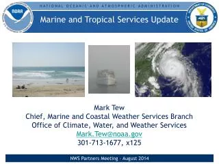
Marine and Tropical Services Update Mark Tew Chief, Marine and Coastal Weather Services Branch Office of Climate, Water, and Weather Services Mark.Tew@noaa.gov 301-713-1677 x 125 NWS Partners Meeting - August 2013
Marine Program Overview • Expanding the National Digital Forecast Database into the Offshore and High Seas • Experimental National Marine Weather Web Portal • Experimental Beach Hazards Statement NWS Partners Meeting - August 2013
Expanding the National Digital Forecast Database into the Offshore & High Seas • Four variables to begin: wind, wind gust, wave height and marine hazards • Joins the new interactive graphical display • Will soon be joined by grids further north and then in Hawaii and Alaska NWS Partners Meeting - August 2013
Experimental National Marine Weather Web Portal:preview.weather.gov/mwp NWS Partners Meeting - August 2013
Experimental Beach Hazards Statement • New segment & VTEC code (BH.S) in the NWS Coastal Hazard Message (CFW) • Provides information about hazardsaffecting people in coastal/beach areas and in the surf zone • Locally significant weather-related hazards issued from all participating test offices • Ecological-related hazards at select offices (partnership w/NOAA LOs or gov’t agencies) • Test began May 2012: 6 WFOs • Expanded May 2013: 10 more WFOs (16 total) Feedback: weather.gov/survey/nws-survey.php?code=chmbhs NWS Partners Meeting - August 2013
Tropical Program Overview • 2013 Changes • Post-tropical cyclone policy change • Experimental Probabilistic Hurricane Storm Surge With Tide • Experimental Tropical Cyclone Impact Graphics • Experimental Extended Tropical Weather Outlook • Changes On The Way • Storm Surge • - Inundation Graphic • - Storm Surge Watch/Warning • Extended Graphical Tropical Weather Outlook • Watch/Warning Process (TCV, HLS) NWS Partners Meeting - August 2013
Changes implemented for 2013 • “NHC advisory products will continue if a post-tropical cyclone continues to pose a significant threat to life and property and if the transfer of responsibility to another office would result in an unacceptable discontinuity of service.” • Modifies definitions for tropical cyclone watches and warnings • Full suite of NHC and WFO products continue • The NHC Tropical Weather Outlook (TWO) product for the Atlantic and east Pacific basins will experimentally include probabilistic information, in 10-percent increments, about a system’s potential for developing into a tropical cyclone in the next 5 days. • The extended forecast and discussion will be embedded within the current TWO text product on a disturbance-by-disturbance basis. NWS Partners Meeting - August 2013
ExperimentalTropical Cyclone Impact Graphics Graphics • Provides potential impacts of the 4 main hazards from tropical cyclones: • Wind • Coastal flooding • Inland flooding • Tornadoes • Some offices also issue a marine hazards and combined impact graphic • Working with social scientist on how to more effectively communicate the impacts • New for 2013 - Mosaic of multiple WFOs • Operational in 2015 • http://w1.weather.gov/tcig NWS Partners Meeting - August 2013
ExperimentalProbabilistic Hurricane Storm Surge With Tide Tropical Storm Andrea Advisory 2 Storm Surge >= 2 feet • New storm surge website (P-Surge 2.0). • http://www.nws.noaa.gov/mdl/psurge2.0/ • Enhanced by: • Incorporating tide • Providing both above ground and above datum products • Creating probability products at 6 hour intervals for above ground • Incorporating the latest North American Vertical Datum of 1988 (NAVD88) Sea, Lake, and Overland Surges from Hurricane (SLOSH) basins NWS Partners Meeting - August 2013
Storm Surge Inundation Graphic • The entire graphic including colors, labels, thresholds, wording – was tested extensively by social scientists with focus groups • Implementation of experimental tropical cyclone inundation graphic in 2014 • Lays the foundation for extra-tropical inundation graphic (beyond 2015) NWS Partners Meeting - August 2013
Storm Surge Watch/Warning • NWS is developing a collaborative process between the NHC and WFOs to issue tropical cyclone storm surge watches and warnings • Implementation of experimental tropical cyclone storm surge watches and warnings in 2015 • Future work: Expand to include extra-tropical storms NWS Partners Meeting - August 2013
Transformation of Tropical Cyclone Watch/Warning Program • Start Transformation by the 2015 Hurricane Season • New Storm Surge Watch and Storm Surge Warning product • Disseminated through a TCV-like product from NHC andWFOs • New WFO Tropical Cyclone VTEC (TCV) • Largely automated and include all local watches and warnings and meteorological information in a one zone-one segment basis • Replaces the Hurricane Local Statement (HLS) as the WFO tropical cyclone watch/warning product • Updated HLS – No VTEC, Non-Segmented Product • Discussion preparedness product conveying a succinct message on local impacts • Reformatted based on social science research NWS Partners Meeting - August 2013
HLS/TCV/Storm Surge Key Milestones NWS Partners Meeting - August 2013
Questions Mark Tew mark.tew@noaa.gov 301-713-1677 x125 NWS Marine and Coastal Weather Services Branch NWS Partners Meeting - August 2013
Experimental Extended Graphical Tropical Weather Outlook Graphical Tropical Weather Outlook Graphics Prototype
Storm Surge Improvements • NOAA Storm Surge Roadmap commenced in 2005, following Hurricane Isabel (2003) and was energized by Hurricanes Katrina (2005), Ike (2008) and Sandy (2012) • Comprehensive social science research has been completed and documents the public’s understanding, or lack thereof, of storm surge • NWS needs to provide (text) storm surge information in terms of “total water level/inundation” (height above ground) • NWS needs to provide a forecast inundation graphic • WMO and Hurricane Sandy Assessment recommend a storm surge warning, a “missing link” for our nation’s hurricane program NWS Partners Meeting - August 2013
Possible WFO-issued TCV product Waiting for Social Science Input XXXX## KCHS 272130 TCVCHS URGENT - IMMEDIATE BROADCAST REQUESTED HURRICANE XENA LOCAL WATCH/WARNING VTEC STATEMENT AL012000 NATIONAL WEATHER SERVICE CHARLESTON SC 530 PM EDT SUN AUG 27 2000 SCZ050-300200- /O.CON.KCHS.HU.W.1001.000000T0000Z-000000T0000Z/ /O.CON.KCHS.SS.W.1001.000000T0000Z-000000T0000Z/ /O.CON.KCHS.FF.A.0010.000000T0000Z-083100T0000Z/ CHARLESTON- 530 PM EDT SUN AUG 27 2000 ...HURRICANE WARNING IN EFFECT... ...STORM SURGE WARNING IN EFFECT... ...FLOOD WATCH IN EFFECT... * WIND POTENTIAL MAX SUST WIND MAX WIND GUSTS DURATION ONSET DAY 70 – 90 MPH 110 MPH 4 - 6 HRS AFTERNOON TUE * STORM SURGE AND STORM TIDE POTENTIAL /ABOVE GROUND LEVEL/ MAX SURGE MAX STORM TIDE ONSET DAY 8 – 15 FT 13 – 20 FT AFTERNOON TUE * RAINFALL POTENTIAL AMOUNTS ONSET DAY 8 – 12 IN MORNING TUE
PossibleWFO HLS product Waiting for Social Science Input WTUS82 KCHS 272130 HLSCHS URGENT - IMMEDIATE BROADCAST REQUESTED HURRICANE XENA LOCAL STATEMENT NATIONAL WEATHER SERVICE CHARLESTON SC AL012000 530 PM EDT SUN AUGUST 27 2000 ...HURRICANE XENA IN NORTHWESTERN BAHAMAS MOVING TOWARD THE LOW COUNTRY... * NEW INFORMATION A HURRICANE WARNING IS NOW IN EFFECT FOR SOUTHERN SOUTH CAROLINA. HURRICANE XENA HAS STRENGTHENED TO A CATEGORY 3 ON THE SAFFIR SIMPSON WIND SCALE WITH MAXIMUM SUSTAINED WINDS OF 120 MPH AND GUSTS TO 145 MPH. * WATCHES/WARNINGS HURRICANE WARNING IS IN EFFECT FOR THE FOLLOWING COUNTIES IN GEORGIA…MCINTOSH…LIBERTY…BRYAN…CHATHAM…EFFINGHAM…AND SCREVEN IN SOUTH CAROLINA…JASPER…HAMPTON…ALLENDALE…BEAUFORT…COLLETON… CHARLESTON…DORCHESTER…ANDBERKELEY STORM SURGE WARNING IS IN EFFECT FOR THE FOLLOWING COUNTIES IN GEORGIA…MCINTOSH…LIBERTY…BRYAN…AND CHATHAM, etc. TROPICAL STORM WARNING IS IN EFFECT FOR THE FOLLOWING COUNTIES IN GEORGIA…LONG…TATNALL…EVANS…CANDLER…AND JENKINS FLOOD WATCH IS IN EFFECT FOR SOUTHERN SOUTH CAROLINA AND SOUTHEAST GEORGIA. * WIND HIGH WIND IMPACT EXPECTED AS HURRICANE XENA MOVES INTO SOUTH CAROLINA FRIDAY NIGHT. WINDS MAY CAUSE SINGIFICANT DAMAGE TO ROOFING MATERIALS… SLIDING DOORS…FENCES…WINDOWS OF BUILDINGS AND POSSIBLE STRUCTURAL DAMAGE. WINDS OF 85 TO 110 MPH ARE POSSIBLE WITHIN 25 MILES OF WHERE XENA MAKES LANDFALL ALONG THE SOUTH CAROLINA COAST. LOW TO MODERATE WIND IMPACT IS EXPECTED FURTHER WEST OVER INTERIOR GEORGIA. EXPECT DAMAGE TO MOBILE HOMES, etc. * FLASH FLOODING EXPECT SEVERAL INLAND LOCATIONS TO EXPERIENCE MODERATE FRESH WATER FLOODING WITH HIGHEST /FLASH/ FLOOD WATERS CAPABLE OF CAUSING RIVERS AND TRIBUTARIES TO BECOME SWOLLEN AND OVERSPILL THEIR BANKS IN A FEW PLACES…MAINLY IN HISTORICALLY VULNERABLE LOCATIONS…, etc. 8 TO 12 INCHES OF RAIN ARE POSSIBLE WITH LOCALLY HIGHER AMOUNTS. * TORNADOES ISOLATED TORNADOES ARE POSSIBLE AS XENA APPROACHES THE AREA ON TUESDAY. THESE TORNADOES MAY CAUSE DAMAGE TO CHIMNEYS…SCREENED PORCHES… OUTHOUSES…AND LIGHTER-WEIGHT OUTBUILDINGS. TREES…POWERLINES AND LARGE SIGNS MAY BE BLOWN OVER. TORNADOES CAN STRIKE AS FAR AS 200 MILES AWAY FROM WHERE XENA MAKES LANDFALL. && * NEXT UPDATE NEXT LOCAL STATEMENT WILL BE ISSUED BY THE NATIONAL WEATHER SERVICE IN CHARLESTON SOUTH CAROLINA BY 9 PM…OR SOONER IF CONDITIONS WARRANT. * STORM INFORMATION AT 5 PM EDT...THE CENTER OF HURRICANE XENA WAS LOCATED NEAR LATITUDE 25.3N AND LONGITUDE 76.3W. THIS WAS ABOUT 550 MILES SOUTHEAST OF SAVANNAH GEORGIA ...OR ABOUT 560 MILES SOUTH SOUTHEAST OF CHARLESTON SOUTH CAROLINA. STORM MOTION WAS NW AT 15 MPH. STORM MAXIMUM WIND SPEED WAS 120 MPH. * POTENTIAL IMPACTS HURRICANE XENA IS EXPECTED TO MAKE LANDFALL AS A MAJOR HURRICANE ON THE SOUTHERN SOUTH CAROLINA COAST EARLY TUESDAY AFTERNOON. RESIDENTS IN THE WARNED AREA NEED TO PREPARE FOR THE FOLLOWING THREATS /FOR SPECIFIC INUNDATION HEIGHTS…WIND SPEEDS…AND RAINFALL AMOUNTS EXPECTED FOR YOUR AREA INCLUDING WATCHES AND WARNINGS IN EFFECT…SEE CAETCVAT1 PRODUCT/. * STORM SURGE AND INUNDATION EXTREME STORM SURGE FROM HURRICANE XENA COULD PRODUCE WIDESPREAD INUNDATION IN THE FLOOD ZONE ALONG THE CENTRAL AND SOUTHERN SOUTH CAROLINA COAST… POSSIBLY REACHING SEVERAL MILES INLAND NEAR AND TO THE RIGHT OF WHERE XENA MAKES LANDFALL. SIGNIFICANT LOSS OF STRUCTURES AND STRUCTURAL DAMAGE ON THE BARRIER ISLANDS IS POSSIBLE. MANY LARGE SECTIONS OF NEAR-SHORE ROADS COULD BE WASHED OUT WITH LOW-LYING ESCAPE ROUTES SEVERAL FLOODED. POWERFUL STORM SURGE AND TIDE COULD BREACH SAND DUNES AND SEA WALLS…WITH FLOATING DEBRIS CAUSING ADDITIONAL STRUCTURAL DAMAGE. EXTENSIVE DAMAGE IS EXPECTED TO MARINAS…DOCKS…AND PIERS. IN SOUTH CAROLINA…SEA WATER DEPTHS OF 8 TO 15 FEET ABOVE GROUND ARE POSSIBLE NEAR THE COAST AND ALONG VULERNABLE HARBORS…BAYS…AND TIDAL RIVERS TUESDAY. FURTHER SOUTH ALONG THE GEORGIA COUNTY COAST…THERE IS A POTENTIAL FOR MODERATE COASTAL FLOOD DAMAGE…, etc.