
Enhancing Air Quality Forecasting with GOES-R Aerosol Retrievals
The GOES-R Advanced Baseline Imager (ABI) will deliver precise aerosol retrievals with high spatial and temporal resolution, crucial for air quality assessments. The Air Quality Proving Ground (AQPG) aims to prepare the air quality community for these new capabilities by engaging with National Weather Service (NWS) forecasters through pre-operational demonstrations. By utilizing a blend of satellite data, ground-based measurements, and model outputs, the AQPG will develop case studies to enhance product delivery systems. The goal is to establish a user community ready to utilize GOES-R aerosol products upon their release.

Enhancing Air Quality Forecasting with GOES-R Aerosol Retrievals
E N D
Presentation Transcript
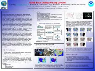
GOES-R Air Quality Proving GroundH. Zhang (hazhang@umbc.edu)1 , R. M. Hoff1, S. Kondragunta2, A. Huff3, M. Green4, S. A. Christopher5, B. Pierce2, and B. Gross6 1. University of Maryland Baltimore County, 2. STAR/NOAA NESDIS, 3. Battelle Memorial Institute 4. Desert Research Institute, 5. University of Alabama in Huntsville, 6. City College of New York Introduction GOES-R ABI will produce accurate aerosol retrievals at high temporal and spatial resolution, which will provide valuable air quality information to the AQPG (Air Quality Proving Ground) and NWS (National Weather Service) air quality forecaster focus group. In order to prepare the air quality community for the new and enhanced aerosol data, National Oceanic and Atmospheric Administration (NOAA) established AQPG as a new component of the GOES-R Satellite Proving Ground. AQPG focuses on engaging primarily NWS air quality forecasting and assessment offices in pre-operational demonstrations of selected capabilities anticipated from the next generation of NOAA geostationary earth observing systems. The AQPG team will examine options for product delivery system so that regional air quality forecasters have access to measurements from GOES-R, from ground based sites, and from models to better predict particulate air quality in the US. The AQPG team has formed a User Advisory Group, comprised of air quality forecasters and analysts, which is providing feedback to NOAA about simulated ABI products and preferred data delivery options. Using datasets from existing satellites, ground based remote sensing, ground based air quality measurements, and models, at least ten case studies are being created which exercise the ABI algorithm and allow the User Group to comment on how those data would be used in their forecast tasks. The overall goal of the AQPG is to build a user community that will be ready to use the new satellite air quality products as soon as they become available. AQPG • Provide synthetic GOES-R proxy data • Use the NCEP NAM-CMAQ numerical guidance as input to the CRTM (Community Radiative Transfer Model) • CRTM generates ABI radiance data for all 16 ABI bands • The GOES-R aerosol retrieval algorithm is then applied to the radiance data to generate aerosol proxy data. • The proxy data will be used for system development/testing and for user training. (a) (b) (c) Figure 3. (a) 12 UTC surface analysis, the pressure gradients are small in the eastern US indicating light surface wind, which may promote local pollution; (b) 600 mb wind; (c) NOAA hazard mapping system fire and smoke analysis, where white areas represent smoke/haze, red dots represent fire hot spots. Smokes were transported from the west to the east aloft by light westerly wind. Figure 1. AQPG workplan A case study example: August 24,2006 • Smoke from the north-western US was transported eastward • Local pollution in the eastern US • Poor air quality in the eastern US Figure 4. Example of simulated ABI aerosol retrievals for August 24, 2006: AOD (top), aerosol type (bottom) with 5-minute update rate. Information on aerosol type that will be available from GOES-R ABI is not available from currently operational GOES satellites. • GOES-R Aerosol product • Derived from 16 channel Advanced Baseline Imager (ABI) • High spatial and temporal resolution: • 2 X 2 km spatial resolution at nadir for AOD (aerosol optical depth), allows picking up localized events • 5-min CONUS, 30-sec mesoscale, 15-min full disk modes or full disk in five minutes allows peeking through clouds, now-casting • AOD retrieval is a multi-channel MODIS/VIIRS type retrieval so that it has accuracy similar to MODIS/VIIRS. Current GASP (GOES Aerosol/Smoke Product) retrieval is a single channel retrieval. • Product include: • AOD • Aerosol Particle Size • Smoke/dust mask • AQPG Testbed – Summer 2011 • Spool the simulated ABI data out every hour during the day to a website that will be accessible to AQPG Advisory Group members • Next summer, we plan to have an AQPG testbed running for a 1-2 week intensive period. The testbed will provide simulated ABI data in near real-time. (c) (a) (b) (d) (e) Acknowledgement This project is supported by NOAA Grants NA09NES4400022 and NA10NES428016. The opinions expressed in this poster do not necessarily represent those of NOAA NWS or NOAA NESDIS. Guidance from Steve Goodman, Mike Johnson and Bonnie Reed are gratefully acknowledged.. Figure 2. (a)MODIS Terra AOD & COT, high AOD in northwest, elevated AOD in the east; (b) MODIS Terra RGB true color image, (c) AIRNow PM2.5 AQI (Air Quality Index) indicate moderate air quality in the eastern US. (d) IMPROVE (Interagency Monitoring of Protected Visual Environments) particulate sulfate concentration; (e) IMPROVE organic carbon concentration.


