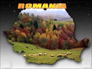
Romania
Romania . Geography. General description. Romania is the twelfth largest country in Europe.

Romania
E N D
Presentation Transcript
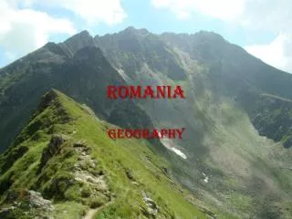
Romania Geography
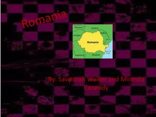
General description • Romania is the twelfth largest country in Europe. • Situated in the northeastern portion of the Balkan Peninsula, the country is halfway between the equator and the North Pole and equidistant from the westernmost part of Europe—the Atlantic Coast—and the most easterly—the Ural Mountains. • Romania has 3,195 kilometers of border. Republic of Moldova lies to the east, Bulgaria lies to the south, and Serbia and Hungary to the west. In the southeast, 245 kilometers of Black Sea coastline provide an important outlet to the Mediterranean Sea and the Atlantic Ocean.
Topography • Romania's natural landscape is almost evenly divided among mountains (31 percent), hills (33 percent), and plains (36 percent). These varied relief forms spread rather symmetrically from the Carpathian Mountains, which reach elevations of more than 2,400 meters, to the Danube Delta, which is just a few meters above sea level.
The Carpathian Mountains • Although not as high as the Alps, the Carpathian Mountains extend over 600 miles in Romania, in the shape of an arch. They are divided into three major ranges: the Eastern (Oriental) Carpathians, the Southern Carpathians (also known as the Transylvanian Alps), and the Western Carpathians. Each of these ranges feature a variety of landscapes, due to the different types of terrain (glacial, karstic, structural, and volcanic). • Romania’s mountains are a great destination for numerous outdoor activities including: climbing, hiking, biking and river-rafting. Some of the most popular ski resorts are Poiana Brasov, Sinaia, Predeal, VatraDornei, Lake Balea and Paltinis.
Main rivers • Danube , Mures runs westward between the Transylvanian Alps and the Bihor Mountains, Olt forms a wide valley in the mountains before reaching the Wallachian Plain, Prut which forms Romania's border with Moldova meets the Danube River just west of the Danube Delta, Siret and Bistrita rivers are the major waterways in Moldavia, Ialomita and Arges rivers cross eastern Wallachia near Bucharest. • Other Romania's rivers are: Somes , Jiu , Buzau , Timis , Jijia , Barlad , Dambovita , Bega , Tarnava Mare , Crisul Alb, Vedea , Moldova , Barlad , Tarnava Mica , Prahova, Neajlov , Oltet , SomesulMic, Suceava and Aries.
The Danube Delta • Danube River ends its journey of almost 1864 miles through Europe in south-eastern Romania. Here the river divides into 3 frayed branches (Chilia, Sulina, Sfântu Gheorghe) forming the Danube Delta. It is the newest land in the country, with beaches expanding almost 65 feet into the sea every year. Overall, the delta is a triangular swampy area of marshes, floating reed islands and sandbanks. It is a UNESCO Biosphere Reservation as well as a protected wetland and natural habitat for rare species of plants and animals.
The Black Sea • The Romanian Black Sea Coast stretches a little over 150 miles. The Black Sea is a continental sea, with a low tide and salinity and water temperatures of 77 - 79˚F in the summertime. It’s wide, sandy beaches facing east and south-east become a major tourist attraction from May until September.
Traditionally Romania is divided into several historic regions that no longer perform any administrative function: • Dobrogea • Moldavia • Wallachia • Transylvania
Moldavia • Geographically, Moldavia is limited by the Carpathian Mountains to the West, the Cheremosh River to the North, the Dniester River to the East and the Danube and Black Sea to the South. The Prut River flows approximately through its middle from north to south. • Of late 15th century Moldavia, with an area of approximately 97,000 km2 (37,000 sq mi), the biggest part is located in Romania (47.5%), followed by the Republic of Moldova (30.5%) and Ukraine (22%). This represents 88% of the Republic of Moldova's surface, 19.5% of Romania's surface, and 3.5% of Ukraine's surface. • The region is mostly hilly, with a range of mountains in the west, and plain areas in the southeast. Moldavia's highest altitude is Ineu peak (2,279m), which is also the westernmost point of the region.
Piatra Neamţ • Piatra Neamţ lies in the Bistriţa River Valley, surrounded by mountains - Pietricica (590 m), Cozla (679 m), Cernegura (852 m), Bâtca Doamnei (462 m) and Cârloman (617 m), at an average height of 345 m (1,131.89 ft). • The city is located 350 km north of the capital city of Bucharest, in the historical region of Moldavia. The nearest airport is Bacău, situated at 60 km south. Piatra Neamţ is linked by Romanian railway trunk number 509 to Bucharest and Iaşi, and by DN15 national road to Bacău (therefore DN2 to Bucharest), Iaşi, Suceava, and Târgu Mureş (Transylvania). • The city is informally divided in several districts (in Romanian: cartiere): • 1 Mai • Băcioaia • Centru • Ciritei • Dărmăneşti • Doamna • Gara Veche • Mărăţei • Precista • Sarata • Speranţa • Valea Viei • Văleni • Vânători • Of these, Ciritei, Doamna and Văleni are formally separate villages administered by the municipality. There are plans to build two new districts, the larger of which will be on the site of the former Reconstrucţia factory.