Download
1 / 14
160 likes | 479 Vues
Lithofacies Mapping at the Hanford Site - Data Management, Analysis, and Visualization -. George V. Last, Presenter Christopher J. Murray Mark L. Rockhold Paul D. Thorne Bruce N. Bjornstad Robert D. Mackley Michael J. Truex Mart Oostrom April 30, 2005. Key Points.

E N D
Lithofacies Mappingat the Hanford Site- Data Management, Analysis, and Visualization - George V. Last, Presenter Christopher J. Murray Mark L. Rockhold Paul D. Thorne Bruce N. Bjornstad Robert D. Mackley Michael J. Truex Mart Oostrom April 30, 2005
Key Points • Lithofacies mapping is a valuable tool for estimating the spatial distribution of physical and chemical transport properties in support of long-term performance assessments. • Progress is being made to advance access to and interpretation of subsurface geologic data to define the spatial distribution of lithofacies. • Progress is also being made to improve understanding of the petrophysical and geochemical properties within these lithofacies to support groundwater flow and transport simulations. 2
Contaminant Transport in ClasticSediments is Highly Controlled by the Physical and Chemical Properties of the Sediments • Particle Size/Pore Size • Sedimentary Fabric/Structures • Mineralogy • Secondary Mineralization (Cementation) • Compaction/Lithification • Secondary Structures (Bioturbation, Jointing, Fracturing) Hanford formation (Gravel-dominated facies association) These are the same properties controlled by the depositional environment and geologic history 3
Sequence Stratigraphic Architecture and Lithofacies Relationships Beneath the Hanford Site 4
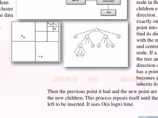
Elements of Lithofacies Mappingto Constrain Spatial Distributionof Transport Parameters • Raw Field Data and Samples • Borehole Data • Trench & Excavation Studies • Outcrop Studies • Field Testing • Infiltration Tests • Tracer Tests • Physical and Geochemical Testing • Borehole Data • Trench & Excavation Studies • Outcrop Studies • Flow and Transport • Parameter Distributions • Laboratory Results • Upscaling • Facies Modeling • Borehole Interpretation (1-D) • Cross-Hole 2-D Interpretation • 3-D Integration and Interpretation • Paleogeography/Basin Modeling Geostatistical Quantification of Spatial Distribution 5
Hanford Borehole GeologicInformation System (HBGIS ) • A secure online web application supported by Microsoft SQL Server as a back end database. • Uses a user friendly GUI (graphical user interface) to provide the Hanford Community with a comprehensive information management system for archival, retrieval, and interpretation of borehole geologic data. 6
The Integrated Borehole GeologicInformation System Approach 7
Assignment of Hydraulic Properties Mean Lithofacies Specific Hydraulic Conductivity Curves (After Last et. al. 2004) 10
Dissolved Aqueous Concentrations of Carbon Tetrachloride (g/L) in the Ringold E Unit in 1993 11
Geostatistical Simulations ofLithofacies Distributions Simulation of the Median Values of the 100 Simulations One of 100 Simulations Courtesy of Debbie A. Bush 12
Summary • Uncertainty in flow and transport parameters are among the primary contributors to overall uncertainty in performance assessment results. • Flow and transport parameters are a function of the geologic framework, thus, lithofacies mapping provides a valuable mechanism for constraining the spatial distribution of these parameters. • Work is ongoing to identify and map a number of lithofacies beneath the Hanford site and to delineate the physical and geochemical parameter distributions for these lithofacies. • Data management and integration are key to the success and defensibility of estimating the spatial distribution of transport properties. 13
This work is being conducted as part of the Groundwater Remediation Project managed by Fluor Hanford, Inc. in support of the US Department of Energy Acknowledgements 14