Geographic Coordinates with GPS: UTM Coordinates Explained
160 likes | 201 Vues
Learn how to determine your precise location using a GPS receiver and understand Global Positioning System coordinates. Explore the significance of Geographic Coordinate Systems like Latitude/Longitude and UTM, and practice plotting and reading UTM coordinates. Enhance your navigation skills with hands-on exercises and map interpretations.

Geographic Coordinates with GPS: UTM Coordinates Explained
E N D
Presentation Transcript
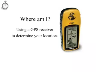
Where am I? Using a GPS receiver to determine your location.
Global Positioning System • Inexpensive handheld GPS receivers • Signals transmitted by orbiting satellites • User’s position is measured with great accuracy • Position result is reported as a geographic coordinate
Geographic Coordinates • A GPS receiver is not much use unless you understand the result. • Geographic Coordinates are a numeric representation of position on (or near) the earth’s surface. • There are many different systems of geographic coordinates.
Geographic Coordinate Systems • Latitude / Longitude • Universal Transverse Mercator (UTM) • Others • State Plane • Military Grid Reference System • British Grid • Maidenhead • and many, many more.
UTM Universal Transverse Mercator Coordinates UTM Exercise Locating Grids on USGS Maps
This 1km square is located at706km E 4344km N • Usually we need to be a bit more precise about a location!
Using UTM is Easy • Take a look at the “UTM Practice Map” handout. • Can you quickly determine what map feature is at: 706.6 km E 4345.3 km N
Using a distance scale, marked in meters, to measure UTM coordinates