Spatial Data Mining: Accomplishments and Research Needs
Spatial Data Mining: Accomplishments and Research Needs. Shashi Shekhar Department of Computer Science and Engineering University of Minnesota. Why Data Mining?. Holy Grail - Informed Decision Making Lots of Data are Being Collected Business - Transactions, Web logs, GPS-track, …

Spatial Data Mining: Accomplishments and Research Needs
E N D
Presentation Transcript
Spatial Data Mining: Accomplishments and Research Needs Shashi Shekhar Department of Computer Science and Engineering University of Minnesota
Why Data Mining? • Holy Grail - Informed Decision Making • Lots of Data are Being Collected • Business - Transactions, Web logs, GPS-track, … • Science - Remote sensing, Micro-array gene expression data, … • Challenges: • Volume (data) >> number of human analysts • Some automation needed • Data Mining may help! • Provide better and customized insights for business • Help scientists for hypothesis generation
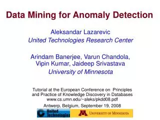
Spatial Data • Location-based Services • E.g.: MapPoint, MapQuest, Yahoo/Google Maps, … Courtesy: Microsoft Live Search (http://maps.live.com)
Spatial Data • In-car Navigation Device Emerson In-Car Navigation System (Courtesy: Amazon.com)
Spatial Data Mining (SDM) • The process of discovering • interesting, useful, non-trivial patterns • patterns: non-specialist • exception to patterns: specialist • from large spatial datasets • Spatial pattern families • Spatial outlier, discontinuities • Location prediction models • Spatial clusters • Co-location patterns • …
Spatial Data Mining and Science • Understanding of a physical phenomenon • Though, final model may not involve location • Cause-effect e.g. Cholera caused by germs • Discovery of model may be aided by spatial patterns • Many phenomenon are embedded in space and time • Ex. 1854 London – Cholera deaths clustered around a water pump • Spatio-temporal process of disease spread => narrow down potential causes • Ex. Recent analysis of SARS • Location helps bring rich contexts • Physical: e.g., rainfall, temperature, and wind • Demographical: e.g., age group, gender, and income type • Problem-specific, e.g. distance to highway or water
Example Pattern: Spatial Cluster • The 1854 Asiatic Cholera in London
Example Pattern: Spatial Outliers • Spatial Outliers • Traffic Data in Twin Cities • Abnormal Sensor Detections • Spatial and Temporal Outliers
Example Pattern: Predictive Models • Location Prediction: • Predict Bird Habitat Prediction • Using environmental variables Nest Locations
Example Patterns: Co-locations • Given: A collection of different types of spatial events • Find: Co-located subsets of event types
What’s NOT Spatial Data Mining • Simple Querying of Spatial Data • Find neighbors of Canada given names and boundaries of all countries • Find shortest path from Boston to Houston in a freeway map • Search space is not large (not exponential) • Testing a hypothesis via a primary data analysis • Ex. Female chimpanzee territories are smaller than male territories • Search space is not large! • SDM: secondary data analysis to generate multiple plausible hypotheses • Uninteresting or obvious patterns in spatial data • Heavy rainfall in Minneapolis is correlated with heavy rainfall in St. Paul, Given that the two cities are 10 miles apart. • Common knowledge: Nearby places have similar rainfall • Mining of non-spatial data • Diaper sales and beer sales are correlated in evening
Application Domains • Spatial data mining is used in • NASA Earth Observing System (EOS): Earth science data • National Inst. of Justice: crime mapping • Census Bureau, Dept. of Commerce: census data • Dept. of Transportation (DOT): traffic data • National Inst. of Health (NIH): cancer clusters • Commerce, e.g. Retail Analysis • Sample Global Questions from Earth Science • How is the global Earth system changing • What are the primary forcing of the Earth system • How does the Earth system respond to natural and human included changes • What are the consequences of changes in the Earth system for human civilization • How well can we predict future changes in the Earth system
Example of Application Domains • Sample Local Questions from Epidemiology [TerraSeer] • What’s overall pattern of colorectal cancer • Is there clustering of high colorectal cancer incidence anywhere in the study area • Where is colorectal cancer risk significantly elevated • Where are zones of rapid change in colorectal cancer incidence Geographic distribution of male colorectal cancer in Long Island, New York (Courtesy: TerraSeer)
Business Applications • Sample Questions: • What happens if a new store is added • How much business a new store will divert from existing stores • Other “what if” questions: • changes in population, ethic-mix, and transportation network • changes in retail space of a store • changes in choices and communication with customers • Retail analysis: Huff model [Huff, 1963] • A spatial interaction model • Given a person p and a set S of choices • Connection to SDM • Parameter estimation, e.g., via regression • For example: • Predicting consumer spatial behaviors • Delineating trade areas • Locating retail and service facilities • Analyzing market performance
Map Construction • Sample Questions • Which features are anomalous? • Which layers are related? • How can the gaps be filled? • Korea Data • Latitude 37deg15min to 37deg30min • Longitude 128deg23min51sec to 128deg23min52sec • Layers • Obstacles (Cut, embankment, depression) • Surface drainage (Canal, river/stream, island, common open water, ford, dam) • Slope • Soils (Poorly graded gravel, clayey sand, organic silt, disturbed soil) • Vegetation (Land subject to inundation, cropland, rice field, evergreen trees, mixed trees) • Transport (Roads, cart tracks, railways)
Colocation in Example Data • Road: river/stream • Crop land/rice fields: ends of roads/cart roads • Obstacles, dams and islands: river/streams • Embankment obstacles and river/stream: clayey soils • Rice, cropland, evergreen trees and deciduous trees: river/stream • Rice: clayey soil, wet soil and terraced fields • Crooked roads: steep slope
Colocation Example • Interestingness • Patterns to Non-Specialist vs. Exceptions to Specialist • Road-River/Stream Colocation Road-River Colocation Example (Korea database, Courtesy: Architecture Technology Corporation)
SQL Example for Colocation Query • SQL3/OGC (Postgres/Postgis) • Detecting Road River Colocation Pattern: • Spatial Query Fragment CREATE TABLE Road-River-Colocation AS SELECT DISTINCT R.* FROM River-Area-Table T, Road-Line-Table R WHERE distance ( T.geom, R.geom ) < 0.001; CREATE TABLE Road-Stream-Colocation AS SELECT DISTINCT R.* FROM Stream-Line-Table T, Road-Line-Table R WHERE distance ( T.geom, R.geom ) < 0.001; CREATE TABLE Cartroad-River-Colocation AS SELECT DISTINCT R.* FROM River-Area-Table T, Cartroad-Line-Table R WHERE distance ( T.geom, R.geom ) < 0.001; CREATE TABLE Cartroad-Stream-Colocation AS SELECT DISTINCT R.* FROM Stream-Line-Table T, Cartroad-Line-Table R WHERE distance ( T.geom, R.geom ) < 0.001;
Colocation: Road-River • 375 road features • Center-line to center-line distance threshold = 0.001 units (about 100 meters) • 77 % of all roads colocated with river Road-River Colocation Example (Korea dataset)
A Complex Colocation Example • Cropland colocated with river, stream or road Complex Colocation Example (Korea dataset, Courtesy: Architecture Technology Corporation)
Outliers in Example Data • Outlier detection • Extra/erroneous features • Positional accuracy of features • Predict mislabeled/misclassified features • Overlapping road and river • Road crossing river and disconnected road Stream mislabeled as river • Cropland close to river and road • Cropland outliers on edges
Outliers in Example • Map production • Identifying errors • E.g., expected colocation: (bridge, ∩(road, river)) • Violations illustrated below: Finding errors in maps having road, river and bridges (Korea dataset)
Overview • Spatial Data Mining • Find interesting, potentially useful, non-trivial patterns from spatial data • Components of Data Mining • Input: table with many columns, domain (column) • Statistical Foundation • Output: patterns and interest measures • e.g., predictive models, clusters, outliers, associations • Computational process: algorithms
Overview • Input • Statistical Foundation • Output • Computational Process • Trends
Overview of Input • Data • Table with many columns (attributes) • e.g., tid: tuple id; fi: attributes • Spatial attribute: geographically referenced • Non-spatial attribute: traditional • Relationships among Data • Non-spatial • Spatial Example of Input Data
Data in Spatial Data Mining • Non-spatial Information • Same as data in traditional data mining • Numerical, categorical, ordinal, boolean, etc • e.g., city name, city population • Spatial Information • Spatial attribute: geographically referenced • Neighborhood and extent • Location, e.g., longitude, latitude, elevation • Spatial data representations • Raster: gridded space • Vector: point, line, polygon • Graph: node, edge, path Raster Data for UMN Campus Courtesy: UMN Vector Data for UMN Campus Courtesy: MapQuest
Relationships on Data in Spatial Data Mining • Relationships on non-spatial data • Explicit • Arithmetic, ranking (ordering), etc. • Object is instance of a class, class is a subclass of another class, object is part of another object, object is a membership of a set • Relationships on Spatial Data • Many are implicit • Relationship Categories • Set-oriented: union, intersection, and membership, etc • Topological: meet, within, overlap, etc • Directional: North, NE, left, above, behind, etc • Metric: e.g., Euclidean: distance, area, perimeter • Dynamic: update, create, destroy, etc • Shape-based and visibility • Granularity
OGC Model • Open GIS Consortium Model • Support spatial data types: e.g. point, line, polygons • Support spatial operations as follows: Examples of Operations in OGC Model
OGIS • Topology • 9-intersection model
Mining Implicit Spatial Relationships • Choices • Materialize spatial info + classical data mining • Customized spatial data mining techniques • What spatial info is to be materialized • Distance measure: • Point: Euclidean • Extended objects: buffer-based • Graph: shortest path • Transactions: i.e., space partitions • Circles centered at reference features • Gridded cells • Min-cut partitions • Voronoi diagram Mining Implicit Spatial Relationships
Research Needs for Data • Limitations of OGC Model • Aggregate functions - e.g. Mapcube • Direction predicates - e.g. absolute, ego-centric • 3D and visibility • Network analysis • Raster operations • Needs for New Research • Modeling semantically rich spatial properties • Moving objects • Spatial time series data
Overview • Input • Statistical Foundation • Output • Computational Process • Trends
Statistics in Spatial Data Mining • Classical Data Mining • Learning samples are independently distributed • Cross-correlation measures, e.g., Chi-square, Pearson • Spatial Data Mining • Learning sample are not independent • Spatial Autocorrelation • Measures: • distance-based (e.g., K-function) • neighbor-based (e.g., Moran’s I) • Spatial Cross-Correlation • Measures: distance-based, e.g., cross K-function • Spatial Heterogeneity
Overview of Statistical Foundation • Spatial Statistics [Cressie, 1991][Hanning, 2003] • Geostatistics • Continuous • Variogram: measure how similarity decreases with distance • Spatial interpolation • Lattice-based statistics • Discrete location, neighbor relationship graph • Spatial Gaussian models • Conditionally specified, Simultaneously specified spatial Gaussian model • Markov Random Fields, Spatial Autoregressive Model • Point process • Discrete • Complete spatial randomness (CSR): Poisson process in space • K-function: test of CSR
Spatial Autocorrelation (SA) • First Law of Geography • “All things are related, but nearby things are more related than distant things. [Tobler, 1970]” • Spatial autocorrelation • Nearby things are more similar than distant things • Traditional i.i.d. assumption is not valid • Measures: K-function, Moran’s I, Variogram, … Pixel property with independent identical distribution Vegetation Durability with SA
[number of events within distance h of an arbitrary event] Spatial Autocorrelation: Distance-based measure • K-function Definition • Test against randomness for point pattern • λis intensity of event • Model departure from randomness in a wide range of scales • Inference • For Poisson complete spatial randomness (CSR): K(h) = πh2 • Plot Khat(h) against h, compare to Poisson CSR • >: cluster • <: decluster/regularity K-Function based Spatial Autocorrelation
: data values : mean of x : number of data Spatial Autocorrelation: Topological Measure • Moran’s I Measure Definition • W: the contiguity matrix • Ranges between -1 and +1 • higher positive value => high SA, Cluster, Attract • lower negative value => interspersed, de-clustered, repel • e.g., spatial randomness => MI = 0 • e.g., distribution of vegetation durability => MI = 0.7 • e.g., checker board => MI = -1
[number of type j event within distance h of a randomly chosen type i event] Cross-Correlation • Cross K-Function Definition • Cross K-function of some pair of spatial feature types • Example • Which pairs are frequently co-located • Statistical significance
Answers: and Cross-Correlation Find Patterns in the following data:
Illustration of Cross-Correlation • Illustration of Cross K-function for Example Data Cross-K Function for Example Data
Spatial Slicing • Spatial heterogeneity • “Second law of geography” [M. Goodchild, UCGIS 2003] • Global model might be inconsistent with regional models • spatial Simpson’s Paradox Global Model Regional Models • Spatial Slicing • Slicing inputs can improve the effectiveness of SDM • Slicing output can illustrate support regions of a pattern • e.g., association rule with support map
Edge Effect • Cropland on edges may not be classified as outliers • No concept of spatial edges in classical data mining Korea Dataset, Courtesy: Architecture Technology Corporation
Research Challenges of Spatial Statistics • State-of-the-art of Spatial Statistics • Research Needs • Correlating extended features: • e.g. road, river (line strings) • e.g. cropland (polygon), road, river • Edge effect • Relationship to classical statistics • Ex. SVM with spatial basis function vs. SAR Data Types and Statistical Models
Overview • Input • Statistical Foundation • Output • Computational Process • Trends
General Approaches in SDM • Materializing spatial features, use classical DM • Ex. Huff's model – distance (customer, store) • Ex. spatial association rule mining [Koperski, Han, 1995] • Ex: wavelet and Fourier transformations • commercial tools: e.g., SAS-ESRI bridge • Spatial slicing, use classical DM • Ex. association rule with support map [P. Tan et al] • commercial tools: e.g., Matlab, SAS, R, Splus • Customized spatial techniques • Ex. geographically weighted regression: parameter = f(loc) • e.g., MRF-based Bayesian Classifier (MRF-BC) • commercial tools • e.g., Splus spatial/R spatial/terraseer + customized codes Association rule with support map (FPAR-high -> NPP-high)
Overview of Data Mining Output • Supervised Learning: Prediction • Classification • Trend • Unsupervised Learning: • Clustering • Outlier Detection • Association • Input Data Types vs. Output Patterns Output Patterns vs. Statistical Models
Location Prediction Nest Locations Vegetation Water Depth Distance to Open Water
Prediction and Trend • Prediction • Continuous: trend, e.g., regression • Location aware: spatial autoregressive model (SAR) • Discrete: classification, e.g., Bayesian classifier • Location aware: Markov random fields (MRF) Prediction Models
Prediction and Trend • Linear Regression • Spatial Regression • Spatial model is better ROC Curve for testing ROC Curve for learning
Spatial Contextual Model: SAR • Spatial Autoregressive Model (SAR) • Assume that dependent values yi are related to each other • yi = f(yi) i ≠ j • Directly model spatial autocorrelation using W • Geographically Weighted Regression (GWR) • A method of analyzing spatially varying relationships • parameter estimates vary locally • Models with Gaussian, logistic or Poisson forms can be fitted • Example: • where are location dependent