Download
1 / 43
430 likes | 547 Vues
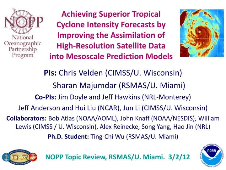
Achieving Superior Tropical Cyclone Intensity Forecasts by Improving the Assimilation of High-Resolution Satellite Data into Mesoscale Prediction Models. PIs: Chris Velden (CIMSS/U. Wisconsin) Sharan Majumdar (RSMAS/U. Miami) Co-PIs: Jim Doyle and Jeff Hawkins (NRL-Monterey)

E N D
Achieving Superior Tropical Cyclone Intensity Forecasts by Improving the Assimilation of High-Resolution Satellite Data into Mesoscale Prediction Models PIs: Chris Velden (CIMSS/U. Wisconsin) Sharan Majumdar (RSMAS/U. Miami) Co-PIs: Jim Doyle and Jeff Hawkins (NRL-Monterey) Jeff Anderson and Hui Liu (NCAR), Jun Li (CIMSS/U. Wisconsin) Collaborators: Bob Atlas (NOAA/AOML), John Knaff (NOAA/NESDIS), William Lewis (CIMSS / U. Wisconsin), Alex Reinecke, Song Yang, Hao Jin (NRL) Ph.D. Student: Ting-Chi Wu (RSMAS/U. Miami) NOPP Topic Review, RSMAS/U. Miami. 3/2/12
Overarching Goals • Development and refinement of a novel approach to supplement contemporary atmospheric observation capabilities with optimal configurations and assimilation methodology that takes advantage of advanced full-resolution satellite-derived observationsin order to improve high-resolution numerical analyses and intensity forecasts of tropical cyclones (TCs). • Provide a pathway towards advanced satellite data assimilation (DA) in operational TC forecast models.
Approach • Use multiple and integrated satellite data sets at their full resolution in a high-resolution analysis/forecast system for tropical cyclones. • Provide a database of full-resolution observations from multiple satellite platforms for selected TCs. • Quantify how best to integrate these multiple datasets using advanced high-resolution models and DA. • Explore EnKF-based DAwithin NCAR WRF/DART and Navy system frameworks. Can extend to NOAA systems. • With current satellite data spatial resolutions, a 27/9 km nested analysis framework may be initially adequate.
WRF-ARW COAMPS-TC HWRF WRF-ARW COAMPS-TC HWRF
Year 1 : Assembling pieces … • IdentifiedTC cases: Typhoon Sinlaku (2008) and Hurricane Ike (2008) • Enhanced satellite datasets processed and archived at CIMSS and NRL Monterey • Further improved retrieval algorithms • Commenced data assimilation experiments in WRF/ARW and COAMPS-TC • Diagnosticsand comparisons against data
Years 2-3: Specialized experiments • Introduction of hourly and rapid-scan AMVs • Prepared QC’dAIRS SFOV clear sky soundings • Preparing AIRS SFOV cloudy soundings • MODIS and AMSR-E Total Precipitable Water • EnKF assimilation using bogus vortices • Combined satellite data in assimilation • Advancement of COAMPS-TC and WRF-ARW in DART. • Ported onto NOAA HFIP Jet. • Investigated ensemble size; localization; inflation • Advanced diagnostic tools • Preparation of ensemble forecasts
Upgraded data assimilation at NCAR • Revised WRF/DART system: • Ensemble size is increased from 32 to 84 • Microphysics: WSM 5 classes is updated to WSM 6 classes • 32 versus 84 members • Analyses using CIMSS AMVs and routine observations are similar • However, for AIRS-Q and TPW data, the differences are large • Sampling error correction showed little impact on the analyses. • Current localization cutoff distance was found to be the most effective (half-width cutoff = 650km).
EnKF Assimilation Experiments • WRF/ARW in DART. 32 and 84 ensemble members. • 9km moving nest with feedback to 27km grid when TC is present.
AMVs in the EnKF Cycles 701-999mb 401-700mb 251-400mb 100-251mb
Analyses vs Independent Observations (h) • NRL P3 Eldora Radar WD: 00 UTC 11 Sep ELDORA CTL CIMSS(h) CIMSS(h+RS) QuikSCAT-UCF WD: 12 UTC 9 Sep
96-h WRF/EnKF Ensemble Forecasts 00 24 48 72 96
Conclusions from AMV study • Assimilation of CIMSS(h) improves the track, intensity and structure analyses in the earlier stage (including RI). • CIMSS(h+RS) wind analyses are most consistent with ELDORA observations throughout the vertical column. • On Sep 9th and 10th, ensemble mean track forecasts from CIMSS(h) outperformed CTL. • On Sep 11th, CIMSS(h+RS) produces the best ensemble mean track forecast. • several members of CIMSS(h+RS) capture the recurvature.
MODIS TPW (left) & AMSR-E TPW (right) 5 km res 17 km res
AIRS T and Q and AMSR-E TPW (84) AMSR-E TPW has dramatic positive impact on INTENSITY analysis AIRS T&Q has positive impact on TRACK analysis
Conclusions from T, Q, TPW studies • For assimilation of TPW and AIRS-Q, the larger ensemble size improves the analyses. • Assimilation of water vapor observations requires a much larger ensemble size than 32? • For AMVs, the larger ensemble size has little impact on the analyses. • AMV and TPW data have a particularly strong impact.
Real Time Evaluation Katia 2011 (Atlantic)00 UTC 31 August Sonca 2011 (WestPac)12 UTC 15 September • Over 250 real-time analyses and forecast made between August and September for the Atlantic and Pacific basins. • Track forecasts real-time probabilistic guidance for forecasters • Data set provides a control for data inclusion/denial experiments.
COAMPS-TC FY12 Experiments • For a subset of the 2011 real-time data set, perform a series of experiments with various observation sets added to the analysis. • Relatively large data set will allow for statistical significance testing. • Experiments to be performed: • Assimilation of AMSU-A radiance observations from METOP and NOAA-15, 16 & 18 using global-model bias coefficients. • Same AMSU-A experiment except using bias coefficients spun up with COAMPS-TC. • Denial of AMV’s. • Assimilation of TPW observations. • Testing with a 3-hr update cycle (currently 6-hr is used).
Other DA experiments • Hurricane Ike (2008) • WRF/3d-Var 12 km: AIRS T and Q • Improvement of track and MSLP forecasts • Hurricane Irene (2011) • WRF/DART 36 km … CTL AIRS Best
How to verify impact on forecast? • Traditional track / MSLP metrics • TC size (using CIMSS analyses) • Comparisons vs independent observations • Can use GOES images, AMSU, MIMIC … • e.g. TPW as a qualitative (and quantitative) metric
Main accomplishments • End-to-end system: satellite observations; DA; ensemble forecasts; verification; diagnostics • Usually, more observations = better! • Benefit from hourly and rapid-scan AMVs, and microwave TPW • Development of new verification and diagnostic tools • Demonstrated potential for operational use
Current and Future Work • Cloudy radiances being tested. Challenges with bias, figure out correction method. • Understanding relative impact of winds, temperature and moisture. • Include satellite surface winds: scatterometers • Other datasets • Surface wind analyses from NESDIS • AMSU-based products • Microwave radiance channels • Hyperspectral radiances
Potential Transitions • Follow-on studies will need to demonstrate the capability to assimilate in (near) real-time the special satellite datasets. • Try in an operational-like environment. • Near real-time demo. • Compare results from research system versus operational analyses and forecasts. • In principle, can accumulate many cases.
Synergies with other projects • ONR TCS-08 • Enhanced AMVs in NOGAPS (PI Velden) • TC sensitivity and initialization (PI Majumdar) • Advanced IR soundings (PI Li) • Related NCAR data assimilation projects • NRL COAMPS-TC data assimilation efforts • Leveraging components of NOAA HFIP
Relevant Publications Doyle, J.D., C.A. Reynolds, and C. Amerault, 2011: Diagnosing tropical cyclone sensitivity. Computing in Science and Engineering, 13, 31-39. Hendricks, E.A., J.R. Moskaitis, Y. Jin, R.M. Hodur, J.D. Doyle, and M.S. Peng, 2011: Prediction and Diagnosis of Typhoon Morakot (2009) Using the Naval Research Laboratory’s Mesoscale Tropical Cyclone Model. Terr. Atmos. Ocean. Sci., 22, (In Press). Kwon, E.-H., J. Li, Jinlong Li, B. J. Sohn, and E. Weisz, 2011: Use of total precipitable water classification of a priori error and quality control in atmospheric temperature and water vapor sounding retrieval, Advances Atmos. Sci. (accepted). Wu, T.-C., H. Liu, S. Majumdar, C. Velden and J. Anderson, 2012: Influence of assimilating satellite-derived atmospheric motion vector observations on analyses and forecasts of tropical cyclone track and structure. Mon. Wea. Rev. (in preparation) Zheng, J., J. Li, T. Schmit and Jinlong Li, 2011: Assimilation of AIRS soundings for improving hurricane forecasts with WRF/3DVAR, J. Geophys. Res. (submitted). Zheng, J., J. Li, T. J. Schmit, J. Li, and Z. Liu, 2012: Variational assimilation of AIRS temperature and moisture profiles for improving hurricane forecasts. J. App. Met. Clim. (in preparation)
Other Satellite Datasets • NESDIS-RAMMB • 6-hourly, multi-platform TC surface wind analyses • AMSU-based TC data and products
Datasets prepared: CIMSS/UWisc. • Enhanced fields of AMVs - from MTSAT during West Pacific Typhoon Sinlaku (TCS-08 field program) - from GOES for Atlantic Hurricane Ike (2008) • Hourly datasets • Use of rapid scans when available • Tailored processing and new quality indicators • Observation confidence estimates; forward operator error estimates for DA
Left: AMV (IR-only) field produced from routinely available hourly sequence of MTSAT-1 images during Typhoon Sinlaku Bottom Left: Same as above, but using a 15-min rapid scan sequence from MTSAT-2 (better AMV coverage and coherence) Bottom Right: Same as above, but using a 4-min rapid scan sequence (improved coverage/detail of typhoon flow fields) MTSAT AMV Example
Forecast track error, spread and track FC09 FC10 00 24 48 72 96 00 24 48 72 96
FC11 01H 12H 24H CTL CTL CTL CIMSS(h) CIMSS(h) CIMSS(h) CIMSS(h+RS) CIMSS(h+RS) CIMSS(h+RS)
96-h WRF/EnKF Forecasts • 27 km domain with 9 km nested domain using 20members. • Same BC, physics and dynamics.
Datasets prepared: CIMSS/UWisc. • Single field of view AIRS temperature/moisture profiles • Recently adapted for IASI clear sky soundings • Under development: algorithms for cloudy sky soundings
Assimilation of AIRS T/Q Soundings (from CIMSS) and TPW • Control (CTL): Radiosondes, cloud winds (AMVs from JMA) extracted from NCEP/GFS dataset, aircraft data, station and ship surface pressure data, JTWC advisory TC positions, 6-hourly analysis cycle. • AIRS T: Add only CIMSS single view (15km) T profiles. • AIRS Q: Add only CIMSS single view (15km) Q profiles. • AIRS T/Q: Add both CIMSS T and Q profiles. • TPW: Add only CIMSS processed AMSR-E microwave TPW data. • AIRS T data reduces the initial track error. • Assimilation of TPW greatly improve the intensity and track analyses.
Analysis track and intensity Minimum Sea-level Pressure 500mb Geopotential Height / wind
Sinlaku track/intensity analysis: AIRS soundings (WRF/DART) CTL run: assimilate radiosonde, satellite cloud winds, QuikSCAT winds, aircraft data, COSMIC GPS refractivity, ship, and land surface data. OBS CTL AIRS-T AIRS-Q AIRS-TQ Rapid intensification from 9 to 10 September 2008 captured with water vapor soundings assimilated OBS CTL AIRS-T AIRS-Q AIRS-TQ CTL AIRS-T AIRS-Q AIRS-TQ Temperatures reduce track errors during rapid intensification