Download
1 / 24
240 likes | 262 Vues
Learn about the processes used by the Joint Typhoon Warning Center (JTWC) to track and analyze tropical cyclones. This workshop provides insights into their best track methods, including real-time tracking, post-storm re-analysis, and data quality control.

E N D
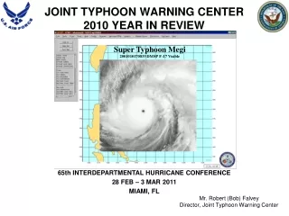
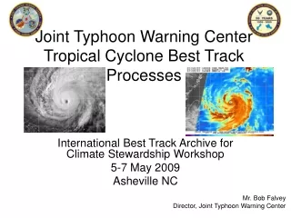
Joint Typhoon Warning CenterTropical Cyclone Best Track Processes International Best Track Archive for Climate Stewardship Workshop 5-7 May 2009 Asheville NC Mr. Bob Falvey Director, Joint Typhoon Warning Center
Background • Established in 1 May 1959 to protect DoD assets • Nimitz Hill, GU until 1999, now Pearl Harbor, HI • United States Pacific Command Instruction 0539.1 established requirements • United States Air Force conducts TC reconnaissance and provides personnel • United States Navy provides facilities, equipment, and personnel 2
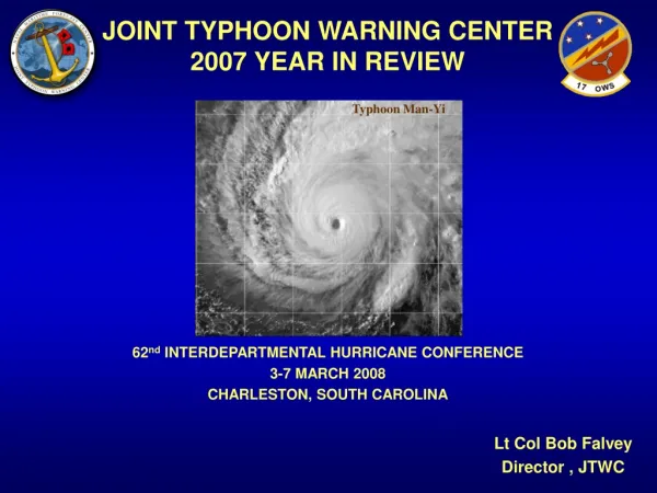
JTWC Mission Provide tropical cyclone forecast and warning support for Department of Defense, Department of State and US Government assets in the Pacific and Indian Oceans as established by Commander, United States Pacific Command Airmen from the 18th Aircraft Maintenance Squadron tow an F-15 Eagle into a protective aircraft shelter in preparation for Typhoon Man-Yi 12 Jul 07 at Kadena Air Base, Japan. (Source: U.S. Air Force/A1C Kasey Zickmund) 3
Organization CO, NMFC/JTWC Navy CAPT Grant Cooper 17th OWS/CC USAF Lt Col Kurt Brueske Director USAF Civilian Mr. Bob Falvey Technical Advisor USN Civilian Mr. Ed Fukada Satellite Operations USAF Capt Kathryn Payne Operations Officer USN LCDR Mike Vancas Chief, Technical Services USAF Civilian Mr. Matt Kucas SATOPS, NCOIC USAF (M)Sgt Ken Viault Typhoon Duty Officer USAF Civilian Mr. Steve Barlow Typhoon Duty Officer USN LCDR Jeremy Callahan Tech Services Tech USAF Civilian Mr. Jim Darlow Satellite Analyst USAF SSgt Rex Ames Satellite Analyst USAF MSgt Mike Oates Typhoon Duty Officer USAF Civilian Mr. Aaron Lana Typhoon Duty Officer USN LT Chris Morris Satellite Analyst USAF Civilian Mr. Dana Uehara Satellite Analyst USAF SrA Rachel Smith Typhoon Duty Officer USAF Civilian Mr. Rick Ballucanag Typhoon Duty Officer USN LTJG John Mayers Satellite Analyst USAF Civilian Mr. Todd Brandon Satellite Analyst USAF SSgt Kienzel USAF: 14 Personnel--Director, 3 Typhoon Duty Officers (TDO), 2 Technical Services, 8 Satellite Analysts USN: 5 Personnel--Technical Advisor, 3 Typhoon Duty Officers (TDO), JTWC Operations Officer 4
JTWC Area of Responsibility JTWC Pearl Harbor, HI 5
Position/Intensity Fixes - IR/EIR/Vis Issued every 3 hours -- Position and Intensity 0530Z + every 6 hours -- Position only 0230Z + every 6 hours - MW as imagery is available
2008 Satellite FixesBy Agency 5% 9199 16% 744 1951 96 266 73% 6% 69 51 29 126 45 5 Total Satellite Fixes Included in JTWC Satellite Fix Archive = 12,581
2008 Microwave Fixes By Platform (PGTW) 5% 34% 15% 1716 869 9% 644 364 453 781 7% 284 13% 17% Total Microwave Fixes = 5,111 Over half of PGTW fixes are now microwave
JTWC Best Track Processes • Real-time best tracking and “re-besting” • Duty TDO (forecaster) is responsible to use all currently available data* to create and maintain the most accurate best track position and intensity during storm lifecycle • On-coming TDO is responsible to review pervious shifts best track and make • adjustments with any data that was not available during the previous shift • Post storm re-best track • Each storm is assigned to a TDO for post storm re-analysis • Satellite operations review all satellite fixes for quality control and all imagery to ensure all available imagery has been “fixed on” • TDO conducts post storm re-analysis using all available data * • Once complete, the Best Track Officer (BTO) completes a thorough review of • the best track using all available data • JTWC Operations Officer completes a review of the entire storm track • JTWC Technical Advisor completes a thorough review of the best track • Bottom Line: 4 sets of eyes are on the best track prior to approval/publishing • The tool used is Automated Tropical Cyclone Forecast system (ATCF) • *Data: VIS/IR/MSI from GEO, VIS/IR/MW from Polar, Radar, SCAT, Buoys, Ships, Land Stations, Rawindsondes, Dropsondes
ATCF with best track and fixes displayed (WP152008 Sinlaku)
Zoomed ATCF with best track and fixes displayed Shape indicates confidence Square = +/- 30nm Triangle = +/- 45nm Diamond = +/- 60nm Color indicates fix type Red=conventional Blue=microwave Purple=aircraft Maroon=automated/research Brown=radar Yellow=flagged
6-hourly best track positions labeled with date/time, speed of movement and current intensity 2-hourly best track positions
Fix positions labeled with date/time, confidence, current intensity, speed of movement Dvorak T-number, agency
JTWC Historical Best Track Data • 2002 paper documented effort to resolve discrepancies within the JTWC historical dataset* • One possible reason for questionable data was that 3 different data bases were used to construct the JTWC best-track historical data set • NCDC database • FNMOC Monterey database • ATCF database; partly developed under contract by Neuman • Corrections were limited to years for which supporting documentation was found • Data after 1984 considered to be of highest quality • Dataset contains data from 1945 (WNP), 1971 NIO, 1985 SH "The Joint Typhoon Warning Center Tropical Cyclone Best-Tracks, 1945-2000", Chu, Sampson, et al., Aug 2002
JTWC Archive QC Process • Visually compared and documented differences between the JTWC Archive and the JTWC Annual Tropical Cyclone Reports • Checked difference against track or data from other sources • Neuman Hurricane Risk Assessment database • Hong Kong Observatory data • Made recommendation for changes • Implemented approved changes and posted comments to document changes on JTWC website
Typographical errors corrected Ensure all cyclones includes a unique “storm ID” Starting and ending DTG together with a name specified for changed data TC’s with different names could be combined if data suggested they were same cyclone 1956, Karen and Lucille combined to Karen-Lucille TC not found in ATCR but in archives, renumbered to 50-79 Different track times; other than 00, 06, 12 & 18 UTC…not changed but comments added to documentation to highlight If unable to refute archives then data kept e.g. NIO archives indicated significantly higher TC numbers but nothing in ATCR to refute…data retained. Rules Applied in Making Changes
Challenges Rectifying Intensity The following is a quote from the JTWC Annual Tropical Cyclone report for 2001: “At 270000Z, JTWC classified the system as a typhoon based on naval ship observations indicating sustained winds within the small eyewall of 75 knots with gusts to 105 knots.” In this case, the ship observations corroborated what one might have expected given the MI signature (Fig. 1). Illustrates that averaging intensities from multiple centers can be very problematic Excerpts from, “A COMPARISON OF TYPHOON BEST-TRACK DATA IN THE WESTERN NORTH PACIFIC: IRRECONCILABLE DIFFERENCES, M. A. Lander, University of Guam, paper presented at the 2008 AMS 28th Conference on Hurricanes and Tropical Meteorology.