Download
1 / 15
150 likes | 292 Vues
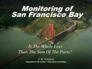
NOAA/NOS/CO-OPS Maritime Services Current Observation Project San Francisco Bay and Vicinity. Carl Kammerer Project Lead. Background. NOAA is in the process of developing a hydrodynamic model of San Francisco Bay (outside the Gate to Antioch/Rio Vista).

E N D
NOAA/NOS/CO-OPSMaritime ServicesCurrent Observation ProjectSan Francisco Bay and Vicinity Carl Kammerer Project Lead
Background • NOAA is in the process of developing a hydrodynamic model of San Francisco Bay (outside the Gate to Antioch/Rio Vista). • CO-OPS will be surveying currents in support of this modeling effort. • Whenever possible, CO-OPS wants to leverage resources to meet the needs of many. In addition to modeling, accurate and relevant tidal current data supports: • Navigation • Resource Protection • Engineering (energy, bridges, etc.) • Restoration/remediation • Recreation
Tentative Plans FY2011 - User Meetings and Reconnaissance. • On-water recon at potential sites identifies: • Bottom Type • Depth • Salinity • Traffic/Usage • We also determine possible staging locations and capable vessels.
Tentative Plans 2012 and 2013 we plan on conducting a current observation survey. • 25 stations in 2012 • 20 stations in 2013 • Data are analyzed after recovery of instruments • New/updated predictions will follow a year later • Special predictions can be made available sooner if needed.
Additional Locations • Based on user requests from • Other Federal, State and Local Government Organizations • Professional Mariners • Other Marine Organizations • Public • Oceanographic Significance • Historic Locations • International Hydrographic Organization (IHO) recommended criteria.
Method • Measurements will be made with acoustic Doppler current profilers (ADCP): • They are self contained (not real-time). • They will be upward looking. • There will be no cabling or infrastructure requirements.
Platforms There are 2 basic types of platforms that will be used for this survey: • Bottom Mounted • Shallower water ( <100 feet ) • Where trawling is present • Taut-Line Subsurface Buoy (SUBS) • Deeper Water • No Trawling or other impacts • Does have some motion with currents. • There will be no surface presence from either platform.
Platforms Platforms Bottom Mounts • Less than .75 meters high • TRBM • MTRBM • ES2 • Recovered in entirety via acoustic release MTRBM TRBM
Platforms SUBS • Taut-Line Subsurface Buoy • From a few meters to tens of meters, depending upon requirements • Float with ADCP • Second buoy if needed for floatation • Acoustic Release • Chain/cable (left on bottom) • Anchor (typically steel- left on bottom)
SURVEY • Deployment • About 15 minutes on site, depending upon conditions and platforms type. • Arrive on station & check traffic. • Lower or free fall to bottom. • Typical vessel has A-Frame or crane with a winch. • CTD cast. • Record required metadata • Date, time, lat and long, depth, etc. • 35 to 70 days on bottom • Again… no surface presence.
SURVEY • Recovery • About 30 minutes on site, depending upon conditions and platforms type. • Arrive on station & check traffic. • Signal acoustic release. • Recover using winch and A-frame or if bottom mount • Recover by hand or winch & crane for SUBS • CTD cast. • Record required metadata • Date, time, lat and long, depth, etc. • Data are downloaded and transferred to CO-OPS in Silver Spring, MD.
Questions? Contact: Carl.Kammerer@noaa.gov office: 603-862-3285 Cell: 301-908-1545