Download
1 / 12
140 likes | 346 Vues
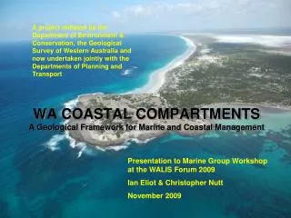
A project initiated by the Department of Environment & Conservation, the Geological Survey of Western Australia and now undertaken jointly with the Departments of Planning and Transport. WA COASTAL COMPARTMENTS A Geological Framework for Marine and Coastal Management.

E N D
A project initiated by the Department of Environment & Conservation, the Geological Survey of Western Australia and now undertaken jointly with the Departments of Planning and Transport WA COASTAL COMPARTMENTS A Geological Framework for Marine and Coastal Management Presentation to Marine Group Workshop at the WALIS Forum 2009 Ian Eliot & Christopher Nutt November 2009
Project Aims • The aims of the project are to: • Identify a hierarchy of planning units based on natural coastal systems similar to the approach used to identify river catchments. • The marine and coastal planning units should approximately accord with mapping scales commonly used for the preparation of statutory plans.
BASIC CONCEPTS • The hierarchy of planning units is based on the geologic framework of the coast. • At the broadest planning levels the planning units comprise a set of discrete coastal compartments determined by geologic boundaries, structures, landforms and aspect of the shore together with the landforms they contain. • At the most detailed planning levels the planning units are identified as sediment cells in which sediments sources, transport pathways and sinks can be clearly defined. • Together, coastal compartments and sediment cells provide a framework for a variety of applications including: • (a) planning and management of natural resources within the nearshore marine and coastal environment; and • (b) assessment of vulnerability to coastal hazards, climate change and rise in sea level.
Nominal Scale Hierarchical Level Mapping Scale Planning Hierarchy Location, climate, geology, landscape, biologicalprovince • Level 1 • Policy 1: 1 000 000 Location, climate, large landforms, bathymetry, hydrology, primary biotopes Level 2 Regional strategies 1: 250 000 Level 3 Regional and local plans Location, geology, geomorphology, physico-chemical and biological features, jurisdictional areas, secondary biotopes 1: 50 000 Location, geology, geomorphology, coastal dynamics, physico-chemical and biological features (ecological character), habitats, biological facies, jurisdictional areas, land tenure, land use, management issues, environmental hazard and risk 1: 10 000 Level 4 Local and site plans Basic information (core data) requirements
REGIONS & PRIMARY COMPARTMENTS Compartments have been identified for three levels. These correspond with the lower three tiers in the planning hierarchy. Landforms contained in the primary and secondary compartments have been identified. Potentially these broad descriptions are applicable as planning units at regional strategic planning levels
From Stul et al (2007) THE LOCAL SCALE: SEDIMENT CELLS & SEDIMENT BUDGETS
POTENTIAL APPLICATIONS COMPARTMENTS Landforms (Framework) & Processes (Drivers) PLANNING PURPOSES Marine & coastal risk assessment Marine & coastal planning Habitat description Marine conservation EBFM
WHERE TO NEXT? Primary and secondary planning units (compartments & the landforms each contains) have been completed for the State. Tertiary compartments have been identified but the landforms each compartment contains remain to be determined There is a need to agree on appropriate descriptors of the landforms at each level to avoid duplication of jargon. Examples of the potential planning applications at each scale are being compiled, particularly potential use in the Coastal Planning Policy (SPP 2.6). Custodianship of the data needs to be determined, although GSWA is recommended as the potential custodian. The framework will be made available for use by interested agencies and organisations and it is up to whoever is interested to further develop the applications.