Download
1 / 34
350 likes | 373 Vues
This workshop discusses the significance of satellite-derived surface vector winds (SVW) for Tropical Prediction Center (TPC) operations, focusing on QuikSCAT data advances, limitations, and future needs, including tropical cyclone forecasts, marine forecasting, and wind data coverage enhancements.

E N D
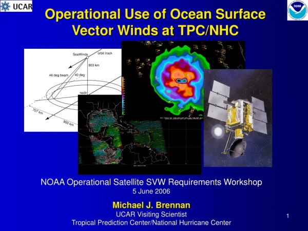
Operational Use of Ocean Surface Vector Winds at TPC/NHC NOAA Operational Satellite SVW Requirements Workshop 5 June 2006 Michael J. Brennan UCAR Visiting Scientist Tropical Prediction Center/National Hurricane Center
Outline • Importance of satellite derived SVW at TPC • Current use of SVW in TPC operations (QuikSCAT) • Tropical cyclones • Marine forecasting and analysis • Advances made possible by QuikSCAT • Shortcomings of QuikSCAT • Current and future needs
Area of Responsibility • Tropical cyclone forecasts in Atlantic and Eastern Pacific basins • Marine forecast, warning, and analysis over 12 million nm2 area
Typical 12Z Surface Chart • Compare observation density in Eastern Pacific to Gulf and Caribbean • Only 2 ship/buoy wind observations in southeast Pacific area • Need exists for better spatial coverage of surface wind data
QuikSCAT Characteristics • 1800-km wide swaths of data • One ascending and descending pass per day in sun synchronous orbit • ~500 km gaps equatorward of 20° and ~1000 km near Equator
Use of QuikSCAT Winds at TPC • Winds from NASA QuikSCAT available at TPC in near-real time since 2000 • 25-km and 12.5-km winds available • QuikSCAT integrated into TPC operations • Display on NMAP workstations • Used for analysis and product generation • Overlay with other data (obs, satellite, etc.) • Grids of 1/3°, 1/4°, and 1/8° QSCAT winds created for improved visualization and computation of derived quantities MGDR-Lite winds Streamlines and vorticity
Tropical CyclonesCenter Fixing • Ambiguity removal errors makes automated QuikSCAT center fixes unreliable • Small errors in center location potentially detrimental to numerical track guidance • Tropical Storm Lisa 21:15 UTC 28 Sep 2004 Automated solution depicts closed circulation centered near 25.3°N 46.3°W
Tropical CyclonesCenter Fixing • Manual ambiguity analysis located center farther north • This type of analysis useful in real time and post-storm analysis • Centers from the automated QuikSCAT solutions often biased to the SW • Manual analysis of ambiguities by forecasters used to help locate true center (e.g., Edson 2004) Manual analysis supports center location further north near 25.9°N, 46.2°W. Westerly ambiguities north of QSCAT solution center
Tropical CyclonesClosing off a system • 0937 UTC 3 August 2004 • Automated solution indicates open wave No closed circulation evident in automated solution
Tropical CyclonesInitiation of Advisories • Manual ambiguity analysis indicates closed circulation • Advisories initiated on TD#2 (later Bonnie) partly based on this analysis: Tropical Cyclone Discussion: “IT IS DIFFICULT TO ASCERTAIN IF THE SYSTEM...AN ESPECIALLY FAST MOVING ONE...HAS A CLOSED CIRCULATION WITHOUT DATA FROM A RECONNAISSANCE PLANE. YOU COULD MAKE THE CASE THAT A SMALL CIRCULATION EXISTS USING QUICKSAT AMBIGUITY ANALYSIS.” Manual analysis supports surface circulation centered near 12.9°N, 52.4°W Several northerly and northwesterly ambiguities to W and SW of apparent center
Tropical CyclonesMaximum Winds • Estimation of maximum winds in TCs using QuikSCAT complicated by • Rain contamination • Over- or under-estimation depends on rain rate and wind speed • Lack of co-located rain rate makes interpretation difficult • Saturation of instrument at high wind speeds (> 100 kt) • Spatial resolution • 25-km and 12.5-km winds unable to resolve inner core of hurricane • QSCAT winds sometimes used in determining intensity in tropical storms & marginal hurricanes • Real time and best track analysis
Tropical CyclonesMaximum Winds • All available 25-km and 12.5-km QuikSCAT passes over 2005 Atlantic TCs examined • 171 25-km passes • 139 12.5-km passes • Maximum QSCAT wind from w/in 200 nm of center compared to • Best track intensity • TAFB Dvorak intensity • Bias and mean absolute error (MAE) computed • Averaged by best track and Dvorak intensity bins
Average QS Bias Binned by Best Track Intensity Bias reverses sign around 50 kt (25 km) 70 kt for 12.5 km Bias increases rapidly > 70 kt 12.5-km bias generally smaller at high winds QS maximum wind has high bias at TD/weak TS stage 12.5 km bias ~10 kt higher than 25 km Relatively few passes over very intense hurricanes
Average MAEBinned by Best Track Intensity Bias reverses sign around 50 kt for 25 km data 70 kt for 12.5 km Bias increases rapidly > 70 kt 12.5-km bias generally less at high winds Same overall trend seen as in bias MAE smallest in 40–60 kt range 25 km MAE generally smaller than 12.5 km MAE values larger than bias in tropical storm stage cancellation due to errors of opposite sign QS max wind has high bias at TD/weak TS stage Bias of 12.5 km significantly larger than 25 km
Average QS Bias Binned by TAFB Dvorak CI Bias reverses sign around 50 kt for 25 km data 70 kt for 12.5 km Bias increases rapidly > 70 kt 12.5-km bias generally less at high winds QS max wind has high bias at TD/weak TS stage Bias of 12.5 km significantly larger than 25 km Similar trends in QSCAT bias when compared to Dvorak intensity estimates Positive bias for weak systems Negative bias for hurricanes
QuikSCAT and TC Maximum Winds • Comparison of QuikSCAT maximum wind to best track and Dvorak intensity estimates shows limited skill • Smallest bias/MAE in tropical storms and weak hurricanes • Some low bias values due to cancellation errors of opposite sign • Large positive bias in TD stage likely due to rain enhanced backscatter • Weak winds at surface overwhelmed by effects of rain • Negative bias at high winds due to attenuation from rain, saturation of signal, and limited resolution • QuikSCAT winds must be used with care for intensity analysis • Interpretation ambiguous at best • Lack of co-located rain rate information • Evaluation of QuikSCAT winds compared to aircraft recon & SFMR, and with TRMM and 88-D radar underway
Tropical CyclonesWind Radii • QuikSCAT can provide valuable information on the radius of 34 and 50 kt winds in tropical cyclones outside range of reconnaissance aircraft • 34-kt radii often outside the area of rain in major hurricanes, limiting rain contamination • Wind radii analyses and forecasts critical to timing of watch/warning issuance and for marine interests • Gridded QuikSCAT makes radii analysis easier • Development of automated routine underway
Exercises! - Wilma Estimated center from best track • Estimate 34-kt wind radii in NE quadrant from QuikSCAT pass over Wilma • 2332 UTC 18 October 2005 Which (if any) of these areas of 34+ kt vectors do you believe?
Compare with Recon, Obs Surface/ship obs suggest winds < 34 kt here 34 kt reduced flight level wind
Enhanced Satellite Imagery Higher winds here associated with patch of colder cloud tops higher rain rates
Wilma • 34+ kt QuikSCAT winds well north and east of center can be discounted due to rain contamination • Operational 34-kt wind radius in 03Z advisory in NE quadrant were 135 nm • Taking QuikSCAT as truth would have resulted in radii > 250 nm
Exercises! - Zeta Estimated center from interpolated best track • Estimate maximum wind and 34-kt wind radii from QuikSCAT pass over Zeta • 752 UTC 30 December 2005 • No aircraft reconnaissance available Which (if any) of these areas of 34+ kt vectors do you believe? Your answer drastically impacts 34-kt radii in NE and SE quadrants
Exercises! - Zeta No ship/buoy observations nearby All of these 34 kt + areas in areas of enhanced convection Which, if any to trust?
Zeta • Particularly difficult estimation of current intensity and 34-kt radii • Higher winds would be expected in areas of convection • No ship/buoy obs to serve as “ground truth” • Zeta not classified operationally at this time • Best track intensity set at 40 kt at 06Z • 34-kt radii set to 125 nm in NE and SE quadrants discounting 34 kt wind areas farthest from center in each quadrant
TAFB QuikSCAT Applications • Provides valuable wind information for analyses, forecasts, and warnings • Useful in placement of fronts, high/low centers, trough/ridge axes, tropical waves, and ITCZ • Verification for forecasts, warnings, and NWP model output • Differentiation between gale and storm force events • Utility limited due to rain contamination effects H
ITCZ Analysis • QuikSCAT allows for analysis of ITCZ even in absence of convection • Increased confidence and continuity enabled placement of ITCZ on TPC and Unified surface analysis
Surface Analysis Applications • QuikSCAT provides surface winds in regions typically void of dense observations • Improves analysis of features w/o distinct cloud signatures • Weak fronts (especially in Tropics) • Ridge axes and surface high centers • Tropical waves • Improve isobar packing in areas of enhanced winds Coverage of 12Z ship/buoy wind observations w/ QSCAT (TPC analysis area south of pink line) Coverage of 12Z ship/buoy wind observations (TPC analysis area south of pink line)
Tehuantepec Climatology • QuikSCAT has allowed development of climatology of high-wind events in Eastern Pacific associated with gap flow (e.g., Cobb et al. 2003) • Only non-TC storm force winds in Eastern Pacific forecast area • From 1999-present • 128 gale force events • 29 storm force events • Average of 17 (4) gale (storm) force winds each cold season
Tehuantepec Events 72 h 48 h • Ship observations sparse and many events would go unverified w/o QuikSCAT • “Ground truth” of QuikSCAT winds allows forecasters to adjust model guidance • Improve forecast of onset and intensity of events • GFS model often too slow and too weak with onset of high winds at 10-m • Rain contamination non-factor 45 kt 41 kt 24 h QSCAT 43 kt 58 kt GFS model 10-m wind forecast for Tehuantepec events in Feb. 2006
Advances at TPC Made Possible by QuikSCAT • Tropical Cyclones • TC center location (and identification) possible with manual ambiguity analysis • Limited skill in intensity analysis at tropical storm stage • Outer wind radii in absence of reconnaissance aircraft • Improved surface analysis • Feature placement, especially features lacking significant cloud signatures • Inclusion of ITCZ on surface map • Improved pressure analysis • Improved forecast and warnings for gale/storm force winds • Verification of forecasts/warnings/models • Differentiate between gale and storm force winds in rain-free areas • Climatology of East Pacific gap wind events • Model biases recognized • Recognition of areas where model under-forecasts winds (gaps, passes, Columbian coast, etc.)
Limitations of QuikSCAT • Rain contamination greatly complicates interpretation of QuikSCAT • All Tropical Cyclone applications • Other features accompanied by precipitation • Lack of co-located rain rate estimate empirical rain flag • Determination of rain bias due requires a priori knowledge of rain rate and wind speed • Unable to resolve inner core of TC • Saturation of signal at high wind speeds • Maximum of two passes daily & gaps between swaths • TCs and other features can be missed by several consecutive passes • Delay in receipt of real time data • 1.5–3 hr for 25 km • 45–60 min longer for 12.5 km
QuikSCAT and Beyond • New real time QuikSCAT retrieval algorithm being evaluated and tested • Initial WindSat evaluation underway • Data available in near real time • Comparisons underway to QuikSCAT and ship/buoy observations • Forecaster training in development
Acknowledgements • James Franklin and Rick Knabb (TPC) provided ambiguity analysis examples • Greg McFadden (SAIC/OPC) provided code for gridding QuikSCAT data • Hugh Cobb (TPC) provided Tehuantepec climatology data and figures