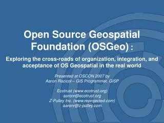
Open Source Geospatial Foundation (OSGeo) :
This presentation, delivered by Aaron Racicot at OSCON 2007, delves into the integration and acceptance of Open Source Geospatial (OSGeo) technologies in real-world applications. It covers a variety of OS GIS applications, including web and desktop tools like MapServer, QGIS, and GRASS, alongside foundational tools such as GDAL and PostGIS. The discussion highlights OSGeo's mission of promoting open geodata, fostering community cooperation, and enhancing accessibility and education within the geospatial community. This resource provides insight into OSGeo's projects, events, and the importance of open standards for interoperability.

Open Source Geospatial Foundation (OSGeo) :
E N D
Presentation Transcript
Open Source Geospatial Foundation (OSGeo): Exploring the cross-roads of organization, integration, and acceptance of OS Geospatial in the real world Presented at OSCON 2007 by Aaron Racicot – GIS Programmer, GISP Ecotrust (www.ecotrust.org) aaronr@ecotrust.org Z-Pulley Inc. (www.reprojected.com) aaronr@z-pulley.com
Open Source Geospatial – What Is It? OS GIS Web Apps (Mapserver, MapGuide, OpenLayers, etc.) OS GIS Desktop Apps (QGIS, GRASS, UDig Jump, OSSIM, etc.) OS GIS Base Tools (GDAL, FDO, PostGIS, etc.) OS Base Tools (Apache, Compilers, etc.) OS Core (Linux)
OSGeo – Open Source Geospatial Foundation Website System Administration Fundraising Education and Curriculum Incubation Public Geospatial Data Promotion and Visibility Projects General Members Charter Members Board of Directors
OSGeo – Mission • To provide resources for foundation projects - eg. infrastructure, funding, legal. • To promote freely available geodata - free software is useless without data. • To promote the use of open source software in the geospatial industry (not just foundation software) - eg. PR, training, outreach. • To encourage the implementation of open standards and standards-based interoperability in foundation projects. • To ensure a high degree of quality in foundation projects in order to build and preserve the foundation "brand". • To make foundation and related software more accessible to end users - eg. binary "stack" builds, cross package documentation. • To provide support for the use of OSGeo software in education via curriculum development, outreach, and support. • To encourage communication and cooperation between OSGeo communities on different language (eg. Java/C/Python) and operating system (eg. Win32, Unix, MacOS) platforms. • To support use and contribution to foundation projects from the worldwide community through internationalization of software and community outreach. • To operate an annual OSGeo Conference, possibly in cooperation with related efforts (eg. EOGEO). • To award the Sol Katz award for service to the OSGeo community.
OSGeo – Projects Mapbender Mapbuilder MapGuide OS MapServer OpenLayers GRASS OSSIM QGIS FDO GDAL/OGR GeoTools GeoNetwork Projects
A picture speaks louder than words…
Examples - Desktop Grass Raster Processing
Examples - Desktop QGis 0.8
Examples - Web-Based Chameleon Mapserver framework Spatially constrained queries and scenarios GMT generated graphics AJAX-User Based Data Filter PostGIS Spatial Data
Slippy Maps…OpenLayers “Google Maps” Like Tools Super Slippy! Tile based image server
Personal Use…. Navigating Wilderness Areas with GRASS Classification Cost Surface Thanks to Dylan Beaudette: http://casoilresource.lawr.ucdavis.edu/drupal/node/244
Creating Data…. Digitizing, Modifying, Extracting… Context Layer Viewing Create New Shapes Create New Attributes
Transforming Data…. How to get coordinates in UTM to Geo-NAD83?
Spatially enable your database…. How to select data within a polygon area? Intersects Geometry Definition Distance(geometry, geometry) Equals(geometry, geometry) Disjoint(geometry, geometry) Intersects(geometry, geometry) Touches(geometry, geometry) Crosses(geometry, geometry) Within(geometry A, geometry B) Overlaps(geometry, geometry) Contains(geometry A, geometry B) Intersects(geometry, geometry) Relate(geometry, geometry, intersectionPatternMatrix) Relate(geometry, geometry) Centroid(geometry) Area(geometry) Length(geometry) PointOnSurface(geometry) Boundary(geometry) Buffer(geometry, double, [integer]) ConvexHull(geometry) Intersection(geometry, geometry) SymDifference(geometry A, geometry B) Difference(geometry A, geometry B) GeomUnion(geometry, geometry) GeomUnion(geometry set) MemGeomUnion(geometry set)
Where to go for more info Ecotrust • http://www.ecotrust.org Reprojected • http://www.reprojected.com OSGeo • http://www.osgeo.org OSGIS • Maptools - http://www.maptools.org • FreeGIS - http://freegis.org/ • Open Source GIS - http://opensourcegis.org/ Standards • OGC - http://www.opengeospatial.org/ Desktop • GRASS - http://grass.itc.it/ • QGIS - http://qgis.org/ • OSSIM - http://www.ossim.org/ • UDIG - http://udig.refractions.net/ • JUMP – http://jump-project.org/ • OpenEV - http://openev.sourceforge.net/ Server/Web • Mapserver - http://mapserver.gis.umn.edu/ • MapBender - http://www.mapbender.org • MapBuilder - http://communitymapbuilder.osgeo.org/ • MapGuide OS – http://mapguide.osgeo.org/ • OpenLayers - http://www.openlayers.org/ Tools • PostGIS - http://postgis.refractions.net/ • Remote Sensing - http://remotesensing.org/ • GDAL/OGR - http://gdal.maptools.org/ • PROJ.4 - http://proj.maptools.org/ • R-Statistics - http://www.r-project.org/ • GMT - http://gmt.soest.hawaii.edu/ Blogs - Aggregators • http://planetosgeo.crschmidt.net/ • http://www.planetgs.com/ • http://slashgeo.org/ Blogs - Individual • http://www.osgeo.org/blog • http://zcologia.com/news/ • http://openlayers.org/blog • http://blog.qgis.org/ • http://mappinghacks.com/ • http://hobu.biz/ • http://www.reprojected.com/geoblog IRC • #osgeo, #grass, #mapserver, #openlayers, etc… Local User Group • http://groups.google.com/group/cugos