Download
1 / 30
300 likes | 396 Vues
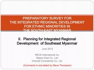
PREPARATORY SURVEY FOR THE INTEGRATED REGIONAL DEVELOPMENT FOR ETHNIC MINORITIES IN THE SOUTH-EAST MYANMAR II. Planning for Integrated Regional Development of Southeast Myanmar. June 2013 RECS International Inc. Nippon Koei Co., Ltd.

E N D
PREPARATORY SURVEY FORTHE INTEGRATED REGIONAL DEVELOPMENT FOR ETHNIC MINORITIES INTHE SOUTH-EAST MYANMAR II. Planning for Integrated Regional Developmentof Southeast Myanmar June 2013 RECS International Inc. Nippon Koei Co., Ltd. Oriental Consultants Co., Ltd. (Comments in red added by Steve Thompson)
1. Economic Corridors Development 1) East-west economic development corridors: original alignment designated by ABD and its alternatives for Southeast Myanmar 2) Southern economic development corridors: original alignment designated by ABD and its alternative linking Payathonezu and Thanbyuzayat 3) Economic corridor in northern part 4) North-south economic corridor (National artery) 5) New east-west economic corridor: Walley- Sukali- Kyaikdon- Kyainsekkyi- Mudon • New north-south economic corridor: Hpapun- Hpaan- Kyainsekkyi- Payathonezu Why does this “integrated” survey “for ethnic minorities” start with promoting big development projects that take and pollute their land, when it should be addressing issues of conflict resolution, land, resettlement and rehabilitation? This reflects a remarkable blindness on the part of the Japanese consultant engineers and JICA.
2. Artery Road Network for Southeast Myanmar • These roads are a continuing security threat to ethnic nationality peoples, their cultures and their environment. • While the Burmese military continues to hold and reinforce bases in Karen lands and remains unanswerable to its’ government, road-making provides it unacceptable strategic advantage. • Indigenous land tenure is even less certain under the 2 Burmese land laws passed after the 2012 ceasefire. Land confiscations are widespread throughout the country. Road-making further threatens the land and livelihood security for the Karen people in their path. Why is this not understood? • Yet further undermining community land security, without clear land policy roads will bring an influx of settlers from elsewhere, Burmese army families and businessmen.
3. Industrial Clusters Development 1) Rubber industrial cluster 2) Wood and bamboo works industrial cluster 3) Cashew industrial cluster 4) Apiculture (bee raising) industrial cluster • Other industrial clusters: tourism industry, antimony industry, wellness industry (i.e. spas, massage, alternative health) etc. Some of these (bamboo, cashew, bees, alternative health, tourism) are basically okay. However the plan only hints at the real large scale mining agenda. It also promotes unsustainable mono-culture plantation farming. There is no inclusion of biodiverse, low input, self reliant and carbon-neutral indigenous farming practices. Growing rice, pepper & other spices, betel nut & leaf, and the sustainable cultivation and management of fuelwood species and high value timber species are all missing from the plan.
4. Rubber Industrial Cluster Focus on rubber is economically shortsighted, as most rubber is used in the transport industry which cannot be sustained without fossil fuels. These are being quickly depleted and fuel costs already at historic highs. Not far in the future this will become critical, likely damaging or destroying the market for rubber. Rubber trees take 7 years to come into production, so any new planting carries very high risk. Diversifying into food, building materials, paper and wood energy – where increasing future needs are far more certain may prove a much better investment.
5. Wood and Bamboo Works Industrial Cluster This makes good sense, as cultivating different kinds of bamboo, rattan canes and timber can be sustainably productive using local skills and inputs. Investing in developing local peoples skills for cultivating and enriching forests, processing bamboo, cane, “non-timber forest products” and wood, and making better quality furniture and paper is therefore good.
6. Cashew Industrial Cluster No serious problems foreseen with this; however it may still be too much of a monoculture though the integrated farming with goats helps to diversify it. It could be improved by introducing more things to the system to better meet needs of communities for self sufficiency in food, fuelwood, fertilizer.
7.Apiculture Industrial Cluster No serious problems foreseen with this… Integrating this with increasing the number of flowering species and medicinal herbs in the surrounding forests and farmlands would improve it. Reducing pesticide use in the surrounding areas would better guarantee honey quality and bee survival.
8. River Basins Water Resources Development and Management Program 1) Megatat River, a tributary of the Zami River, for water supply, mini hydro power, and flood mitigation • Bilin River for water supply, hydro power development, irrigation and watershed management. According to the 1994 Norconsult study for the ADB, this dam will flood a huge area of over 200 km2. 3)DontamiRiver for water supply, mini hydro power, and watershed management 4) Ye River for water supply and mini hydro power 5)MelagaRiver, a tributary of the Moei River, for water supply, irrigation and mini hydro power • Yunzalin River, a tributary of Thanlwin River, for water supply, hydro power and irrigation • These dams will severely disrupt wildlife and local fisheries, and will flood more villages and much good farm and forest land. These seem like just an excuse fore more dam building in the interests of the consulting companies.
9. Megatat River Basin Water Resources Development and Management This development area and dam is located in the core area of the Megatha Wildlife Sanctuary. It will destroy an exceptionally beautiful area and will be devastating for wildlife and the remaining forests.
10. Bilin River Basin Water Resources Development and Management This dam has an extremely big flood area for the amount of electricity it will generate. (200 km2 for 400 MW, Norconsult 1994). Significantly, It will flood critical wildlife habitat of the KNU Thuplay Wildlife Sanctuary. It will displace many of the communities who are key to protecting the forests and wildlife there. It will also flood good lowland rice farms and forest land. Like other big dams this will only serve to power cities and industries, mostly foreign owned.
11. Dontami River and Ye River Basin Water Resources Development and Management Dontami川 Ye川
Mywaddy Walley Sukali 12. Melaga River Basin Water Resources Development and Management More dams?!. As with most other dam plans, no reservoir area is given – i.e how much Karen land will be flooded. Would the hydropower be used to power the zinc and other resource mining activities in the area?
13. Yunzalin River Basin Water Resources Development and Management Yet more damming of exceptionally beautiful and clean rivers for a questionable development agenda….
14. Payathonezu Settlement Areas Development Program 1) Provision of water supply with public standpipes, power supply by mini hydro or diesel, branch schools and clinics (Why no off grid solar power or micro-hydro? What guarantee of sustainable resourcing of schools and clinics?) 2) Productive re-forestation on hills with fruits and cashew trees 3) Participatory land use planning: residential lots with home gardens, productive re-forestation areas, paddy fields, protection areas for water sources • Community organizing: CBO or CDC for community facilities planning & implementation They make the “master plan”, allowing actual participation of communities, in only a few areas after their plan is discussed and approved
15. Returnees Empowerment Center (REC) Stage 1: Information function 1) Provision of audio-visual equipment, computers and associated facilities 2) Support for preparation of promotion materials for settlement areas, industrial estates, policy and support activities by State Government 3) Planning for facilities and services for Stage 2 development by cooperation of KNU, State Government and other stakeholders Stage 2: Skill training function 1) Adoption of some returnees as trainers and TOT for them 2) Provision of training facilities and equipment 3) Association with industrial estates and related facilities and enterprises located in those facilities
16. Conciliatory Access Improvement Program 1) Theinseik – Laykhay road improvement (KNU brigade No.1) 2) Ye – Joohaproud road improvement (NMSP) 3) Leiktho – Yardo road improvement (KNU brigade No. 2) 4) Kamamaung – Myainggyingu ferry services improvement with a new ship and landing facilities (KNU brigade No.2 on Kamamaung side and KNU brigade No. 5 and DKB-BGF on Myainggyingu side)
19. Objectives for Regional Development of Southeast Myanmar 1) Economic objective: To diversify employment and income opportunities to improve livelihood, increase local capital accumulation, and enhance competitiveness of regional economy in globalizing economy 2) Social objective: To revitalize local communities to initiate new economic activities, effect better environmental management, and enhance local governance capacity 3) Environmental objective: To protect and enhance environmental quality to ensure sustainable economic development, safeguard traditional lifestyles and value, and ensure lasting peace
20. Basic Strategy for Regional Development of Southeast Myanmar 1) Improving security conditions through sharing development and security related information with all stakeholders to cultivate mutual trust among them, 2) Establishing mechanism for broad-based participation of all stakeholders in the process of development planning and implementation, and 3) Promoting alternative socio-economic activities, which are less resource intensive and environment friendly, combining traditional practices and modern technology.
21. Vision for Regional Development of Southeast Myanmar • Realization ofrobustandresilientsocio-economyopentotheglobalsocietysupportedbyabundantnaturalresources, diverse economic activities and rich cultural heritage of ethnic peoples.
22. Factors Supporting the Regional Development Vision 1) Transport and logistic infrastructure of the first quality linking the Southeast Myanmar to neighboring regions and countries 2) Industrial clusters to produce a variety of products having comparative advantage in the global market 3) Environment friendly socio-economic activities combining traditional wisdom of peoples with modern technology 4) Active communities of mixed ethnicity with revitalized conventional cultural activities that residents are proud of and visitors can enjoy 5) All of the above embraced in rich natural environment under proper management by local communities and local governments to ensure sustainability
23. Important Concepts to Support the Regional Development of Southeast Myanmar
24. Development Scenario Development Phasing 1) Preparatory phase: up to 2015/16 2) Phase 1: 2016/17~2020/21 3) Phase 2: 2021/22~2025/26 4) Phase 3: 2026/27~2035/36
25. Preparatory Phase: up to 2015/16 1) Completion of integrated regional development master plan with urgent projects 2) Establishment of REC with information function 3) Initial return of refugees and IDPs on voluntary base 4) Pilot implementation of participatory mechanism to plan and implement community facilities 5) Initiation of productive re-forestation 6) Preparatory works to establish new economic activities in agriculture and industry 7) Skill training for new products to be produced by mixed farming and integrated farming 8) Urgent improvement of key artery roads 9) Selective improvement of urban infrastructure
26. Phase 1: 2016/17~2020/21 1) Conclusion of peace agreement and acceleration of return of refugees and IDPs 2) Expansion of REC with skill training function 3) Institutionalization of participatory planning and development 4) Expansion of new mixed farming and integrated farming pilot implemented in preparatory phase 5) Establishment of rubber industrial cluster with diversified final products (more rubber plantations) 6) Establishment of skills and raw materials collection and marketing mechanism for cashew industrial cluster 7) Initial formation of other industrial clusters 8) FTZ and IE development in full scale (accelerate to hazardous waste production. No treatment plan or facilities mentioned) 9) Strengthening of east-west economic corridor and development of branch arteries 10) Initial improvement of access to settlement sites from western side of Dawna mountain range (obvious priority: open up the secure areas to neutralize resistance…..)
27. Phase 2: 2021/22~2025/26 1) Increasing return of migrant workers (under what pressure?) 2) Production increase from productive re-forestation areas 3) Full establishment of cashew industrial cluster 4) Diversification of industries in FTZs and I.E.s (Dawei and other polluting Industrial Estates) 5) Formation of full transport and logistic network with Kyaikkami regional port, FTZs and I.E.s (based on unsustainable growth model and heavily extractive industries) 6) Establishment of urban hierarchy for effective urban services delivery 7) Initiation of joint development and management of border areas with Thailand 8) Completion of physical integration of Southeast Myanmar by resolution of missing links (not hidden agenda of road building to open up KNU secure areas) 9) Development and management of tributaries of major rivers to reduce flooding and improve access (BIG DAMS – HATGYI) 10) More broad based participatory planning and implementation – FPIC? When? Believe it only when you see credible consultation process….
28. Phase 3: 2026/26~2035/36 1) Completion of return of migrant workers 2) Diversification of export products of agriculture with fruits, cashew products, goat meat and milk products, bamboo products, and specialty products 3) Establishment of additional industrial clusters based on mineral resources, tourism and other resources 4) Completion of fully operational transport and logistic network linked with neighboring regions and countries 5) Reduction of major flooding to manageable magnitude to improve further links between different areas in major river basins 6) Formation of a city network with urban hierarchy extending to neighboring regions and countries to share higher order urban functions for mutually complementary development
29. Future Characteristic of Southeast Myanmar 1) In-migrating region with average income higher than national average & diversified employment opportunities 2) Model region for alternative socio-economic activities with many viable industrial clusters and sustainable resource utilization and management by peoples (to centre it around dams & roads is wrong model…..) 3) Major tourism center with variety of tour itineraries for international and domestic tourists, embracing rich cultural heritage of ethnic peoples 4) Center for alternative technology with advanced education and research facilities (so where is this in their plan? 5) Agricultural area specialized in mixed and integrated farming to attain high productivity without relying much on high use of agro chemicals, fertilizer and other external input (so where is this in their plan? 6) Regional society open to global society with logistic networks linked to neighboring regions and countries, city networking to share higher order urban functions, cosmopolitan atmosphere accommodating peoples of diverse socio-cultural backgrounds 7) Self-reliant region based on the utilization of indigenous resources by and for the benefit of local peoples under effective development administration by public-private partnership