Download
1 / 28
280 likes | 472 Vues
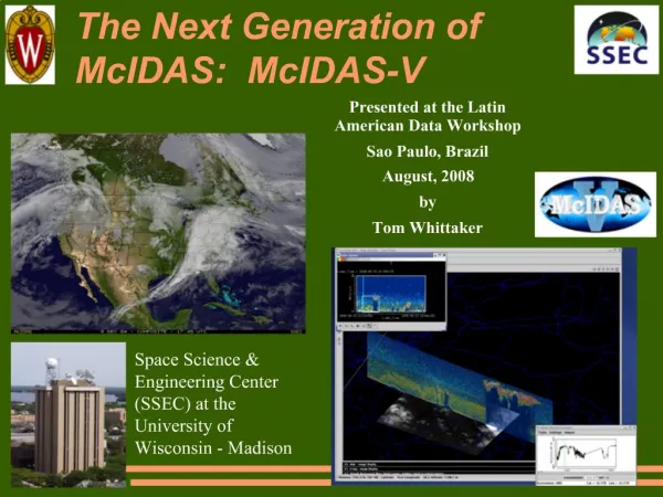
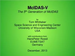
by Tom Whittaker Space Science and Engineering Center University of Wisconsin-Madison USA with contributions from HansPeter Roesli EUMETSAT Germany December, 2013. McIDAS-V The 5 th Generation of McIDAS. McIDAS Man-computer Interactive Data Access System.

E N D
by Tom Whittaker Space Science and Engineering Center University of Wisconsin-Madison USA with contributions from HansPeter Roesli EUMETSAT Germany December, 2013 McIDAS-VThe 5th Generation of McIDAS
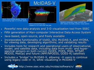
McIDAS Man-computer Interactive Data Access System • More than 30 years of evolution • “A” is transitioning from “Access” to “Analysis” • Originally developed for satellite-derived winds • Was the first “GIS” system and longest lived • Now in its 5th generation, named: McIDAS-V • Based on the IDV from Unidata • Core is VisAD from Bill Hibbard • Freely available for download and use • Multi-platform (Windows, Linux, OS-X) • On-line User Support Forum, Documentation, Tutorials
Many Types of Display and Analyses • Data plots • Contour & streamlines • Color-filled contours • Vertical cross sections and transects • Data probes – vertical, time, etc. • 3D surfaces • Python scripting and background processing • …and many more….
Surface Data Plot …and Streamlines
Vertical Data Probe Of Model Temperature Field Skew-T plot from Sounding
Vertical Cross Section
3D Isosurface of wind speed …colored by temperature
Next: the Field SelectorParameter(s), Display type, Times, Levels, Regions
Data Integration • Model and other grids • Point data • Plots and contouring • Imagery • Geostationary • Polar and hyper-spectral • Miscellaneous types • WMS, Text files • JPG/PNG/GIF images and Web Cams • Base maps and other ShapeFiles • Integration in display and computations
Data Formats • Image • McIDAS AREA (via ADDE servers local and remote) • NetCDF (CF Conventions), HDF5 (some) • TIFF, JPG, PNG, etc. • Grids • GRIB and GRIB2 • NetCDF, HDF (CF Conventions) • Flat Binary • Point (in situ) • BUFR (common tables) • McIDAS point (via remote ADDE servers) • NetCDF (CF conventions) • ASCII Text files
Making Derived Products • Jython (Python for Java) formulas and functions • Can be integrated into Field Selector • Save as a plug-in to share with others • HansPeterRoesli made a plug-in for MSG and Metop data • Here is an example of an RGB:
McIDAS-V + EUMETCast= McVCast • Long relationship between EUMETSAT and SSEC • McIDAS-V is very flexible in dealing with satellite (and other) data • McIDAS-V is freely available, world-wide • Much work by EUMETSAT to create servers and plug-ins for McIDAS-V • Gives end-users a powerful analysis system at low cost • Pre-configured for Africa region • Some user-interaction options pre-set for convenience • RGB plug-in provided • Test / sample dataset • Installation and Getting Started tutorial
Using EUMETCast to Distribute Code and Data • Only Windows version being distributed in the broadcast • Send software installer and Installation Guide via the broadcast • End-user set up is mostly to connect to broadcast data files on local systems • EUMETSAT providing user support • Sites with Internet can get other data
Download at: www.ssec.wisc.edu/mcidas/software/v/download.html (or just Google “mcidas-v download”) There are also links to: Support Forums User Guide Tutorials Where to get McIDAS-V