Download
1 / 28
280 likes | 409 Vues
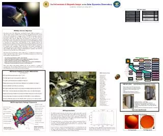
The CEDAR New Dimensions Strategy aims to address critical questions about geospace impacts on Earth's habitability and technology reliance. It emphasizes the interconnectedness of climate change and the geospace system, insisting on a systems approach to investigate complex phenomena. By highlighting themes such as space weather, interhemispheric asymmetry, and energy flow, the initiative promotes global scientific collaboration to fill gaps in current measurements. The strategic plan encourages input from the scientific community to enhance understanding and response to these challenges.

E N D
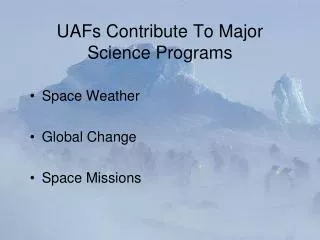
UAFs Contribute To Major Science Programs • Space Weather • Global Change • Space Missions
CEDAR New Dimensions Strategy • CEDAR Strategic Plan • Overarching Problem Statement: ‘What are the geospace impacts on Earth’s habitability and the sustainability of technology-reliant societies?’
CEDAR New Dimensions • Climate Change with the geospace system • Space climate • Geospace effects on climate • Complexity in the geospace system • Nonlinear, complex system (e.g. space weather, extreme events) • Energy flow in the geospace system • Follow the energy • Propagation, Transformation, Manifestation Contributions/input to the plan are very welcome!
CEDAR New Dimensions • Themes are Global • Measurements are not…
Current global coverage is uneven • Poker Flat • Resolute Bay N & C • Sondrestrom • Millstone Hill • Arecibo • Jicamarca • EISCAT ESR • EISCAT UHF • EISCAT VHF • Kharkov • Irkutsk • MU
Pivotal Science with an Antarctic ISR • Large scale interhemispheric asymmetry in magnetosphere-ionosphere coupling. • Difference in interhemispheric potential • Interhemispheric asymmetry on intermediate and small scales • Plasma sources for the magnetosphere • Interhemispheric asymmetry in the mesosphere and thermosphere
Pivotal Science with an Antarctic ISR • Space Weather • Magnetosphere-Ionosphere coupling • Plasma source/Ion outflow • Coupling/non-coupling between scales • Global climate change/disruption • Interhemispheric asymmetry in mesosphere and thermosphere • Neutral dynamics • Space Missions • Space weather • Global change… So where does AMISR fit in?
AMISR Changes the Picture • ISRs have been considered in Antarctica before • Structural size, heavy equipment, complexity of O&M were significant issues • AMISR reduces the issues to completely manageable sizes
Polar Cap • Environment is characterized by open field-line geometry where the Earth’s magnetic field connects into the interplanetary fields of the Sun and the Solar Wind. • Small scale physics of field-line reconnection, viscous coupling between the solar wind and the magnetosphere, and the interchange of particles and energy between geo- and inter-planetary space. • Auroral Zone • Propagation of particles and/or waves along flux tubes; inter-hemispheric differences in substorm optical, magnetic, and riometer particle precipitation signatures; and substorm evolution in the deep tail • Sub-Auroral Zone • Energy transport within the geospace system • Near auroral-zone observations also provide remote sensing of the Earth’s radiation belts (approximately between L shells of 4 and 8).
McMurdo • Polar cap location • Relative ease of logistics • Should be realized while RISR-N is still in the northern polar cap • Solar max - polar cap, solar min - lower latitudes
Additional sites/relocations • Polar cap (McMurdo) • Cusp (Davis/Zhong Shan) • Auroral (Troll) • Sub-Auroral (Peninsula/Palmer) Great opportunity for international collaboration….
Liotard (c.2225m) Leonie Island Ryder Bay Reptile Ridge Rothera
Rothera Research Station • Principal BAS logistics station in support of field science • Main operational hub for BAS Air Operations • Important air hub for other National Operators • Year round operations (Summer/Winter) • 120 Beds Available • Average 200 visitors per summer season – (12,000 Nights) • Average 21 personnel over wintering – (22 for 2010) • Strong collaborative history
Other Science at Rothera, • Radar Hut • Skiymet Radar • MF Radar • Optical Hut • Low Power Magnetometer • POM Sky Radiometer • Met Tower • Doris Beacon • ARIES • VLF Radar • Met Balloon Launch Container
Community involvement • Chicago workshop Aug 2008 • CEDAR workshop June 2009 • EISCAT Workshop Aug 2009 • EISCAT SOC meeting Arecibo Sept 2009 • CEDAR Strategic Plan • InFO • Next International Workshop ~2011 • … • Proposal also includes outreach and education
Drivers for Southern high latitude facility • Space Science research benefits from contributions of UAFs • CEDAR new strategy • Geospace on a global scale • Systems approach to S-T • Success and practicality of AMISR So what could this look like?
Future coverage • New sites • AMISR • Resolute Bay • Argentina • Antarctica (2) • Europe • EISCAT_3D Collaboration?
Antarctic ISR - EISCAT 3D? • Initiative of next generation EISCAT radar in mainland EUROPE - EISCAT 3D • Possibility of upgraded Antarctic AMISR using EISCAT 3D ideas as part of the design • Important step in international collaboration between US and EISCAT in Antarctica
Summary • We have a critical need for understanding • We have the technology, expertise, and experience • We can exploit available capabilities to solve societally important problems • Also exploits OPP expertise and experience in Antarctica to complete northern hemisphere programs • The time is now (but there’s lots to do for the 2nd site) One last idea…