Download
1 / 30
300 likes | 390 Vues
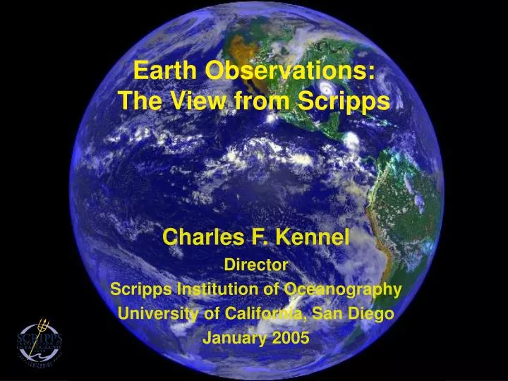
Earth Observations: The View from Scripps. Charles F. Kennel Director Scripps Institution of Oceanography University of California, San Diego January 2005. Humans have transformed the earth in the last 50 years. City Lights from Space.

E N D
Earth Observations:The View from Scripps Charles F. Kennel Director Scripps Institution of Oceanography University of California, San Diego January 2005
Humans have transformed the earth in the last 50 years City Lights from Space Water, ozone, global air pollution, climate change, ecosystems
Earth System Science • In addition to dealing with eons past, earth science has a new focus on the geological here and now- predict the next hundred years. • We are creating an interdisciplinary panorama of the earth as it is today and as it will be tomorrow. • We are taking into account the human activities that influence earth’s systems • Earth system science can now make useful forecasts in fields beyond weather • The entire enterprise requires an earth observing system of global scale
Global Earth Observing System • Human Architecture • Multi-Sensor Networks • Cyber-Infrastructure • Decision-Support Systems
Human Architecture:International Framework • Global Change Research Act of 1990 • Calls for “global measurements, establishing worldwide observations necessary to understand the physical, chemical, and biological processes responsible for changes in the Earth system on all relevant spatial and time scales,” as well as “documentation of global change, including the development of mechanisms for recording changes that will actually occur in the Earth system over the coming decades.” • International Global Observing Strategy (OSTP, July 17, 1995) • “The Global Observing System would be an internationally coordinated system of mutually funded experimental and operational space-based and in situ data acquisition, archive, and distribution systems and programs for earth observations and environmental monitoring.”
Human Architecture - 2 G-8 Summit, Evian France, June 2, 2003 “ We will focus our efforts on three areas that present great opportunities for progress: … close co-ordination of our respective global observation strategies for the next ten years; identify new observations to minimize data gaps; ...” Declaration of the Earth Observation Summit “We, the participants in this Earth Observation Summit held in Washington, DC, on July 31, 2003 … Affirm the need for timely, quality, long-term,global information as a basis for sound decision making.” Ministers at theEarth Observation Summit III in Brussels, February 2005, endodrsed the 10-Year Implementation Plan.
55 GEO members as of March 2005 Netherlands New Zealand Niger Nigeria Norway Portugal Republic of the Congo Republic of Korea Russian Federation Slovak Federation South Africa Spain Sudan Sweden Switzerland Thailand Tunisia Ukraine United Kingdom United States Uzbekistan Germany Greece Guinea-Bissau Honduras India Indonesia Iran Ireland Israel Italy Japan Kazakhstan Luxembourg Malaysia Mali Mexico Morocco Nepal Algeria Argentina Australia Belgium Belize Brazil Cameroon Canada Chile China Croatia Cyprus Denmark Egypt European Commission Finland France
African Association of Remote Sensing of the Environment Asia-Pacific Network for Global Change Research Association for the Development of Environmental Information (ADIE) Central American Commission for the Environment and Development (SICA/CCAD) Committee on Earth Observation Satellites (CEOS) EuroGeoSurveys European Centre for Medium-Range Weather Forecasts (ECMWF) European Environmental Agency (EEA) European Space Agency (ESA) European Organization for the Exploitation of Meteorological Satellites (EUMETSAT) European Sea Level Service Federation of Digital Broad-Band Seismograph Networks (FDSN) Food and Agriculture Organization of the United Nations (FAO) Global Climate Observing System (GCOS) 40 NGO Participants as of March 2005 Global Ocean Observing System (GOOS) Global Terrestrial Observing System (GTOS) Institute of Electrical and Electronic Engineers (IEEE) Integrated Global Observing Strategy Partnership (IGOS-P) Intergovernmental Oceanographic Commission (IOC) International Association of Geodesy (IAG) International Association of Geodesy (IAG) International Council for Science (ICSU) International Council on Systems Engineering International Geosphere-Biosphere Program (IGBP) International Group of Funding Agencies for Global Change Research (IGFA )International Institute for Space Law (IISL) International Society for Photogrammetry and Remote Sensing International Steering Committee for Global Mappingハ (ISCGM) International Strategy for Disaster Reduction (ISDR) Open Geospatial Consortium Partnership for Observation of the Global Ocean (POGO) The Network of European Meteorological Services/Composite Observing System (EUMETNET/EUCOS) United Nations Convention on Biodiversity (UNCBD) United Nations Educational, Scientific and Cultural Organization (UNESCO) United Nations Environment Programme (UNEP) United Nations Framework Convention on Climate Change (UNFCCC) United Nations Institute for Training and Research United Nations Office for Outer Space Affairs (UNOOSA) World Climate Research Programme (WCRP) World Meteorological Organization (WMO)
Human Architecture - Summary • The human architecture is developing, starting with government organizations representing producers of observing systems • International framework for coordination is being developed • Main participants are national governments supporting scientific programs • Limited decision-support activities to date • Participation of users at all levels will eventually be required
Multi-Sensor NetworksToday • Remotely sensed and in situ • Spacecraft, aircraft, ships, moorings, floats, • Radars, lidars, physical, chemical and biological sensors… • Oceans, atmosphere, land, ice • Global to regional to local
NSF Ocean Observatory Networks
NOAA/DOD/NASA National Polar Orbiting Operational Environmental Satellite System (NPOESS) EUMETSAT/NOAA Metop
Multi-Sensor NetworksTomorrow • Today’s sensors and platforms require substantial infrastructure for power and communications • Eventually, there will be hundreds of millions of “nano-sensors on cell-phones”
Modeling Communications Visualization Cyber-Infrastructure Information management and architecture Computing
The Internet:An Evolutionary Tale • Phase 1: Early Internet (1970s) • Big servers and small number of clients • Government funded and controlled • Phase 2: (late 1980s) • Distributed international network of largely scientific users • Phase 3: Internet today • Hundreds of millions of users • Peer-to-peer • No centralized control • Use of a few powerful standards
Similar path for GEO? • Phase 1: government operated networks between major installations • Phase 2: distributed high-performance research network being established now • Phase 3: work on miniaturization of sensors and distributed (Grid) computing; evolving to massive numbers of individual nodes
Growing Fiber Infrastructure - Future Backbone for GEO?From Shared Internet to Dedicated Lightpipes
Beyond Indicators to Decision-Support Tools If we connect GEO to effective decision support systems, then it will become a principal tool for achieving sustainability on a global scale. Photo credit: Global Spatial Data Infrastructure Project Photo credit: New York Times
Global Observations are needed for Global and Local Decisions GEO Societal Benefit Areas • Disasters • Health • Energy • Climate • Water • Weather • Ecosystems • Agriculture/Desertification • Biodiversity Local Issues (examples) • Health and safety from severe natural events • Risk management • Infrastructure planning • Facility design, landscaping, maintenance • Travel and recreation • Emergency preparedness
Climate variations affect energy supply and demand and therefore decisions El Nino North Pacific Oscillation (NPO)
Decision support examples Fisheries Productivity: How to manage coastal resources Warming Waters Identified as Cause of Marine Life Depletions off California Offshore Hydrocarbon Exploration: Where to invest Illustration: Free air gravity anomaly map of the Gulf of Mexico produced using ERS data (Courtesy: Satellite Observing Systems)
Evolving Role of the Science Community Originating science, creating models, & developing observing technologies Designing observing strategies and systems Transferring designs, technologies, models, and tested systems to the public and private sectors Partnering in the governance and management of long-term observing and decision support systems Infusing new objectives and technologies into on-going systems Linking new capabilities to new users Research community is becoming more multi-disciplinary and service-oriented
Human Architecture Needs to Evolve • For the full array of environmental information • Phase 1: Government agencies in charge • E.g., weather satellites, global weather models • Phase 2: Large sophisticated scientific and technology users engaged • Regional forecast centers tied to universities looking at climate as well as weather • Phase 3: Broad user base with information products tailored to their needs and presented in their language • Wide network of commercial value-added industries providing local forecasts for specific clients (frost warnings for citrus growers; snow forecasts for ski resorts; beach conditions, etc.)
New Management Concepts • System of systems • Multi-sector consortia • Standards • Interoperability • Open communication • Evolving, adaptive • Education and outreach
Center for Earth Observations and ApplicationsUCSD’s Contribution to GEOSS Vision: to establish international leadership in education, research, technology development, observation, and information management for Earth observations. • Headed by SIO/John Orcutt UCSD may be unique in its ability to work end-to-end on all aspects of global observing.
CEOA Mission • To develop, deploy, operate, and use observing platforms and sensors for the land, oceans, and atmosphere • To collect and integrate observational data from a global network of multidisciplinary sources • To develop technologies and decision-support tools that promote a balance between the natural environment and human activities • To participate in GEOSS
CEOA Approach: Internal “Venture Capital” Group Promote major interdisciplinary scientific and technical programs that cross Division, Department, and School boundaries Substantially increase funding available for interdisciplinary programs Assist teams in writing major proposals & providing matching funds. If necessary, assist when needed in program operation. Assist in hiring where needed. Provide a coherent and comprehensive interface to the external community on behalf of the extensive UCSD capabilities and programs.
The Grand Convergence The convergence of earth science and information technology will lead to continuous awareness of earth’s systems and their interactions with human activities. We will use continuous awareness to manage our resources and environment, and our response to disasters Continuous awareness will promote integrated responses to emerging global environmental challenges
Conclusion As civilization becomes increasingly global and technologically sophisticated, our need for a global observing capability will grow. We are beginning an endeavor that will evolve over the entire 21st century and endure as long as we have an advanced civilization.